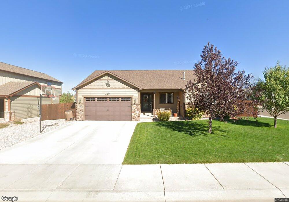
4325 Cliff St Laramie, WY 82070
Estimated Value: $492,000 - $606,000
5
Beds
3
Baths
1,497
Sq Ft
$363/Sq Ft
Est. Value
About This Home
This home is located at 4325 Cliff St, Laramie, WY 82070 and is currently estimated at $544,002, approximately $363 per square foot. 4325 Cliff St is a home with nearby schools including Beitel Elementary School, Laramie Middle School, and Laramie High School.
Ownership History
Date
Name
Owned For
Owner Type
Purchase Details
Closed on
Jan 30, 2013
Sold by
Gateway Construction Llc
Bought by
Bazan Richard R and Bazan Andrea L
Current Estimated Value
Home Financials for this Owner
Home Financials are based on the most recent Mortgage that was taken out on this home.
Original Mortgage
$247,807
Outstanding Balance
$173,311
Interest Rate
3.42%
Mortgage Type
New Conventional
Estimated Equity
$370,691
Purchase Details
Closed on
Sep 28, 2012
Sold by
Country Club Llc
Bought by
Gateway Construction Llc
Create a Home Valuation Report for This Property
The Home Valuation Report is an in-depth analysis detailing your home's value as well as a comparison with similar homes in the area
Home Values in the Area
Average Home Value in this Area
Purchase History
| Date | Buyer | Sale Price | Title Company |
|---|---|---|---|
| Bazan Richard R | -- | None Available | |
| Gateway Construction Llc | -- | None Available |
Source: Public Records
Mortgage History
| Date | Status | Borrower | Loan Amount |
|---|---|---|---|
| Open | Bazan Richard R | $247,807 |
Source: Public Records
Tax History Compared to Growth
Tax History
| Year | Tax Paid | Tax Assessment Tax Assessment Total Assessment is a certain percentage of the fair market value that is determined by local assessors to be the total taxable value of land and additions on the property. | Land | Improvement |
|---|---|---|---|---|
| 2025 | $3,629 | $38,654 | $6,919 | $31,735 |
| 2024 | $3,629 | $49,713 | $8,952 | $40,761 |
| 2023 | $3,483 | $47,719 | $7,991 | $39,728 |
| 2022 | $3,142 | $43,042 | $7,465 | $35,577 |
| 2021 | $2,791 | $38,239 | $6,751 | $31,488 |
| 2020 | $2,737 | $37,488 | $6,618 | $30,870 |
| 2019 | $2,170 | $29,729 | $6,271 | $23,458 |
| 2018 | $2,113 | $28,950 | $6,131 | $22,819 |
| 2017 | $2,041 | $27,953 | $6,131 | $21,822 |
| 2016 | $2,002 | $27,418 | $5,734 | $21,684 |
| 2015 | $1,910 | $26,168 | $5,700 | $20,468 |
| 2014 | $1,804 | $24,711 | $0 | $0 |
Source: Public Records
Map
Nearby Homes
- 4141 Cliff St
- 4031 Cliff St
- 1916 Peak Cir
- 4500 E Meadowlark Ln Unit A
- 4223 Moraine St
- 4039 Bill Nye Ave
- 4037 Bill Nye Ave
- 429 Bill Nye Ave
- 4033 Bill Nye Ave
- 4029 Bill Nye Ave
- 4328 Beech St Unit SR1
- 4328 Beech St Unit 7
- 1702 Walsh Ct Unit C
- 3930 Buckskin Trail
- 4609 Meadowlark Ln
- 3911 Buckskin Trail
- 3834 Buckskin Trail
- 3816 Buckskin Trail
- 1501 Arabian Dr
- 1517 Shetland Dr
- 4317 Cliff St
- 4328 Cliff St
- 4320 Cliff St
- 4311 Cliff St
- 1843 Forest St
- 1835 Forest St
- 1905 Forest St
- 4326 Foothills St
- 4312 Cliff St
- 1829 Forest St
- 4316 Foothills St
- 1913 Forest St
- 4303 Cliff St
- 4302 Cliff St
- 4308 Foothills St
- 4321 Crestridge St
- 4227 Cliff St
- 1823 Forest St
- 1919 Forest St
- 4329 Crestridge St