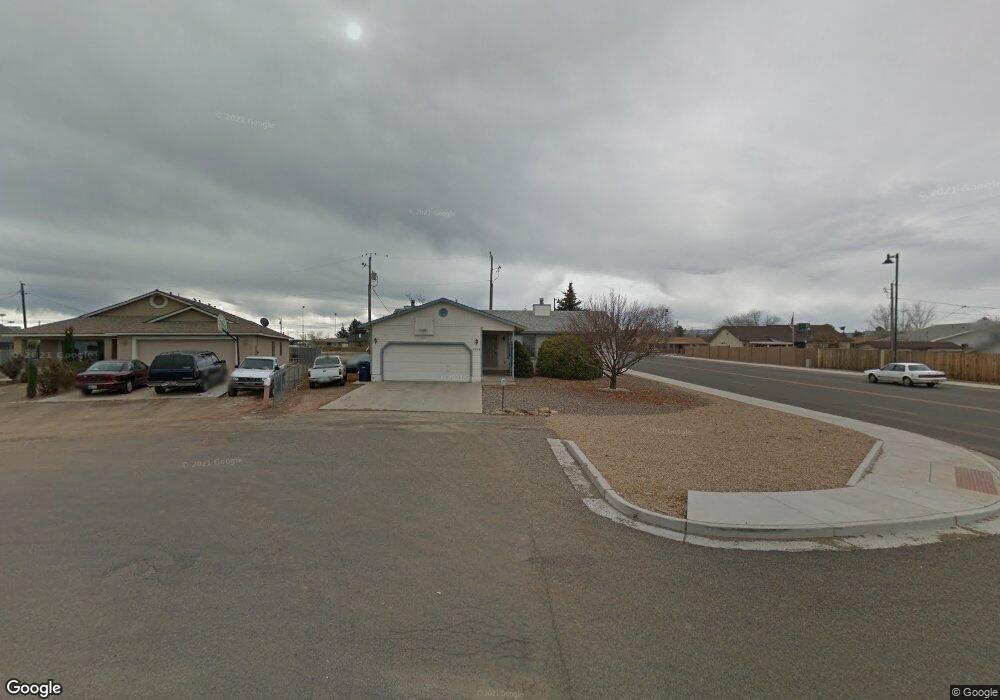
4329 N Noel Ct Prescott Valley, AZ 86314
Estimated Value: $369,027 - $425,000
--
Bed
--
Bath
1,740
Sq Ft
$227/Sq Ft
Est. Value
About This Home
This home is located at 4329 N Noel Ct, Prescott Valley, AZ 86314 and is currently estimated at $395,757, approximately $227 per square foot. 4329 N Noel Ct is a home located in Yavapai County with nearby schools including Mountain View Elementary School, Glassford Hill Middle School, and Bradshaw Mountain High School.
Ownership History
Date
Name
Owned For
Owner Type
Purchase Details
Closed on
Jan 18, 2017
Sold by
Sullivan Thomas J and Sullivan Delores I
Bought by
Rundquist Timothy W and Siviter Harriet M
Current Estimated Value
Home Financials for this Owner
Home Financials are based on the most recent Mortgage that was taken out on this home.
Original Mortgage
$198,500
Outstanding Balance
$163,629
Interest Rate
4.13%
Mortgage Type
VA
Estimated Equity
$232,128
Create a Home Valuation Report for This Property
The Home Valuation Report is an in-depth analysis detailing your home's value as well as a comparison with similar homes in the area
Home Values in the Area
Average Home Value in this Area
Purchase History
| Date | Buyer | Sale Price | Title Company |
|---|---|---|---|
| Rundquist Timothy W | $198,500 | Yavapai Title Agency Inc |
Source: Public Records
Mortgage History
| Date | Status | Borrower | Loan Amount |
|---|---|---|---|
| Open | Rundquist Timothy W | $198,500 |
Source: Public Records
Tax History Compared to Growth
Tax History
| Year | Tax Paid | Tax Assessment Tax Assessment Total Assessment is a certain percentage of the fair market value that is determined by local assessors to be the total taxable value of land and additions on the property. | Land | Improvement |
|---|---|---|---|---|
| 2026 | $1,397 | $34,699 | -- | -- |
| 2024 | $1,281 | $36,461 | -- | -- |
| 2023 | $1,281 | $30,429 | $0 | $0 |
| 2022 | $1,260 | $23,371 | $2,868 | $20,503 |
| 2021 | $1,316 | $21,629 | $2,883 | $18,746 |
| 2020 | $1,265 | $0 | $0 | $0 |
| 2019 | $1,250 | $0 | $0 | $0 |
| 2018 | $1,188 | $0 | $0 | $0 |
| 2017 | $1,165 | $0 | $0 | $0 |
| 2016 | $1,325 | $0 | $0 | $0 |
| 2015 | $1,292 | $0 | $0 | $0 |
| 2014 | $1,049 | $0 | $0 | $0 |
Source: Public Records
Map
Nearby Homes
- 4461 N Phillip Dr
- 4500 N Phillip Dr Unit 4
- 4395 N Katie Cir W
- 547 N Vermillion Dr
- 4441 N Tonto Way
- 4112 N Edith Ct
- 7316 Spouse Dr
- 8591 E Tracy Dr
- 4148 N Jay Ct
- 7940 E Loos Dr
- 4471 N Romero Cir E Unit E
- 3965 N Robert Rd
- 4096 N Jay Ct
- 4420 N Katie Cir E
- 3860 E Teri (Plus Full Basement) Ct
- 8515 E Leigh Dr
- 3981 N Robert Rd
- 7869 E Spouse Dr
- 38-A1 N Norman Rd
- 8775 E Loos Dr
- 4343 N Noel Ct Unit 4
- 4343 N Noel Ct
- 4300 N Sauter Dr E
- 4342 N Noel Dr Unit 3
- 4342 N Noel Dr
- 4357 N Noel Ct
- 4301 N Sauter Dr W
- 4322 N Sauter Dr E Unit 4
- 4324 N Sauter Dr E
- 4301 N Sauter Dr E Unit OO
- 4348 N Noel Dr
- 4348 N Noel Dr Unit 1
- 4356 N Sauter Dr E
- 4356 N Sauter Dr E Unit East
- 4360 N Sauter Dr E
- 4387 N Noel Ct
- 4387 N Noel Ct Unit 4
- 4307 N Sauter Dr W
- 4307 N Sauter Dr W Unit 3
- 4365 N Noel Ct