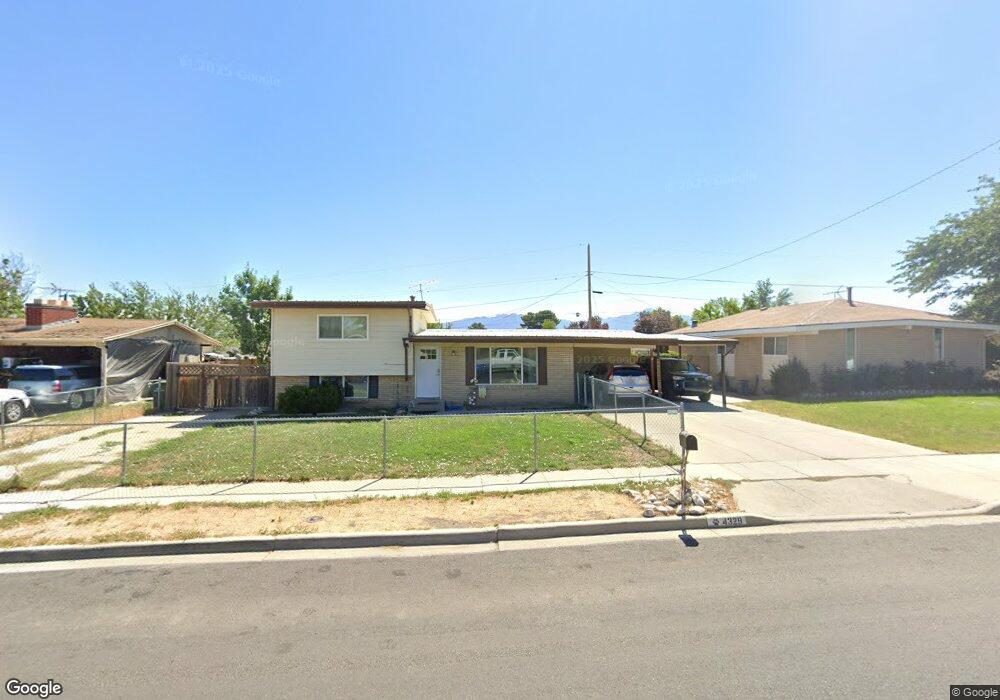
4329 S 4625 W Unit 100 Salt Lake City, UT 84120
Granger NeighborhoodEstimated Value: $446,388 - $488,000
4
Beds
2
Baths
2,075
Sq Ft
$227/Sq Ft
Est. Value
About This Home
This home is located at 4329 S 4625 W Unit 100, Salt Lake City, UT 84120 and is currently estimated at $470,847, approximately $226 per square foot. 4329 S 4625 W Unit 100 is a home located in Salt Lake County with nearby schools including Academy Park Elementary School, Kennedy Junior High School, and Hunter High School.
Ownership History
Date
Name
Owned For
Owner Type
Purchase Details
Closed on
Dec 1, 2022
Sold by
Hernandez Cynthia A
Bought by
Linnett Jonathan
Current Estimated Value
Purchase Details
Closed on
Dec 20, 2019
Sold by
Hernandez Cynthia A and Hernandez Darrell C
Bought by
Hernandez Cynthia A and Hernandez Darrell C
Home Financials for this Owner
Home Financials are based on the most recent Mortgage that was taken out on this home.
Original Mortgage
$256,308
Interest Rate
3.7%
Mortgage Type
FHA
Purchase Details
Closed on
Apr 26, 2018
Sold by
Stelter Nancy
Bought by
Draper Cynthia A and Hernandez Darrell C
Home Financials for this Owner
Home Financials are based on the most recent Mortgage that was taken out on this home.
Original Mortgage
$247,926
Interest Rate
4.44%
Mortgage Type
FHA
Purchase Details
Closed on
Apr 30, 2014
Sold by
West Colony
Bought by
Stelter Nancy
Home Financials for this Owner
Home Financials are based on the most recent Mortgage that was taken out on this home.
Original Mortgage
$169,866
Interest Rate
4.28%
Mortgage Type
FHA
Purchase Details
Closed on
Mar 10, 2011
Sold by
Home Wizard Llc
Bought by
West Colony
Purchase Details
Closed on
Jun 6, 2007
Sold by
Home Wizard Llc
Bought by
Bingham Amy and 4329 West Family Land Trust
Purchase Details
Closed on
Feb 13, 2007
Sold by
Ouchakova Anna
Bought by
Home Wizard Llc
Purchase Details
Closed on
Nov 12, 2006
Sold by
James Rita and James John
Bought by
Green Summit Land Trust
Purchase Details
Closed on
Sep 20, 2004
Sold by
Mayhew Guy S and Mayhew Carol Jean
Bought by
James Rita
Home Financials for this Owner
Home Financials are based on the most recent Mortgage that was taken out on this home.
Original Mortgage
$111,120
Interest Rate
5.25%
Mortgage Type
Purchase Money Mortgage
Purchase Details
Closed on
Aug 14, 2002
Sold by
Mayhew Guy S and Mayhew Carol M
Bought by
Mayhew Guy S and Mayhew Carol Jean
Create a Home Valuation Report for This Property
The Home Valuation Report is an in-depth analysis detailing your home's value as well as a comparison with similar homes in the area
Home Values in the Area
Average Home Value in this Area
Purchase History
| Date | Buyer | Sale Price | Title Company |
|---|---|---|---|
| Linnett Jonathan | -- | -- | |
| Hernandez Cynthia A | -- | Vanguard Title Union Park | |
| Draper Cynthia A | -- | First American Title Ins | |
| Stelter Nancy | -- | Gateway Title Ins Agcy Llc | |
| West Colony | -- | None Available | |
| Bingham Amy | -- | None Available | |
| Home Wizard Llc | -- | None Available | |
| Green Summit Land Trust | -- | None Available | |
| James Rita | -- | Founders Title | |
| Mayhew Guy S | -- | -- |
Source: Public Records
Mortgage History
| Date | Status | Borrower | Loan Amount |
|---|---|---|---|
| Previous Owner | Hernandez Cynthia A | $256,308 | |
| Previous Owner | Draper Cynthia A | $247,926 | |
| Previous Owner | Stelter Nancy | $169,866 | |
| Previous Owner | James Rita | $111,120 | |
| Closed | James Rita | $27,780 | |
| Closed | Linnett Jonathan | $0 |
Source: Public Records
Tax History Compared to Growth
Tax History
| Year | Tax Paid | Tax Assessment Tax Assessment Total Assessment is a certain percentage of the fair market value that is determined by local assessors to be the total taxable value of land and additions on the property. | Land | Improvement |
|---|---|---|---|---|
| 2025 | $2,794 | $432,500 | $93,100 | $339,400 |
| 2024 | $2,794 | $428,000 | $92,500 | $335,500 |
| 2023 | $2,827 | $414,600 | $89,000 | $325,600 |
| 2022 | $2,665 | $391,900 | $87,300 | $304,600 |
| 2021 | $2,344 | $309,800 | $67,100 | $242,700 |
| 2020 | $2,166 | $270,200 | $67,100 | $203,100 |
| 2019 | $2,157 | $259,500 | $63,300 | $196,200 |
| 2018 | $1,952 | $226,400 | $63,300 | $163,100 |
| 2017 | $1,756 | $207,100 | $63,300 | $143,800 |
| 2016 | $1,626 | $192,100 | $63,300 | $128,800 |
| 2015 | $1,529 | $172,000 | $78,300 | $93,700 |
| 2014 | $1,287 | $141,800 | $74,200 | $67,600 |
Source: Public Records
Map
Nearby Homes
- 4308 S 4580 W
- 4297 S 4580 W
- 4332 S 4665 W
- 4332 Losee Dr
- 5548 W 4100 S
- 4211 S 4900 W
- 4532 W 4065 S
- 4171 S 4900 W
- 4270 S Whipoorwhil St
- 4208 S 4205 W
- 4989 W Cherrywood Ln
- 4216 W 4495 S
- 4171 S 4205 W
- 4894 W Westpoint Dr
- 4632 S Arlington Park Dr
- 4597 S Trojan Dr
- 4749 W Arlington Park Dr
- 5050 W Lotus Blossom Dr
- 4644 S Carnegie Tech St Unit 4
- 4114 S Blue Jay St