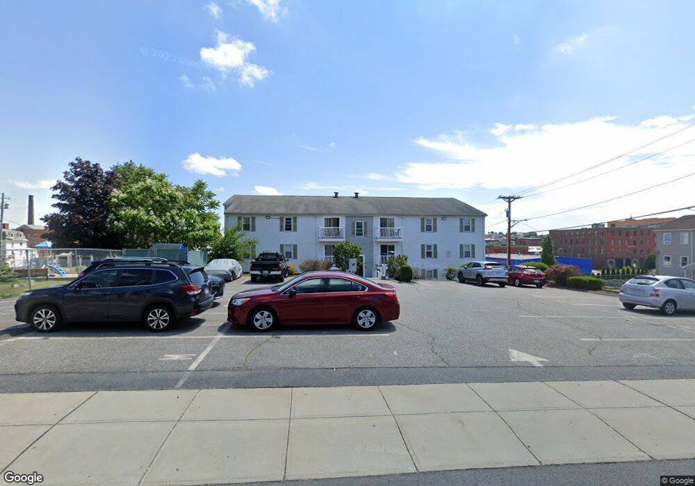
433 Bank St Unit 2 Fall River, MA 02720
Bank Street NeighborhoodEstimated Value: $264,735 - $324,000
3
Beds
1
Bath
1,044
Sq Ft
$283/Sq Ft
Est. Value
About This Home
This home is located at 433 Bank St Unit 2, Fall River, MA 02720 and is currently estimated at $295,934, approximately $283 per square foot. 433 Bank St Unit 2 is a home located in Bristol County with nearby schools including Mary Fonseca Elementary School, Morton Middle School, and B M C Durfee High School.
Ownership History
Date
Name
Owned For
Owner Type
Purchase Details
Closed on
Dec 16, 2011
Sold by
Robidoux John J
Bought by
Dealmeida Manuel and Dealmeida Maria
Current Estimated Value
Purchase Details
Closed on
Apr 1, 2008
Sold by
Tmg Rt and Lindo Manny V
Bought by
Robidoux John J
Home Financials for this Owner
Home Financials are based on the most recent Mortgage that was taken out on this home.
Original Mortgage
$202,896
Interest Rate
5.76%
Mortgage Type
Purchase Money Mortgage
Create a Home Valuation Report for This Property
The Home Valuation Report is an in-depth analysis detailing your home's value as well as a comparison with similar homes in the area
Home Values in the Area
Average Home Value in this Area
Purchase History
| Date | Buyer | Sale Price | Title Company |
|---|---|---|---|
| Dealmeida Manuel | $34,000 | -- | |
| Robidoux John J | $206,000 | -- |
Source: Public Records
Mortgage History
| Date | Status | Borrower | Loan Amount |
|---|---|---|---|
| Previous Owner | Robidoux John J | $202,896 |
Source: Public Records
Tax History
| Year | Tax Paid | Tax Assessment Tax Assessment Total Assessment is a certain percentage of the fair market value that is determined by local assessors to be the total taxable value of land and additions on the property. | Land | Improvement |
|---|---|---|---|---|
| 2025 | $2,400 | $209,600 | $0 | $209,600 |
| 2024 | $2,331 | $202,900 | $0 | $202,900 |
| 2023 | $2,155 | $175,600 | $0 | $175,600 |
| 2022 | $1,758 | $139,300 | $0 | $139,300 |
| 2021 | $1,684 | $121,800 | $0 | $121,800 |
| 2020 | $1,490 | $103,100 | $0 | $103,100 |
| 2019 | $1,287 | $88,300 | $0 | $88,300 |
| 2018 | $1,273 | $87,100 | $0 | $87,100 |
| 2017 | $1,263 | $90,200 | $0 | $90,200 |
| 2016 | $1,195 | $87,700 | $0 | $87,700 |
| 2015 | $1,213 | $92,700 | $0 | $92,700 |
| 2014 | $1,255 | $99,800 | $0 | $99,800 |
Source: Public Records
Map
Nearby Homes
- 433 Bank St Unit 12
- 433 Bank St Unit 11
- 433 Bank St Unit 10
- 433 Bank St Unit 9
- 433 Bank St Unit 8
- 433 Bank St Unit 7
- 433 Bank St Unit 6
- 433 Bank St Unit 5
- 433 Bank St Unit 4
- 433 Bank St Unit 3
- 433 Bank St Unit 1
- 433 Bank St
- 44 N 7th St
- 34 N 7th St
- 464 Bank St Unit 12
- 464 Bank St Unit 11
- 464 Bank St Unit 9
- 464 Bank St Unit 8
- 464 Bank St Unit 7
- 464 Bank St Unit 6
Your Personal Tour Guide
Ask me questions while you tour the home.