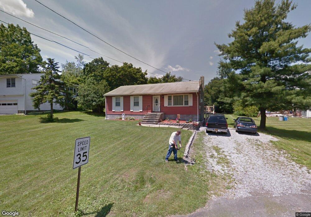
433 Carter Ave Newburgh, NY 12550
Estimated Value: $309,000 - $420,000
3
Beds
1
Bath
1,104
Sq Ft
$326/Sq Ft
Est. Value
About This Home
This home is located at 433 Carter Ave, Newburgh, NY 12550 and is currently estimated at $359,583, approximately $325 per square foot. 433 Carter Ave is a home located in Orange County with nearby schools including Marlboro Central High School and Bishop Dunn Memorial.
Ownership History
Date
Name
Owned For
Owner Type
Purchase Details
Closed on
Jan 23, 2012
Sold by
Estate Of Bruce Anniballi
Bought by
Wolfe Steven S
Current Estimated Value
Purchase Details
Closed on
Sep 13, 1997
Sold by
Sutton Stephen E
Bought by
Anniballi Bruce A and Anniballi Debra K
Purchase Details
Closed on
Apr 29, 1997
Sold by
Sutton Stephen E and Sutton Valerie L
Bought by
Sutton Stephen E
Purchase Details
Closed on
May 29, 1996
Sold by
Thompson John C
Bought by
Comparetto Ignazio and Comparetto Rosalia
Purchase Details
Closed on
Jan 30, 1996
Sold by
Sylvester Frank Michael and Sylvester Anne Elizabeth
Bought by
Comparetto Ignazio and Comparetto Rosalia
Purchase Details
Closed on
Aug 10, 1995
Sold by
Pumphrey Joe M and Dorn Robert J
Bought by
Comparetto Ignazio and Comparetto Nancy
Create a Home Valuation Report for This Property
The Home Valuation Report is an in-depth analysis detailing your home's value as well as a comparison with similar homes in the area
Home Values in the Area
Average Home Value in this Area
Purchase History
| Date | Buyer | Sale Price | Title Company |
|---|---|---|---|
| Wolfe Steven S | $120,000 | Sarah Ramos | |
| Anniballi Bruce A | $105,000 | -- | |
| Sutton Stephen E | -- | American Title Ins Co | |
| Comparetto Ignazio | $150,000 | Commonwealth Land Title Ins | |
| Comparetto Ignazio | $35,000 | -- | |
| Comparetto Ignazio | $120,000 | -- |
Source: Public Records
Tax History Compared to Growth
Tax History
| Year | Tax Paid | Tax Assessment Tax Assessment Total Assessment is a certain percentage of the fair market value that is determined by local assessors to be the total taxable value of land and additions on the property. | Land | Improvement |
|---|---|---|---|---|
| 2024 | $4,592 | $40,500 | $8,500 | $32,000 |
| 2023 | $4,592 | $40,500 | $8,500 | $32,000 |
| 2022 | $4,748 | $40,500 | $8,500 | $32,000 |
| 2021 | $5,135 | $40,500 | $8,500 | $32,000 |
| 2020 | $4,192 | $40,500 | $8,500 | $32,000 |
| 2019 | $3,911 | $40,500 | $8,500 | $32,000 |
| 2018 | $3,911 | $40,500 | $8,500 | $32,000 |
| 2017 | $3,756 | $40,500 | $8,500 | $32,000 |
| 2016 | $3,673 | $40,500 | $8,500 | $32,000 |
| 2015 | -- | $40,500 | $8,500 | $32,000 |
| 2014 | -- | $40,500 | $8,500 | $32,000 |
Source: Public Records
Map
Nearby Homes
- 1 Summer Dr
- 2 Harcourt Cosman Dr
- 98 Lattintown Rd
- 28 Overlook Dr
- 17 Midway Dr
- 18 Midway Dr
- 15 Midway Dr
- 11 Midway Dr
- 14 Midway Dr
- 1304 Parr Lake Dr
- 9 Midway Dr
- 12 Midway Dr
- 1404 Parr Lake Dr Unit 14D
- 3 Midway Dr
- 36 Lexington Dr
- 1 Midway Dr
- 404 Parr Meadow Dr Unit 4D
- 23 Lexington Dr
- 2 Midway Dr
- 804 Parr Meadow Dr
- 429 Carter Ave
- 55 Lattintown Rd
- 423 Carter Ave
- 3 Holmes Rd
- 7 Holmes Rd
- 419 Carter Ave
- 11 Holmes Rd
- 42 Lattintown Rd
- 0 Holmes Rd
- 0 Holmes Rd Unit 20131346
- 0 Holmes Rd Unit H6104396
- 0 Holmes Rd Unit H6046345
- 0 Holmes Rd Unit H4640138
- 0 Holmes Rd Unit H5089262
- 0 Holmes Rd Unit 6022278
- 0 Holmes Rd Unit 4825894
- 61 Lattintown Rd
- 38 Lattintown Rd
- 40 Lattintown Rd
- 41 Lattintown Rd