Estimated Value: $333,000 - $369,737
3
Beds
3
Baths
2,580
Sq Ft
$138/Sq Ft
Est. Value
About This Home
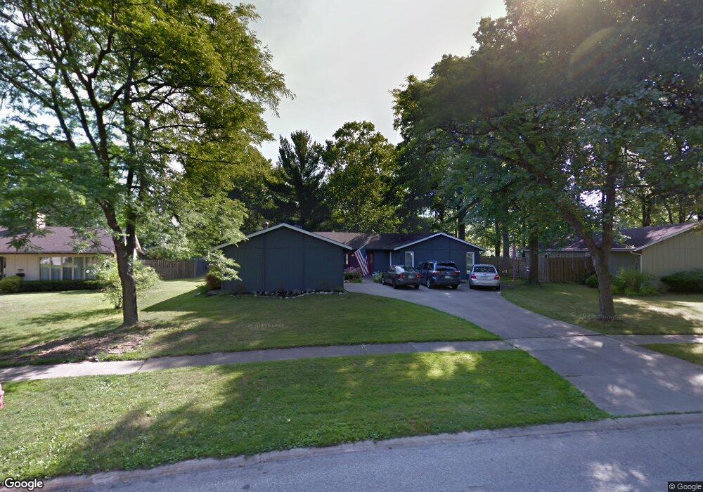
This home is located at 433 Cranston Dr, Berea, OH 44017 and is currently estimated at $357,184, approximately $138 per square foot. 433 Cranston Dr is a home located in Cuyahoga County with nearby schools including Grindstone Elementary School, Berea-Midpark Middle School, and Berea-Midpark High School.
Ownership History
Date
Name
Owned For
Owner Type
Purchase Details
Closed on
Jul 16, 1997
Sold by
Marginian Linda C
Bought by
Kavander David C and Kavander Dana J
Current Estimated Value
Home Financials for this Owner
Home Financials are based on the most recent Mortgage that was taken out on this home.
Original Mortgage
$158,000
Outstanding Balance
$22,903
Interest Rate
7.63%
Mortgage Type
New Conventional
Estimated Equity
$334,281
Purchase Details
Closed on
Jul 1, 1993
Sold by
Justice John M
Bought by
Marginian Linda C
Purchase Details
Closed on
May 22, 1992
Sold by
Sotos Raymond G and Sotos Carol J
Bought by
Justice John M
Purchase Details
Closed on
Jan 1, 1975
Bought by
Sotos Raymond G and Sotos Carol J
Create a Home Valuation Report for This Property
The Home Valuation Report is an in-depth analysis detailing your home's value as well as a comparison with similar homes in the area
Home Values in the Area
Average Home Value in this Area
Purchase History
| Date | Buyer | Sale Price | Title Company |
|---|---|---|---|
| Kavander David C | $185,900 | -- | |
| Marginian Linda C | $160,000 | -- | |
| Justice John M | $154,500 | -- | |
| Sotos Raymond G | -- | -- |
Source: Public Records
Mortgage History
| Date | Status | Borrower | Loan Amount |
|---|---|---|---|
| Open | Kavander David C | $158,000 |
Source: Public Records
Tax History Compared to Growth
Tax History
| Year | Tax Paid | Tax Assessment Tax Assessment Total Assessment is a certain percentage of the fair market value that is determined by local assessors to be the total taxable value of land and additions on the property. | Land | Improvement |
|---|---|---|---|---|
| 2024 | $6,425 | $111,090 | $23,135 | $87,955 |
| 2023 | $5,681 | $82,260 | $19,780 | $62,480 |
| 2022 | $5,645 | $82,250 | $19,780 | $62,480 |
| 2021 | $5,571 | $81,870 | $19,780 | $62,090 |
| 2020 | $5,322 | $69,370 | $16,770 | $52,610 |
| 2019 | $5,180 | $198,200 | $47,900 | $150,300 |
| 2018 | $5,151 | $69,370 | $16,770 | $52,610 |
| 2017 | $5,016 | $62,690 | $15,160 | $47,530 |
| 2016 | $4,979 | $62,690 | $15,160 | $47,530 |
| 2015 | $4,952 | $62,690 | $15,160 | $47,530 |
| 2014 | $4,952 | $65,980 | $15,960 | $50,020 |
Source: Public Records
Map
Nearby Homes
- 517 Wyleswood Dr
- 537 Wyleswood Dr
- 543 Wyleswood Dr
- 549 Wyleswood Dr
- Passionflower II Plan at Aspire at Longbrooke
- Daffodil II Plan at Aspire at Longbrooke
- 396 Crossbrook Dr
- 405 Baldwin Dr
- 540 Crossbrook Dr
- 451 Edgewood Cir
- 626 Ensenada Ct Unit 5
- 266 Race St
- 23002 Chandlers Ln Unit 221
- 23002 Chandlers Ln
- 23002 Chandlers Ln Unit 342
- 732 Wyleswood Dr
- 585 Woodmere Dr
- 294 West St
- 23155 Wainwright Terrace
- 23390 Wainwright Terrace
- 415 Cranston Dr
- 429 Cranston Dr
- 425 Cranston Dr
- 439 Cranston Dr
- 409 Cranston Dr
- 435 Cranston Dr
- 434 Cranston Dr
- 419 Cranston Dr
- 430 Cranston Dr
- 401 Cranston Dr
- 445 Cranston Dr
- 443 Cranston Dr
- 446 Cranston Dr
- 398 Cranston Dr
- 416 Cranston Dr
- 411 Cranston Dr
- 392 Cranston Dr
- 481 Race St
- 453 Cranston Dr
- 489 Race St