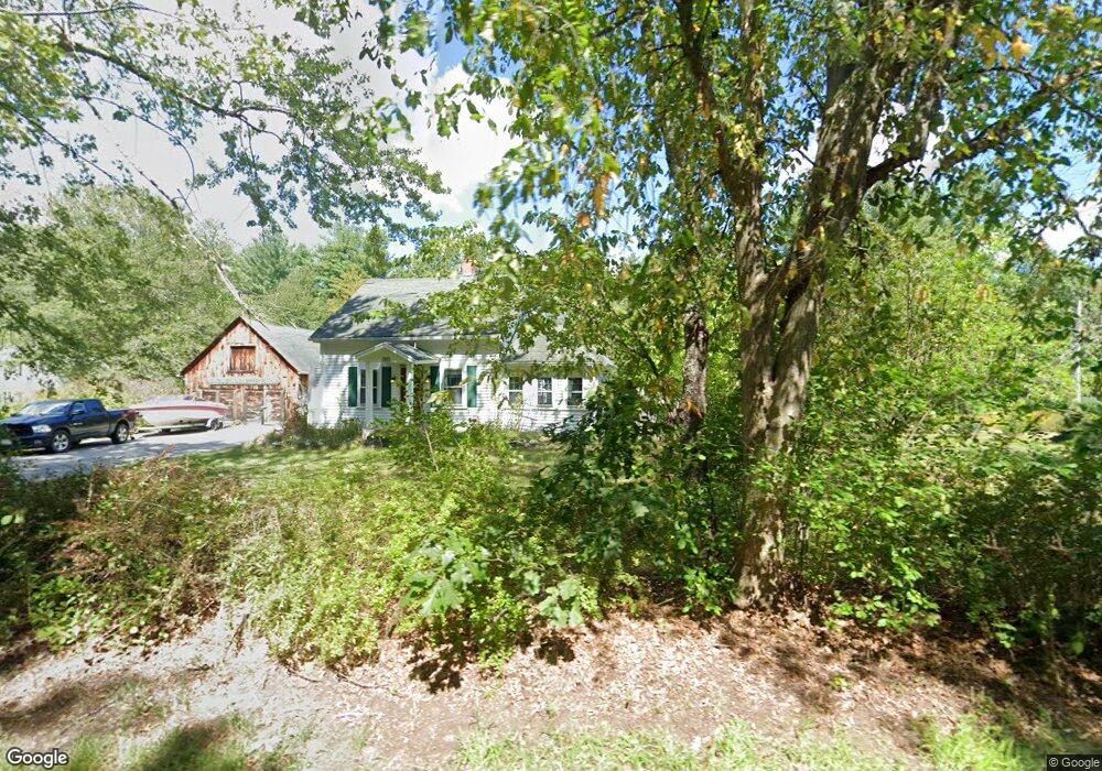
433 Groton St Dunstable, MA 01827
Estimated Value: $508,000 - $567,000
4
Beds
2
Baths
1,409
Sq Ft
$376/Sq Ft
Est. Value
About This Home
This home is located at 433 Groton St, Dunstable, MA 01827 and is currently estimated at $529,952, approximately $376 per square foot. 433 Groton St is a home located in Middlesex County with nearby schools including Groton Dunstable Regional High School.
Ownership History
Date
Name
Owned For
Owner Type
Purchase Details
Closed on
Apr 2, 2024
Sold by
Spang David A
Bought by
Uncuetnassette Farm T and Spang
Current Estimated Value
Purchase Details
Closed on
Jan 4, 2020
Sold by
Spang David A and Spang Julie A
Bought by
Spang David A
Home Financials for this Owner
Home Financials are based on the most recent Mortgage that was taken out on this home.
Original Mortgage
$177,000
Interest Rate
2.71%
Mortgage Type
New Conventional
Purchase Details
Closed on
Aug 1, 1996
Sold by
New England Dev Rt and Page
Bought by
Polewarczyk Brian and Polewarczyk Cynthia
Purchase Details
Closed on
Jan 31, 1992
Sold by
Lanoue David A and Lanoue Ellen A
Bought by
Spang David and Spang Julie Ann
Create a Home Valuation Report for This Property
The Home Valuation Report is an in-depth analysis detailing your home's value as well as a comparison with similar homes in the area
Home Values in the Area
Average Home Value in this Area
Purchase History
| Date | Buyer | Sale Price | Title Company |
|---|---|---|---|
| Uncuetnassette Farm T | -- | None Available | |
| Uncuetnassette Farm T | -- | None Available | |
| Spang David A | -- | None Available | |
| Spang David A | -- | None Available | |
| Polewarczyk Brian | $53,750 | -- | |
| New England Dev Rt | $107,500 | -- | |
| New England Dev Rt | $107,500 | -- | |
| Spang David | $147,000 | -- | |
| Spang David | $147,000 | -- |
Source: Public Records
Mortgage History
| Date | Status | Borrower | Loan Amount |
|---|---|---|---|
| Previous Owner | Spang David A | $177,000 | |
| Previous Owner | Spang David | $200,000 | |
| Previous Owner | Spang David | $15,000 |
Source: Public Records
Tax History Compared to Growth
Tax History
| Year | Tax Paid | Tax Assessment Tax Assessment Total Assessment is a certain percentage of the fair market value that is determined by local assessors to be the total taxable value of land and additions on the property. | Land | Improvement |
|---|---|---|---|---|
| 2025 | $5,776 | $420,100 | $221,000 | $199,100 |
| 2024 | $5,511 | $394,800 | $202,700 | $192,100 |
| 2023 | $5,487 | $366,500 | $202,700 | $163,800 |
| 2022 | $5,496 | $360,400 | $202,700 | $157,700 |
| 2021 | $8,330 | $320,300 | $185,400 | $134,900 |
| 2020 | $11,692 | $315,400 | $185,400 | $130,000 |
| 2019 | $5,275 | $309,200 | $185,400 | $123,800 |
| 2018 | $12,648 | $293,500 | $184,400 | $109,100 |
| 2017 | $5,144 | $291,000 | $184,400 | $106,600 |
| 2016 | $4,569 | $276,100 | $176,200 | $99,900 |
| 2015 | $4,268 | $255,100 | $148,500 | $106,600 |
| 2014 | $3,980 | $252,400 | $148,500 | $103,900 |
Source: Public Records
Map
Nearby Homes
- 8 Jamie Rd
- 153 Off Pond St
- 660 Old Dunstable Rd
- 319 Pleasant St
- 2 Wildflower Ln
- 208 North St
- 0 Old Dunstable Rd
- 452 River St
- 5 June St
- 91 Chicopee Row
- 446 Westford St
- 46 Lowell Rd
- 23 Shawnee Rd Unit 23
- 573 Longley Rd
- 38 Tarbell St Unit 5B
- 9 Tarbell St
- 18 Ingalls Rd
- 28-30 Groton St
- 31 Prospect St
- 80A Nashua Rd