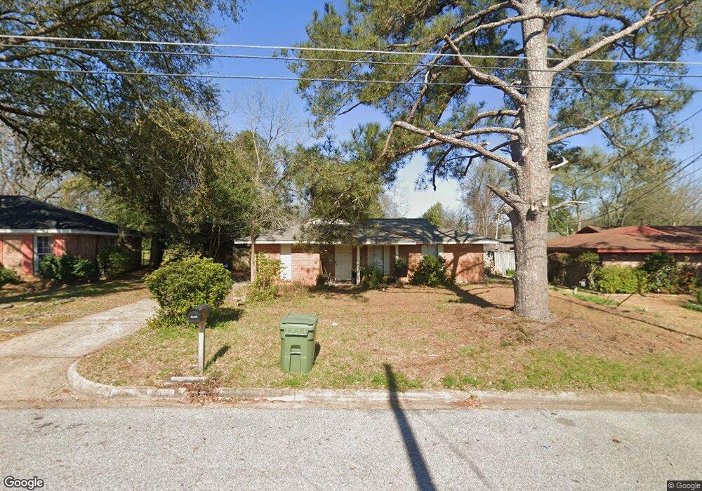
433 Mulligan Dr Montgomery, AL 36117
East Montgomery NeighborhoodEstimated Value: $131,000 - $138,685
3
Beds
2
Baths
1,552
Sq Ft
$86/Sq Ft
Est. Value
About This Home
This home is located at 433 Mulligan Dr, Montgomery, AL 36117 and is currently estimated at $133,921, approximately $86 per square foot. 433 Mulligan Dr is a home located in Montgomery County with nearby schools including Wares Ferry Road Elementary School, Goodwyn Middle School, and Dr. Percy L. Julian High School.
Ownership History
Date
Name
Owned For
Owner Type
Purchase Details
Closed on
Sep 29, 2009
Sold by
Cook Ryan O and Cook Linsey D
Bought by
Wilson Renisha S
Current Estimated Value
Home Financials for this Owner
Home Financials are based on the most recent Mortgage that was taken out on this home.
Original Mortgage
$98,090
Outstanding Balance
$63,857
Interest Rate
5.1%
Mortgage Type
FHA
Estimated Equity
$70,064
Purchase Details
Closed on
Sep 30, 2004
Sold by
Finesilver Michael P and Finesilver Mimi
Bought by
Cook Ryan O and Grimes Linsey D
Home Financials for this Owner
Home Financials are based on the most recent Mortgage that was taken out on this home.
Original Mortgage
$85,085
Interest Rate
5.73%
Mortgage Type
Purchase Money Mortgage
Purchase Details
Closed on
May 21, 2004
Sold by
Tenorio Francisco
Bought by
Finesilver Michael P and Finesilver Mimi
Purchase Details
Closed on
Apr 29, 2004
Sold by
Tenorio Francisco
Bought by
Finesilver Michael
Create a Home Valuation Report for This Property
The Home Valuation Report is an in-depth analysis detailing your home's value as well as a comparison with similar homes in the area
Home Values in the Area
Average Home Value in this Area
Purchase History
| Date | Buyer | Sale Price | Title Company |
|---|---|---|---|
| Wilson Renisha S | $100,090 | None Available | |
| Cook Ryan O | $85,585 | -- | |
| Finesilver Michael P | -- | -- | |
| Finesilver Michael | -- | -- |
Source: Public Records
Mortgage History
| Date | Status | Borrower | Loan Amount |
|---|---|---|---|
| Open | Wilson Renisha S | $98,090 | |
| Previous Owner | Cook Ryan O | $85,085 |
Source: Public Records
Tax History Compared to Growth
Tax History
| Year | Tax Paid | Tax Assessment Tax Assessment Total Assessment is a certain percentage of the fair market value that is determined by local assessors to be the total taxable value of land and additions on the property. | Land | Improvement |
|---|---|---|---|---|
| 2025 | $528 | $11,500 | $1,500 | $10,000 |
| 2024 | $514 | $11,230 | $1,500 | $9,730 |
| 2023 | $514 | $11,630 | $1,500 | $10,130 |
| 2022 | $307 | $9,530 | $1,500 | $8,030 |
| 2021 | $269 | $8,500 | $0 | $0 |
| 2020 | $269 | $8,490 | $1,500 | $6,990 |
| 2019 | $282 | $8,830 | $1,500 | $7,330 |
| 2018 | $307 | $8,410 | $1,500 | $6,910 |
| 2017 | $231 | $14,920 | $3,000 | $11,920 |
| 2014 | $264 | $8,359 | $1,500 | $6,859 |
| 2013 | -- | $9,220 | $1,500 | $7,720 |
Source: Public Records
Map
Nearby Homes
- 6120 Hinchcliff Rd
- 6119 Hinchcliff Rd
- 6228 Hinchcliff Rd
- 6214 Gladstone Dr
- 0000 N Burbank Dr
- 740 Havelock Ln
- 310 Kroy Dr
- 6201 Dalford Dr
- 6204 Lycoming Rd
- 6241 Wares Ferry Rd
- 6316 Pinebrook Dr
- 6427 Pinebrook Dr
- 6408 Pinebrook Dr
- 6037 Burbank Crossing Loop
- 225 Townsend Dr
- 767 N Burbank Dr
- 6272 Nature Dr
- 5922 Havenwood Dr
- 6520 Pinebrook Dr
- 5821 Hyde Park Dr
- 429 Mulligan Dr
- 437 Mulligan Dr
- 6108 Hinchcliff Rd
- 6112 Hinchcliff Rd
- 6104 Hinchcliff Rd
- 441 Mulligan Dr
- 425 Mulligan Dr
- 6116 Hinchcliff Rd
- 434 Stroll Dr
- 426 Stroll Dr
- 421 Mulligan Dr
- 438 Mulligan Dr
- 449 Mulligan Dr
- 430 Mulligan Dr
- 424 Mulligan Dr
- 422 Stroll Dr
- 442 Mulligan Dr
- 417 Mulligan Dr
- 418 Stroll Dr
- 457 Mulligan Dr