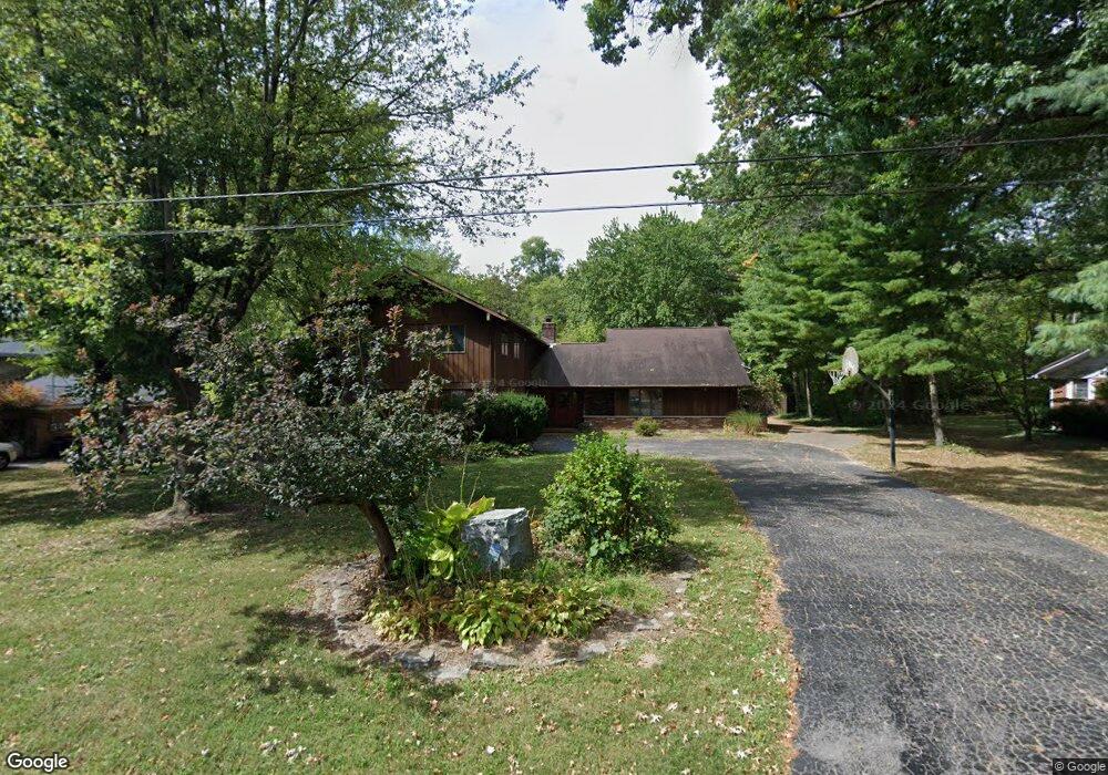
433 N Green St Georgetown, OH 45121
Estimated Value: $305,000 - $393,971
4
Beds
3
Baths
3,330
Sq Ft
$107/Sq Ft
Est. Value
About This Home
This home is located at 433 N Green St, Georgetown, OH 45121 and is currently estimated at $355,993, approximately $106 per square foot. 433 N Green St is a home located in Brown County with nearby schools including Georgetown Elementary School and Georgetown Jr/Sr High School.
Ownership History
Date
Name
Owned For
Owner Type
Purchase Details
Closed on
Oct 5, 2004
Sold by
Heslar James E and Heslar Debra L
Bought by
Heslar James E and Heslar Debra L
Current Estimated Value
Home Financials for this Owner
Home Financials are based on the most recent Mortgage that was taken out on this home.
Original Mortgage
$100,000
Interest Rate
5.93%
Mortgage Type
New Conventional
Create a Home Valuation Report for This Property
The Home Valuation Report is an in-depth analysis detailing your home's value as well as a comparison with similar homes in the area
Home Values in the Area
Average Home Value in this Area
Purchase History
| Date | Buyer | Sale Price | Title Company |
|---|---|---|---|
| Heslar James E | -- | -- |
Source: Public Records
Mortgage History
| Date | Status | Borrower | Loan Amount |
|---|---|---|---|
| Closed | Heslar James E | $100,000 | |
| Closed | Heslar James E | $66,000 |
Source: Public Records
Tax History Compared to Growth
Tax History
| Year | Tax Paid | Tax Assessment Tax Assessment Total Assessment is a certain percentage of the fair market value that is determined by local assessors to be the total taxable value of land and additions on the property. | Land | Improvement |
|---|---|---|---|---|
| 2024 | $4,082 | $115,230 | $7,130 | $108,100 |
| 2023 | $4,082 | $87,140 | $5,990 | $81,150 |
| 2022 | $3,228 | $83,710 | $2,560 | $81,150 |
| 2021 | $3,199 | $83,710 | $2,560 | $81,150 |
| 2020 | $2,831 | $69,770 | $2,140 | $67,630 |
| 2019 | $2,811 | $69,770 | $2,140 | $67,630 |
| 2018 | $2,791 | $69,770 | $2,140 | $67,630 |
| 2017 | $2,061 | $61,160 | $2,350 | $58,810 |
| 2016 | $2,060 | $61,160 | $2,350 | $58,810 |
| 2015 | $2,229 | $61,160 | $2,350 | $58,810 |
| 2014 | $2,229 | $60,950 | $2,140 | $58,810 |
| 2013 | $2,223 | $60,950 | $2,140 | $58,810 |
Source: Public Records
Map
Nearby Homes
- 508 Mount Orab Pike
- 409 N Main St
- 405 N Main St
- 414 N Water St
- 120 N Apple St
- 102 Bill Dee Dr
- 403 Elmwood Ct
- 401 Elmwood Ct
- 331 Spring Grove Dr
- 406 E North St
- 107 N Elm St
- 874 Mount Orab Pike
- 60 New St
- 427 Kenwood Ave
- 102 N Elm St
- 306 W 2nd St
- 402 S Pleasant St
- 202 W 4th St
- 505 S Water St
- 418 Home St