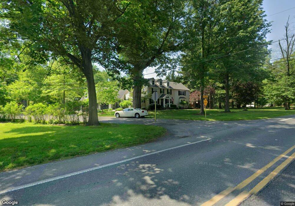
433 Norristown Rd Horsham, PA 19044
Estimated Value: $729,000 - $804,000
5
Beds
3
Baths
3,315
Sq Ft
$230/Sq Ft
Est. Value
About This Home
This home is located at 433 Norristown Rd, Horsham, PA 19044 and is currently estimated at $763,685, approximately $230 per square foot. 433 Norristown Rd is a home located in Montgomery County with nearby schools including Blair Mill Elementary School, Keith Valley Middle School, and Hatboro-Horsham Senior High School.
Ownership History
Date
Name
Owned For
Owner Type
Purchase Details
Closed on
Oct 6, 2016
Sold by
Hollish Lewis A and Buchanan Hollish Barbara J
Bought by
Hollish Lewis and Hollish Barbara
Current Estimated Value
Home Financials for this Owner
Home Financials are based on the most recent Mortgage that was taken out on this home.
Original Mortgage
$298,000
Outstanding Balance
$139,564
Interest Rate
3.44%
Mortgage Type
New Conventional
Estimated Equity
$624,121
Purchase Details
Closed on
Sep 10, 2003
Sold by
Barbieri Mary K
Bought by
Hollish Lewis A and Buchanan Hollish Barbara J
Home Financials for this Owner
Home Financials are based on the most recent Mortgage that was taken out on this home.
Original Mortgage
$30,000
Interest Rate
6.35%
Create a Home Valuation Report for This Property
The Home Valuation Report is an in-depth analysis detailing your home's value as well as a comparison with similar homes in the area
Home Values in the Area
Average Home Value in this Area
Purchase History
| Date | Buyer | Sale Price | Title Company |
|---|---|---|---|
| Hollish Lewis | $535,000 | Tohickon Settlement Services | |
| Hollish Lewis A | $240,000 | -- |
Source: Public Records
Mortgage History
| Date | Status | Borrower | Loan Amount |
|---|---|---|---|
| Open | Hollish Lewis | $298,000 | |
| Previous Owner | Hollish Lewis A | $30,000 |
Source: Public Records
Tax History Compared to Growth
Tax History
| Year | Tax Paid | Tax Assessment Tax Assessment Total Assessment is a certain percentage of the fair market value that is determined by local assessors to be the total taxable value of land and additions on the property. | Land | Improvement |
|---|---|---|---|---|
| 2025 | $9,130 | $232,240 | -- | -- |
| 2024 | $9,130 | $232,240 | -- | -- |
| 2023 | $8,690 | $232,240 | $0 | $0 |
| 2022 | $8,408 | $232,240 | $0 | $0 |
| 2021 | $8,209 | $232,240 | $0 | $0 |
| 2020 | $8,015 | $232,240 | $0 | $0 |
| 2019 | $7,862 | $232,240 | $0 | $0 |
| 2018 | $6,383 | $232,240 | $0 | $0 |
| 2017 | $7,510 | $232,240 | $0 | $0 |
| 2016 | $7,419 | $232,240 | $0 | $0 |
| 2015 | $7,270 | $232,240 | $0 | $0 |
| 2014 | $7,085 | $232,240 | $0 | $0 |
Source: Public Records
Map
Nearby Homes
- 2 Cedarbrook Dr
- 80 Whetstone Rd
- 45 Ember Ln
- 124 Sarahs Ln
- 4 Beaver Hill Rd
- 585 Colonial Dr
- 8 Barrel Stave Cir
- 45 Brookside Ct
- 44 Brookside Ct Unit 44
- 15 Barrel Stave Cir
- 3 Emily Ct
- 603 Norristown Rd
- 454 1/2 Avenue A Unit A
- 43 Black Watch Ct
- 6 Pheasant Run
- 890 Easton Rd
- 18 Hunt Dr
- 414 Watson Ave
- 204 Wilson Ave
- 240 Roberts Ave
- 609 Eugenia Rd
- 431 Norristown Rd
- 00 Locust Ln
- 612 Eugenia Rd
- 435 Norristown Rd
- 610 Eugenia Rd
- 91 Greenwoods Dr
- 607 Eugenia Rd
- 424 Norristown Rd
- 89 Greenwoods Dr
- 426 Norristown Rd
- 428 Norristown Rd
- 439 Norristown Rd
- 1 Firewood Dr
- 87 Greenwoods Dr
- 432 Norristown Rd
- 3 Firewood Dr
- 85 Greenwoods Dr
- 5 Firewood Dr
- 83 Greenwoods Dr