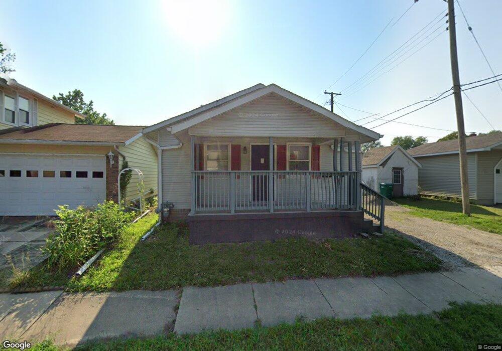
433 S 22nd St Decatur, IL 62521
Lions Park NeighborhoodEstimated Value: $39,000 - $57,000
2
Beds
1
Bath
1,728
Sq Ft
$26/Sq Ft
Est. Value
About This Home
This home is located at 433 S 22nd St, Decatur, IL 62521 and is currently estimated at $45,651, approximately $26 per square foot. 433 S 22nd St is a home located in Macon County with nearby schools including Muffley Elementary School, Stephen Decatur Middle School, and Robertson Charter School.
Ownership History
Date
Name
Owned For
Owner Type
Purchase Details
Closed on
Feb 13, 2024
Sold by
Martinez Rosalba and Hernandez Martinez Rosalba
Bought by
Andrade Alejandro and Leija Rocio
Current Estimated Value
Purchase Details
Closed on
Dec 10, 2021
Sold by
Carnahan Joe E
Bought by
Hernandez-Martinez Rosalba E and Martinez Rosalba
Purchase Details
Closed on
Nov 29, 2006
Sold by
Kuhn Zachary A
Bought by
Carnahan Joe E
Home Financials for this Owner
Home Financials are based on the most recent Mortgage that was taken out on this home.
Original Mortgage
$40,000
Interest Rate
8.5%
Mortgage Type
Future Advance Clause Open End Mortgage
Create a Home Valuation Report for This Property
The Home Valuation Report is an in-depth analysis detailing your home's value as well as a comparison with similar homes in the area
Home Values in the Area
Average Home Value in this Area
Purchase History
| Date | Buyer | Sale Price | Title Company |
|---|---|---|---|
| Andrade Alejandro | $36,500 | None Listed On Document | |
| Hernandez-Martinez Rosalba E | $15,000 | None Listed On Document | |
| Hernandez-Martinez Rosalba E | $15,000 | None Listed On Document | |
| Carnahan Joe E | $36,000 | None Available |
Source: Public Records
Mortgage History
| Date | Status | Borrower | Loan Amount |
|---|---|---|---|
| Previous Owner | Carnahan Joe E | $40,000 |
Source: Public Records
Tax History
| Year | Tax Paid | Tax Assessment Tax Assessment Total Assessment is a certain percentage of the fair market value that is determined by local assessors to be the total taxable value of land and additions on the property. | Land | Improvement |
|---|---|---|---|---|
| 2024 | $1,136 | $11,736 | $683 | $11,053 |
| 2023 | $1,127 | $11,321 | $659 | $10,662 |
| 2022 | $1,052 | $10,283 | $610 | $9,673 |
| 2021 | $988 | $9,604 | $570 | $9,034 |
| 2020 | $974 | $9,159 | $544 | $8,615 |
| 2019 | $974 | $9,159 | $544 | $8,615 |
| 2018 | $1,002 | $9,533 | $906 | $8,627 |
| 2017 | $1,025 | $9,787 | $930 | $8,857 |
| 2016 | $1,045 | $9,886 | $939 | $8,947 |
| 2015 | $993 | $9,711 | $922 | $8,789 |
| 2014 | $922 | $9,615 | $913 | $8,702 |
| 2013 | $952 | $9,976 | $947 | $9,029 |
Source: Public Records
Map
Nearby Homes
- 2152 E Decatur St
- 2150 E Clay St
- 2104 E Whitmer St
- 2360 E Wood St
- 729 S 22nd St
- 2039 E Whitmer St
- 1739 E Johns Ave
- 1722 E Johns Ave
- 111 S 24th+520 E Division+870 N Union St
- 632 S 17th St
- 2440 E Wood St
- 203 S 25th St
- 1608 E Clay St
- 230 S 16th St
- 2434 E Prairie St
- 1422 Sedgwick St
- 1135 S 21st St
- 1901 Indiana Ct
- 1202 Florida Ave
- 1263 Sedgwick St
- 2195 E Johns Ave
- 2192 E Decatur St
- 2185 E Johns Ave
- 2182 E Decatur St
- 2172 E Decatur St
- 2175 E Johns Ave
- 420 S 22nd St
- 450 S 22nd St
- 430 S 22nd St
- 440 S 22nd St
- 404 S 22nd St
- 2165 E Johns Ave
- 2195 E Decatur St
- 2185 E Decatur St
- 2216 E Decatur St
- 2175 E Decatur St
- 2155 E Johns Ave
- 375 S 22nd St
- 2192 E Johns Ave
- 2224 E Decatur St
Your Personal Tour Guide
Ask me questions while you tour the home.