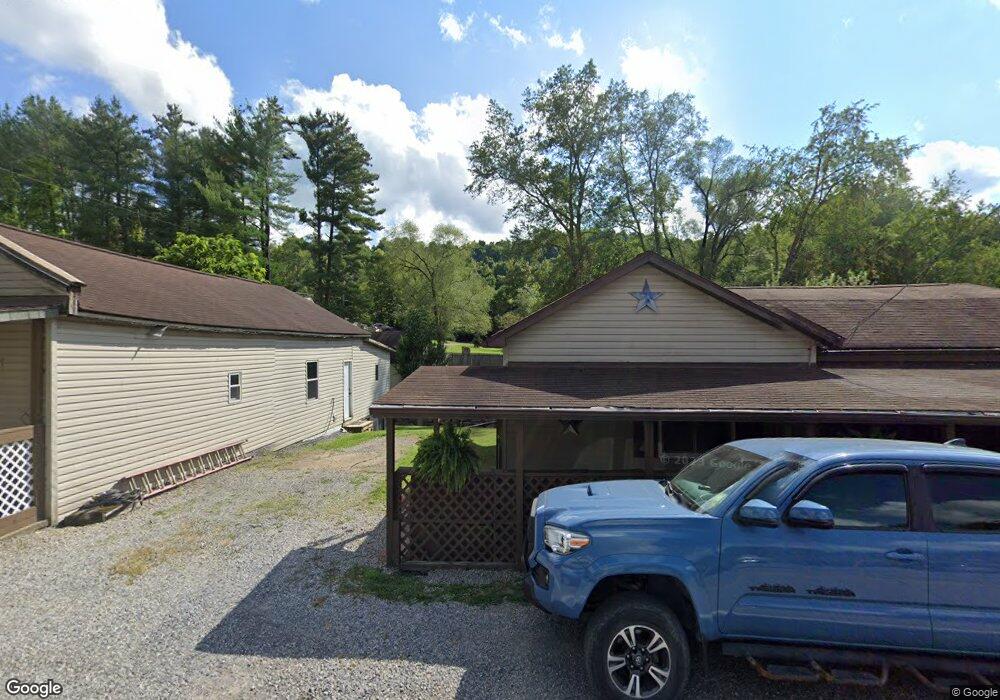
433 S Pike St Anmoore, WV 26323
Estimated Value: $70,000 - $98,576
2
Beds
1
Bath
1,144
Sq Ft
$72/Sq Ft
Est. Value
About This Home
This home is located at 433 S Pike St, Anmoore, WV 26323 and is currently estimated at $81,894, approximately $71 per square foot. 433 S Pike St is a home with nearby schools including St. Mary's Grade School, Heritage Christian School, and Dollie Hilll Christian Academy.
Ownership History
Date
Name
Owned For
Owner Type
Purchase Details
Closed on
Nov 17, 2017
Sold by
Barker Chadrick A
Bought by
Barker Charles L and Barker Pamela J
Current Estimated Value
Purchase Details
Closed on
Jul 9, 2008
Sold by
Barker Charles L and Barker Pamela J
Bought by
Barker Chadrick A
Create a Home Valuation Report for This Property
The Home Valuation Report is an in-depth analysis detailing your home's value as well as a comparison with similar homes in the area
Home Values in the Area
Average Home Value in this Area
Purchase History
| Date | Buyer | Sale Price | Title Company |
|---|---|---|---|
| Barker Charles L | -- | -- | |
| Barker Chadrick A | -- | None Available |
Source: Public Records
Tax History Compared to Growth
Tax History
| Year | Tax Paid | Tax Assessment Tax Assessment Total Assessment is a certain percentage of the fair market value that is determined by local assessors to be the total taxable value of land and additions on the property. | Land | Improvement |
|---|---|---|---|---|
| 2025 | $942 | $33,300 | $2,700 | $30,600 |
| 2024 | $942 | $31,560 | $2,700 | $28,860 |
| 2023 | $882 | $29,160 | $2,700 | $26,460 |
| 2022 | $838 | $29,340 | $2,700 | $26,640 |
| 2021 | $884 | $31,260 | $4,560 | $26,700 |
| 2020 | $877 | $31,260 | $4,560 | $26,700 |
| 2019 | $874 | $31,140 | $4,560 | $26,580 |
| 2018 | $438 | $31,320 | $4,560 | $26,760 |
| 2017 | $434 | $31,140 | $4,560 | $26,580 |
| 2016 | $423 | $30,660 | $4,560 | $26,100 |
| 2015 | $421 | $30,360 | $4,560 | $25,800 |
| 2014 | $405 | $29,280 | $3,480 | $25,800 |
Source: Public Records
Map
Nearby Homes
- 54 Church St
- TBD Sterling Dr
- 516 Brushy Fork Rd
- TBD N 24th St
- 2589 Philippi Pike
- TBD Benedum Run Rd
- 17 Solomon Dr
- 8264 Powell Ave
- 8712 Cost Ave
- 8688 Cost Ave
- 8030 Labrador Ln
- 8037 Maple Ave
- 40 Chickerell St
- 2-A Cherry Tree Dr
- 606 W Virginia Ave
- 134 Pennsylvania Ave
- 332 Timberbrook Ln
- 217 Burton Ave
- 111 Frisco Ln
- 113 Frisco Ln
- 431 S Pike St
- 429 S Pike St
- 365 Park Way
- 430 S Pike St
- 3299 Philippi Pike
- 3299 Philippi Pike
- 3337 Philippi Pike
- 3352 Philippi Pike
- 421 S Pike St
- 507 S Pike St
- 502 S Pike St
- 420 S Pike St
- 3367 Philippi Pike
- 417 S Pike St
- 307 Park Way
- 298 Park Way
- 3389 Philippi Pike
- 491 Mary Dr
- 3401 Philippi Pike
- 410 S Pike St