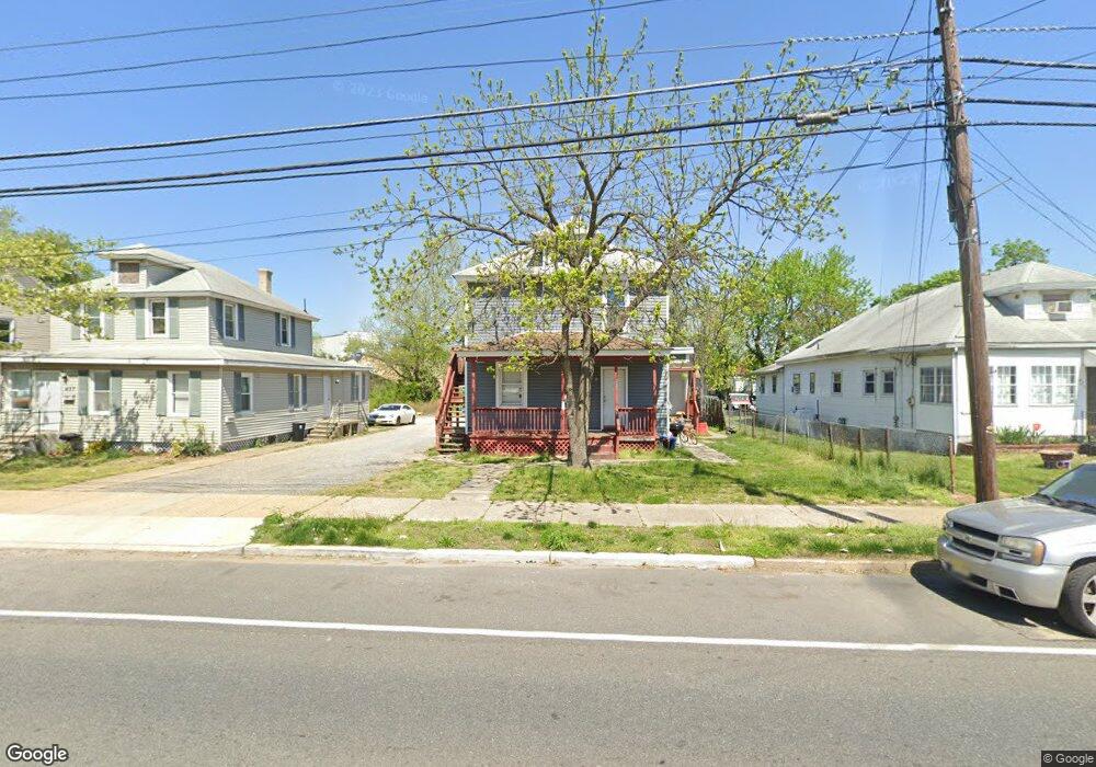
433 W Broad St Paulsboro, NJ 08066
Estimated Value: $201,666 - $279,000
--
Bed
--
Bath
1,952
Sq Ft
$117/Sq Ft
Est. Value
About This Home
This home is located at 433 W Broad St, Paulsboro, NJ 08066 and is currently estimated at $229,167, approximately $117 per square foot. 433 W Broad St is a home located in Gloucester County with nearby schools including Billingsport Elementary School, Loudenslager Elementary School, and Paulsboro High School.
Ownership History
Date
Name
Owned For
Owner Type
Purchase Details
Closed on
Oct 21, 2004
Sold by
Tar Justine M
Bought by
Muluh Lovelyne
Current Estimated Value
Home Financials for this Owner
Home Financials are based on the most recent Mortgage that was taken out on this home.
Original Mortgage
$107,280
Outstanding Balance
$53,237
Interest Rate
5.8%
Mortgage Type
FHA
Estimated Equity
$175,930
Purchase Details
Closed on
Jul 3, 1997
Sold by
Hud
Bought by
Tar Justine M
Home Financials for this Owner
Home Financials are based on the most recent Mortgage that was taken out on this home.
Original Mortgage
$10,000
Interest Rate
7.86%
Purchase Details
Closed on
Jan 11, 1996
Sold by
Gill Charles W
Bought by
Hud
Home Financials for this Owner
Home Financials are based on the most recent Mortgage that was taken out on this home.
Original Mortgage
$46,753
Interest Rate
8.05%
Create a Home Valuation Report for This Property
The Home Valuation Report is an in-depth analysis detailing your home's value as well as a comparison with similar homes in the area
Home Values in the Area
Average Home Value in this Area
Purchase History
| Date | Buyer | Sale Price | Title Company |
|---|---|---|---|
| Muluh Lovelyne | $109,000 | Surety Title Corp | |
| Tar Justine M | $25,418 | Surety Title Corporation | |
| Hud | -- | -- |
Source: Public Records
Mortgage History
| Date | Status | Borrower | Loan Amount |
|---|---|---|---|
| Open | Muluh Lovelyne | $107,280 | |
| Previous Owner | Tar Justine M | $10,000 | |
| Previous Owner | Hud | $46,753 |
Source: Public Records
Tax History Compared to Growth
Tax History
| Year | Tax Paid | Tax Assessment Tax Assessment Total Assessment is a certain percentage of the fair market value that is determined by local assessors to be the total taxable value of land and additions on the property. | Land | Improvement |
|---|---|---|---|---|
| 2025 | $5,654 | $128,500 | $16,500 | $112,000 |
| 2024 | $5,649 | $128,500 | $16,500 | $112,000 |
| 2023 | $5,649 | $128,500 | $16,500 | $112,000 |
| 2022 | $5,546 | $128,500 | $16,500 | $112,000 |
| 2021 | $5,438 | $128,500 | $16,500 | $112,000 |
| 2020 | $5,405 | $128,500 | $16,500 | $112,000 |
| 2019 | $5,235 | $128,500 | $16,500 | $112,000 |
| 2018 | $4,936 | $128,500 | $16,500 | $112,000 |
| 2017 | $4,915 | $128,500 | $16,500 | $112,000 |
| 2016 | $4,683 | $128,500 | $16,500 | $112,000 |
| 2015 | $4,656 | $128,500 | $16,500 | $112,000 |
| 2014 | $4,419 | $131,200 | $18,200 | $113,000 |
Source: Public Records
Map
Nearby Homes
- 335 W Buck St
- 344 W Washington St
- L18 20 W Broad St
- 219 Vanneman Blvd
- 269 W Broad St
- 255 Elizabeth Ave
- 1043 Penn Line Rd
- 227 W Buck St
- 836 E Broad St
- 122 W Washington St
- 129 W Washington St
- 1534 Pine St
- 140 142 W Jefferson St
- 1519 Pine St
- 1214 Walter Ave
- 28 W Jefferson St
- 20 W Adams St
- 21 W Adams St
- 11 W Washington St
- 1224 Heddon Ave
- 429 W Broad St
- 437 W Broad St
- 425 W Broad St
- 421 W Broad St
- 417 W Broad St
- 449 W Broad St
- 350 W Buck St
- 360 W Buck St
- 424 W Broad St
- 413 W Broad St
- 400-404 W Broad St
- 404 W Broad St
- 453-455 W Broad St
- 455 W Broad St Unit A
- 453 W Broad St Unit B
- 453 W Broad St Unit 455
- 453 455 W Broad St
- 400 W Broad St
- 428 W Broad St
- 340 W Buck St