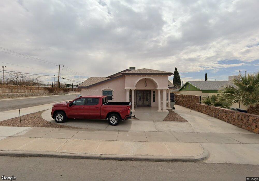
4330 Memphis Ave Unit A-B El Paso, TX 79903
Austin Terrace NeighborhoodEstimated Value: $258,000 - $363,000
4
Beds
2
Baths
2,379
Sq Ft
$121/Sq Ft
Est. Value
About This Home
This home is located at 4330 Memphis Ave Unit A-B, El Paso, TX 79903 and is currently estimated at $288,697, approximately $121 per square foot. 4330 Memphis Ave Unit A-B is a home located in El Paso County with nearby schools including Hillside Elementary School, Burges High School, and Radford School.
Ownership History
Date
Name
Owned For
Owner Type
Purchase Details
Closed on
Sep 7, 2016
Sold by
Romero Manuel
Bought by
Alvarado Laura Lvette
Current Estimated Value
Purchase Details
Closed on
Aug 24, 2009
Sold by
Escobar Enrique
Bought by
Romero Manuel and Alvarado Laura
Home Financials for this Owner
Home Financials are based on the most recent Mortgage that was taken out on this home.
Original Mortgage
$41,667
Interest Rate
5.16%
Mortgage Type
Seller Take Back
Purchase Details
Closed on
Aug 31, 1999
Sold by
Shulgay Mary C and Shulgay Mary M
Bought by
Romero Manuel
Home Financials for this Owner
Home Financials are based on the most recent Mortgage that was taken out on this home.
Original Mortgage
$29,000
Interest Rate
7.58%
Mortgage Type
Seller Take Back
Create a Home Valuation Report for This Property
The Home Valuation Report is an in-depth analysis detailing your home's value as well as a comparison with similar homes in the area
Home Values in the Area
Average Home Value in this Area
Purchase History
| Date | Buyer | Sale Price | Title Company |
|---|---|---|---|
| Alvarado Laura Lvette | -- | None Available | |
| Romero Manuel | -- | None Available | |
| Romero Manuel | -- | -- |
Source: Public Records
Mortgage History
| Date | Status | Borrower | Loan Amount |
|---|---|---|---|
| Previous Owner | Romero Manuel | $41,667 | |
| Previous Owner | Romero Manuel | $29,000 |
Source: Public Records
Tax History
| Year | Tax Paid | Tax Assessment Tax Assessment Total Assessment is a certain percentage of the fair market value that is determined by local assessors to be the total taxable value of land and additions on the property. | Land | Improvement |
|---|---|---|---|---|
| 2025 | $3,534 | $198,092 | -- | -- |
| 2024 | $3,534 | $180,084 | -- | -- |
| 2023 | $3,328 | $163,713 | $0 | $0 |
| 2022 | $4,406 | $148,830 | $0 | $0 |
| 2021 | $4,224 | $155,654 | $17,196 | $138,458 |
| 2020 | $3,780 | $123,000 | $14,012 | $108,988 |
| 2018 | $3,552 | $120,000 | $14,012 | $105,988 |
| 2017 | $3,380 | $120,000 | $14,012 | $105,988 |
| 2016 | $1,908 | $67,749 | $14,012 | $53,737 |
| 2015 | $1,789 | $67,749 | $14,012 | $53,737 |
| 2014 | $1,789 | $65,363 | $14,012 | $51,351 |
Source: Public Records
Map
Nearby Homes
- 4504 Nashville Ave
- 4518 Memphis Ave Unit A
- 2210 Radford St
- 4620 Frankfort Ave
- 3926 Nashville Ave
- 3936 Altura Ave
- 2500 Hawley Cir
- 4405 Cumberland Ave
- 3817 Frankfort Ave
- 4401 Cambridge Ave
- 4333 Pershing Dr Unit 4337
- 3915 Idalia Ave
- 1955 Happer St
- 3919 Cumberland Ave
- 1928 Saint Johns Dr
- 3625 Richmond Ave
- 1623 Howze St
- 3703 Cambridge Ave
- 4130 Trowbridge Dr
- 1506 Raynolds St
- 4330 Memphis Ave
- 4324 Memphis Ave
- 4320 Memphis Ave
- 4331 Frankfort Ave Unit A
- 4331 Frankfort Ave Unit A, B
- 4331 Frankfort Ave Unit B
- 4331 Frankfort Ave
- 4331 Frankfort Ave
- 4331 Frankfort Ave Unit BAK
- 4331 Frankfort Ave Unit RR
- 4331 Frankfort Ave Unit 2
- 4331 Frankfort Ave Unit FRONT/REAR
- 4331 Frankfort Ave Unit REAR
- 4327 Frankfort Ave
- 4316 Memphis Ave
- 4329 Memphis Ave
- 4323 Frankfort Ave
- 4325 Memphis Ave
- 4321 Memphis Ave
- 4321 Memphis Ave Unit REAR
Your Personal Tour Guide
Ask me questions while you tour the home.