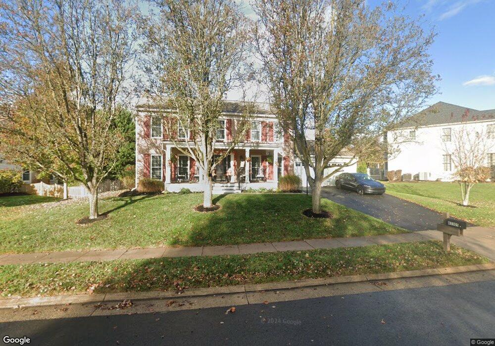
43305 Wayside Cir Ashburn, VA 20147
Estimated Value: $799,000 - $918,506
4
Beds
4
Baths
2,142
Sq Ft
$409/Sq Ft
Est. Value
About This Home
This home is located at 43305 Wayside Cir, Ashburn, VA 20147 and is currently estimated at $875,377, approximately $408 per square foot. 43305 Wayside Cir is a home located in Loudoun County with nearby schools including Sanders Corner Elementary School, Trailside Middle School, and Stone Bridge High.
Ownership History
Date
Name
Owned For
Owner Type
Purchase Details
Closed on
Sep 28, 2022
Sold by
Knowles Keith M and Knowles Robin B
Bought by
Knowles Family Trust
Current Estimated Value
Purchase Details
Closed on
Oct 11, 2005
Sold by
Cawthorne Ronald
Bought by
Knowles Keith
Home Financials for this Owner
Home Financials are based on the most recent Mortgage that was taken out on this home.
Original Mortgage
$402,600
Interest Rate
5.78%
Mortgage Type
New Conventional
Create a Home Valuation Report for This Property
The Home Valuation Report is an in-depth analysis detailing your home's value as well as a comparison with similar homes in the area
Home Values in the Area
Average Home Value in this Area
Purchase History
| Date | Buyer | Sale Price | Title Company |
|---|---|---|---|
| Knowles Family Trust | -- | -- | |
| Knowles Keith | $647,000 | -- |
Source: Public Records
Mortgage History
| Date | Status | Borrower | Loan Amount |
|---|---|---|---|
| Previous Owner | Knowles Keith | $402,600 |
Source: Public Records
Tax History Compared to Growth
Tax History
| Year | Tax Paid | Tax Assessment Tax Assessment Total Assessment is a certain percentage of the fair market value that is determined by local assessors to be the total taxable value of land and additions on the property. | Land | Improvement |
|---|---|---|---|---|
| 2025 | $6,727 | $835,640 | $299,100 | $536,540 |
| 2024 | $6,841 | $790,920 | $299,700 | $491,220 |
| 2023 | $6,747 | $771,080 | $299,700 | $471,380 |
| 2022 | $6,464 | $726,260 | $269,700 | $456,560 |
| 2021 | $6,267 | $639,450 | $219,700 | $419,750 |
| 2020 | $6,212 | $600,150 | $199,100 | $401,050 |
| 2019 | $6,126 | $586,180 | $199,100 | $387,080 |
| 2018 | $5,894 | $543,210 | $179,100 | $364,110 |
| 2017 | $5,891 | $523,600 | $179,100 | $344,500 |
| 2016 | $5,906 | $515,830 | $0 | $0 |
| 2015 | $5,728 | $325,590 | $0 | $325,590 |
| 2014 | $5,588 | $304,750 | $0 | $304,750 |
Source: Public Records
Map
Nearby Homes
- 43494 Postrail Square
- 43501 Postrail Square
- 43535 Postrail Square
- 43485 Plantation Terrace
- 43213 Wayside Cir
- 20965 Timber Ridge Terrace Unit 304
- 43507 Blacksmith Square
- 21026 Timber Ridge Terrace Unit 202
- 43300 Marymount Terrace Unit 301
- 43301 Chokeberry Square
- 20920 Cedarpost Square Unit 200
- 20857 Ashburn Rd
- 20653 Southwind Terrace
- 43183 Glenelder Terrace
- 43218 Chokeberry Square
- 20538 Courier Ridge Place
- 20903 Ivymount Terrace
- 43834 Jenkins Ln
- 21005 Matchlock Ct
- 43537 Graves Ln
- 43309 Wayside Cir
- 43399 Wildrose Ct
- 43395 Wildrose Ct
- 43391 Wildrose Ct
- 43313 Wayside Cir
- 43312 Wayside Cir
- 43304 Wayside Cir
- 43387 Wildrose Ct
- 43308 Wayside Cir
- 43300 Wayside Cir
- 43398 Wildrose Ct
- 43394 Wildrose Ct
- 43317 Wayside Cir
- 43451 Elmhurst Ct
- 43390 Wildrose Ct
- 43456 Elmhurst Ct
- 43383 Wildrose Ct
- 43386 Wildrose Ct
- 43292 Wayside Cir
- 43321 Wayside Cir