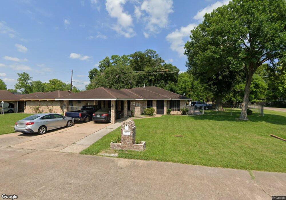
4331 Monitor St Houston, TX 77093
East Aldine NeighborhoodEstimated Value: $202,000 - $276,855
5
Beds
4
Baths
1,823
Sq Ft
$139/Sq Ft
Est. Value
About This Home
This home is located at 4331 Monitor St, Houston, TX 77093 and is currently estimated at $252,714, approximately $138 per square foot. 4331 Monitor St is a home located in Harris County with nearby schools including Vardeman EC/PK/K, Orange Grove Elementary School, and Macarthur Ninth Grade School.
Ownership History
Date
Name
Owned For
Owner Type
Purchase Details
Closed on
Oct 25, 2010
Sold by
Guillory John G and Guillory Zenobia E
Bought by
Gilmore Dexter
Current Estimated Value
Home Financials for this Owner
Home Financials are based on the most recent Mortgage that was taken out on this home.
Original Mortgage
$91,200
Outstanding Balance
$690
Interest Rate
4.38%
Mortgage Type
New Conventional
Estimated Equity
$252,024
Purchase Details
Closed on
Feb 13, 1995
Sold by
Jayroe Elvie Fay
Bought by
Guillory John G and Guillory Zenobia E
Home Financials for this Owner
Home Financials are based on the most recent Mortgage that was taken out on this home.
Original Mortgage
$24,000
Interest Rate
9.13%
Mortgage Type
Seller Take Back
Create a Home Valuation Report for This Property
The Home Valuation Report is an in-depth analysis detailing your home's value as well as a comparison with similar homes in the area
Home Values in the Area
Average Home Value in this Area
Purchase History
| Date | Buyer | Sale Price | Title Company |
|---|---|---|---|
| Gilmore Dexter | -- | Fth | |
| Guillory John G | -- | Texas American Title Company |
Source: Public Records
Mortgage History
| Date | Status | Borrower | Loan Amount |
|---|---|---|---|
| Open | Gilmore Dexter | $91,200 | |
| Previous Owner | Guillory John G | $24,000 |
Source: Public Records
Tax History Compared to Growth
Tax History
| Year | Tax Paid | Tax Assessment Tax Assessment Total Assessment is a certain percentage of the fair market value that is determined by local assessors to be the total taxable value of land and additions on the property. | Land | Improvement |
|---|---|---|---|---|
| 2025 | $2,792 | $279,759 | $41,525 | $238,234 |
| 2024 | $2,792 | $304,680 | $41,525 | $263,155 |
| 2023 | $2,792 | $276,510 | $41,525 | $234,985 |
| 2022 | $3,603 | $206,639 | $14,119 | $192,520 |
| 2021 | $3,434 | $190,950 | $14,119 | $176,831 |
| 2020 | $3,290 | $144,834 | $14,119 | $130,715 |
| 2019 | $3,252 | $136,720 | $14,119 | $122,601 |
| 2018 | $1,621 | $137,908 | $14,119 | $123,789 |
| 2017 | $3,126 | $137,908 | $14,119 | $123,789 |
| 2016 | $3,126 | $137,908 | $14,119 | $123,789 |
| 2015 | $2,207 | $132,381 | $14,119 | $118,262 |
| 2014 | $2,207 | $114,399 | $14,119 | $100,280 |
Source: Public Records
Map
Nearby Homes
- 9213 Washington St
- 4007 Wedgewood St
- 4415 Mooney Rd
- 4522 Collins Rd
- 11206 Eastex Fwy
- 3418 Hopper Rd
- 11769 Gloger St
- 4410 Shelton Rd
- 3804 Cedar Hill Ln
- 11375 Allwood St
- 3214 Brea Crest St
- 11781 Eastex Fwy
- 3111 Hartwick Rd
- 11937 Connor St
- 2915 Brea Crest St
- 5404 Mount Houston Rd
- 4803 Bethany Ln
- 2723 Castledale Dr
- 2817 Cromwell St
- 4801 Marquita Ln
- 4327 Monitor St
- 4323 Monitor St
- 4314 Merrimac St
- 4310 Merrimac St
- 4307 Merrimac St
- 4318 Merrimac St
- 0 Merrimac St
- 4319 Monitor St
- 4306 Merrimac St
- 4306 Monitor St
- 4303 Merrimac St
- 4311 Castledale Dr
- 4302 Merrimac St
- 4302 Monitor St
- 4425 Merrimac St
- 4307 Castledale Dr
- 4215 Merrimac St
- 4315 Monitor St
- 4418 Merrimac St
- 4315 Castledale Dr