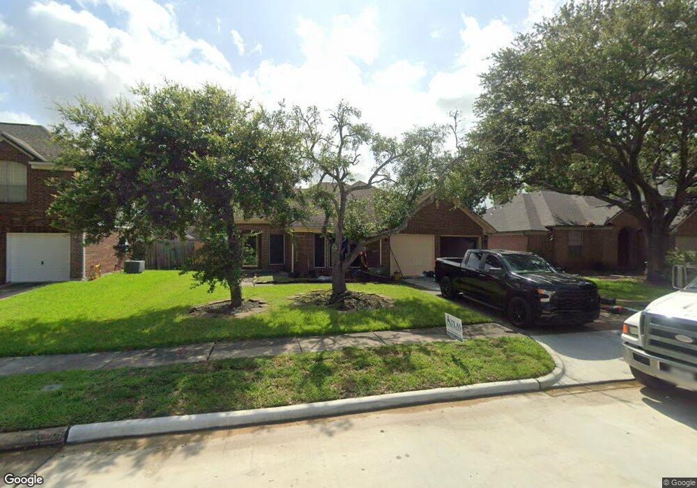
4331 Pristine Dr Fresno, TX 77545
Teal Run NeighborhoodEstimated Value: $253,839 - $276,000
4
Beds
2
Baths
1,878
Sq Ft
$141/Sq Ft
Est. Value
About This Home
This home is located at 4331 Pristine Dr, Fresno, TX 77545 and is currently estimated at $264,210, approximately $140 per square foot. 4331 Pristine Dr is a home located in Fort Bend County with nearby schools including Walter Moses Burton Elementary School, Lake Olympia Middle School, and Hightower High School.
Ownership History
Date
Name
Owned For
Owner Type
Purchase Details
Closed on
May 14, 2025
Sold by
Fields Shawn and Tranacy Martrice
Bought by
Fields Shawn
Current Estimated Value
Home Financials for this Owner
Home Financials are based on the most recent Mortgage that was taken out on this home.
Original Mortgage
$150,000
Outstanding Balance
$149,468
Interest Rate
6.64%
Mortgage Type
Credit Line Revolving
Estimated Equity
$114,742
Purchase Details
Closed on
Sep 27, 2013
Sold by
Cotton Jamaar and Cotton Gladys
Bought by
Fields Shawn
Home Financials for this Owner
Home Financials are based on the most recent Mortgage that was taken out on this home.
Original Mortgage
$128,571
Interest Rate
4.54%
Mortgage Type
New Conventional
Purchase Details
Closed on
Apr 30, 2008
Sold by
Washington Mutual Bank
Bought by
Cotton Jamaar and Cotton Gladys
Home Financials for this Owner
Home Financials are based on the most recent Mortgage that was taken out on this home.
Original Mortgage
$98,455
Interest Rate
5.86%
Mortgage Type
Purchase Money Mortgage
Purchase Details
Closed on
Mar 20, 2008
Sold by
Washington Mutual Bank
Bought by
Fields Shawn
Home Financials for this Owner
Home Financials are based on the most recent Mortgage that was taken out on this home.
Original Mortgage
$98,455
Interest Rate
5.86%
Mortgage Type
Purchase Money Mortgage
Purchase Details
Closed on
Sep 4, 2007
Sold by
Alley Wanda Marie
Bought by
Washington Mutual Bank and Long Beach Mortgage Co
Purchase Details
Closed on
Apr 28, 2006
Sold by
Cervantez Christopher R and Cervantez Sylvia H
Bought by
Alley Wanda Marie
Home Financials for this Owner
Home Financials are based on the most recent Mortgage that was taken out on this home.
Original Mortgage
$111,200
Interest Rate
9.5%
Mortgage Type
Fannie Mae Freddie Mac
Purchase Details
Closed on
Apr 13, 1998
Sold by
Filipp David L and Filipp Rhonda S
Bought by
Smith Steven A and Smith Lisa M
Home Financials for this Owner
Home Financials are based on the most recent Mortgage that was taken out on this home.
Original Mortgage
$87,850
Interest Rate
7.23%
Mortgage Type
Purchase Money Mortgage
Create a Home Valuation Report for This Property
The Home Valuation Report is an in-depth analysis detailing your home's value as well as a comparison with similar homes in the area
Home Values in the Area
Average Home Value in this Area
Purchase History
| Date | Buyer | Sale Price | Title Company |
|---|---|---|---|
| Fields Shawn | -- | None Listed On Document | |
| Fields Shawn | -- | First American Title | |
| Cotton Jamaar | -- | None Available | |
| Fields Shawn | -- | -- | |
| Washington Mutual Bank | $113,238 | None Available | |
| Fields Shawn | -- | -- | |
| Alley Wanda Marie | -- | Vanguard Title Co | |
| Smith Steven A | -- | American Title Co |
Source: Public Records
Mortgage History
| Date | Status | Borrower | Loan Amount |
|---|---|---|---|
| Open | Fields Shawn | $150,000 | |
| Previous Owner | Fields Shawn | $128,571 | |
| Previous Owner | Cotton Jamaar | $98,455 | |
| Previous Owner | Alley Wanda Marie | $111,200 | |
| Previous Owner | Smith Steven A | $87,850 |
Source: Public Records
Tax History Compared to Growth
Tax History
| Year | Tax Paid | Tax Assessment Tax Assessment Total Assessment is a certain percentage of the fair market value that is determined by local assessors to be the total taxable value of land and additions on the property. | Land | Improvement |
|---|---|---|---|---|
| 2025 | $3,617 | $238,841 | $43,680 | $195,161 |
| 2024 | $3,617 | $231,969 | $33,566 | $198,403 |
| 2023 | $3,617 | $210,881 | $0 | $212,259 |
| 2022 | $3,870 | $191,710 | $0 | $192,430 |
| 2021 | $4,327 | $174,280 | $33,600 | $140,680 |
| 2020 | $4,551 | $176,830 | $33,600 | $143,230 |
| 2019 | $4,354 | $162,220 | $23,500 | $138,720 |
| 2018 | $4,118 | $152,000 | $23,500 | $128,500 |
| 2017 | $4,051 | $144,460 | $23,500 | $120,960 |
| 2016 | $3,809 | $140,870 | $23,500 | $117,370 |
| 2015 | $2,357 | $129,060 | $23,500 | $105,560 |
| 2014 | $1,993 | $108,620 | $23,500 | $85,120 |
Source: Public Records
Map
Nearby Homes
- 1710 Blue Heather Ln
- 1906 Twin Tulip Ct
- 4511 Hunter Green Ct
- 1100 Rabb Rd
- 4022 Floral Way Ct
- 4134 Teal Valley Ct
- 1402 Noble Glen Dr
- 1410 Hunter Green Ln
- 1638 Westway Dr
- 3910 Caramel Point Ct
- 1710 Oxford Green Ct
- 4015 Forest Teal Ct
- 3903 Teal Vista Ct
- 4919 Oakwood Dr
- 4922 Oakwood Dr
- 4926 Oakwood Dr
- 4927 Oakwood Dr
- EASTON Plan at Post Oak Pointe
- BAXTOR Plan at Post Oak Pointe
- MITCHELL Plan at Post Oak Pointe
- 4335 Pristine Dr
- 4327 Pristine Dr
- 1731 Blue Heather Ln
- 4403 Pristine Dr
- 4323 Pristine Dr
- 1727 Blue Heather Ln
- 1723 Blue Heather Ln
- 1735 Blue Heather Ln
- 4330 Pristine Dr
- 4407 Pristine Dr
- 4319 Pristine Dr
- 4326 Pristine Dr
- 4402 Pristine Dr
- 4411 Pristine Dr
- 4322 Pristine Dr
- 1718 Regal Blue Ct
- 4406 Pristine Dr
- 4315 Pristine Dr
- 4318 Pristine Dr
- 1715 Blue Heather Ln