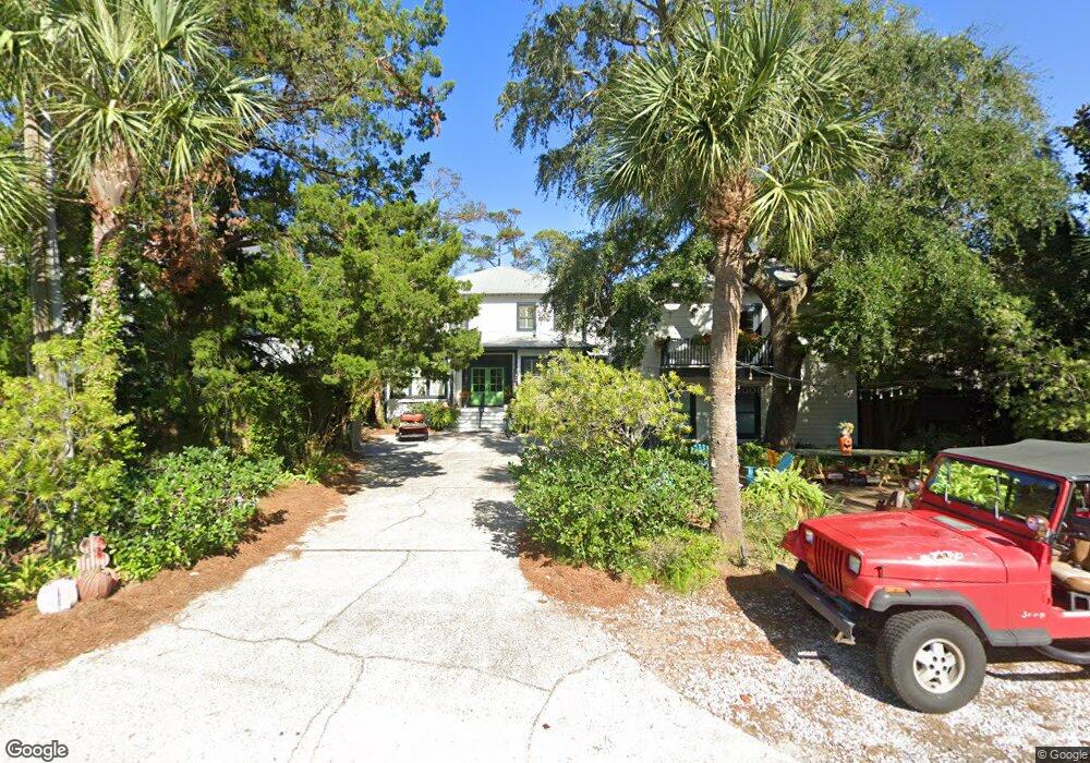
4332 11th St Saint Simons Island, GA 31522
Estimated Value: $2,350,000 - $2,792,000
7
Beds
7
Baths
3,460
Sq Ft
$739/Sq Ft
Est. Value
About This Home
This home is located at 4332 11th St, Saint Simons Island, GA 31522 and is currently estimated at $2,558,361, approximately $739 per square foot. 4332 11th St is a home located in Glynn County with nearby schools including St. Simons Elementary School, Glynn Middle School, and Glynn Academy.
Ownership History
Date
Name
Owned For
Owner Type
Purchase Details
Closed on
Jun 14, 2019
Sold by
Forethought Life Insurance Co
Bought by
Hubert Kathy Reeves
Current Estimated Value
Purchase Details
Closed on
Apr 2, 2019
Sold by
Saari Paul G
Bought by
Forethought Life Insurance Co
Purchase Details
Closed on
Apr 8, 2008
Sold by
Saari Paul G
Bought by
Mts Properties Llc
Create a Home Valuation Report for This Property
The Home Valuation Report is an in-depth analysis detailing your home's value as well as a comparison with similar homes in the area
Home Values in the Area
Average Home Value in this Area
Purchase History
| Date | Buyer | Sale Price | Title Company |
|---|---|---|---|
| Hubert Kathy Reeves | $1,025,000 | -- | |
| Forethought Life Insurance Co | -- | -- | |
| Mts Properties Llc | -- | -- |
Source: Public Records
Tax History Compared to Growth
Tax History
| Year | Tax Paid | Tax Assessment Tax Assessment Total Assessment is a certain percentage of the fair market value that is determined by local assessors to be the total taxable value of land and additions on the property. | Land | Improvement |
|---|---|---|---|---|
| 2025 | $23,154 | $923,240 | $397,800 | $525,440 |
| 2024 | $21,980 | $876,440 | $351,000 | $525,440 |
| 2023 | $21,151 | $850,520 | $386,120 | $464,400 |
| 2022 | $16,885 | $663,320 | $198,920 | $464,400 |
| 2021 | $11,726 | $443,760 | $198,920 | $244,840 |
| 2020 | $10,802 | $404,120 | $198,920 | $205,200 |
| 2019 | $10,531 | $393,760 | $198,920 | $194,840 |
| 2018 | $10,531 | $393,760 | $198,920 | $194,840 |
| 2017 | $10,531 | $393,760 | $198,920 | $194,840 |
| 2016 | $9,700 | $393,760 | $198,920 | $194,840 |
| 2015 | $7,652 | $358,640 | $163,800 | $194,840 |
| 2014 | $7,652 | $307,120 | $140,400 | $166,720 |
Source: Public Records
Map
Nearby Homes
- 4318 13th St
- 2022 Bruce Cir
- 4318 7th St
- 1909 Dixon Ln
- 1709 Dixon Ln
- 1626 Bruce Dr
- 1604 Bruce Dr
- 6 Coast Cottage Ln
- 17 Sea Oats Ln
- 5 and 7 Sea Oats Ln
- 1528 Ocean Blvd
- 1524 Wood Ave Unit 303
- 1524 Wood Ave Unit 215
- 1524 Wood Ave Unit 214
- 1524 Wood Ave Unit 314
- 1524 Wood Ave Unit 116
- 1495 Wood Ave
- 103 Cater St
- 118 Grand Oaks Ln
- 1460 Ocean Blvd Unit 101
- 4334 11th St
- 4330 11th St
- 4338 11th St Unit C
- 4338 11th St Unit LOT C
- 4338 11th St
- 4329 12th St
- 4333 12th St
- 4327 12th St
- 4326 11th St
- 4327 11th St
- 4333 11th St
- 2104 Ocean Rd
- 2104 Ocean Rd Unit A
- 2104 Ocean Rd Unit LOT A
- 4326 11th St E
- 4329 11th St E
- 4327 11th St
- 2032 Ocean Rd
- 4319 12th St
- 4323 11th St