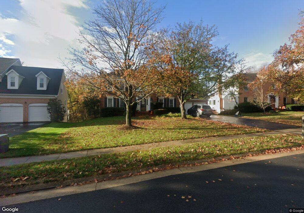
43348 Wayside Cir Ashburn, VA 20147
Estimated Value: $979,261 - $1,021,000
5
Beds
5
Baths
2,983
Sq Ft
$335/Sq Ft
Est. Value
About This Home
This home is located at 43348 Wayside Cir, Ashburn, VA 20147 and is currently estimated at $998,065, approximately $334 per square foot. 43348 Wayside Cir is a home located in Loudoun County with nearby schools including Sanders Corner Elementary School, Trailside Middle School, and Stone Bridge High.
Ownership History
Date
Name
Owned For
Owner Type
Purchase Details
Closed on
Jun 1, 2007
Sold by
Herman F East
Bought by
Tierney Michael and Ashcraft,Jessica
Current Estimated Value
Home Financials for this Owner
Home Financials are based on the most recent Mortgage that was taken out on this home.
Original Mortgage
$544,000
Outstanding Balance
$333,771
Interest Rate
6.24%
Mortgage Type
New Conventional
Estimated Equity
$664,294
Create a Home Valuation Report for This Property
The Home Valuation Report is an in-depth analysis detailing your home's value as well as a comparison with similar homes in the area
Home Values in the Area
Average Home Value in this Area
Purchase History
| Date | Buyer | Sale Price | Title Company |
|---|---|---|---|
| Tierney Michael | $680,000 | -- |
Source: Public Records
Mortgage History
| Date | Status | Borrower | Loan Amount |
|---|---|---|---|
| Open | Tierney Michael | $544,000 |
Source: Public Records
Tax History
| Year | Tax Paid | Tax Assessment Tax Assessment Total Assessment is a certain percentage of the fair market value that is determined by local assessors to be the total taxable value of land and additions on the property. | Land | Improvement |
|---|---|---|---|---|
| 2025 | $7,497 | $931,340 | $301,800 | $629,540 |
| 2024 | $7,720 | $892,460 | $300,600 | $591,860 |
| 2023 | $7,574 | $865,570 | $300,600 | $564,970 |
| 2022 | $7,288 | $818,840 | $270,600 | $548,240 |
| 2021 | $7,068 | $721,230 | $220,600 | $500,630 |
| 2020 | $6,910 | $667,610 | $201,800 | $465,810 |
| 2019 | $6,804 | $651,060 | $201,800 | $449,260 |
| 2018 | $6,659 | $613,760 | $181,800 | $431,960 |
| 2017 | $6,659 | $591,950 | $181,800 | $410,150 |
| 2016 | $6,672 | $582,700 | $0 | $0 |
| 2015 | $6,590 | $398,830 | $0 | $398,830 |
| 2014 | $6,411 | $373,300 | $0 | $373,300 |
Source: Public Records
Map
Nearby Homes
- 43494 Postrail Square
- 21014 Timber Ridge Terrace Unit 302
- 21018 Strawrick Terrace
- 43147 Gatwick Square
- 43105 Gatwick Square
- 43334 Butterfield Ct
- 20504 Deerwatch Place
- 20525 Lansing Terrace
- 21027 Forest Highlands Ct
- 43245 Stillforest Terrace
- 43785 Timberbrooke Place
- 21217 Tiger Lily Place
- 43374 Greyswallow Terrace
- 43834 Jenkins Ln
- 20385 Belmont Park Terrace Unit 103
- 43312 Greyswallow Terrace
- 43842 Grantner Place
- 21282 Hedgerow Terrace
- 43866 Laburnum Square
- 20432 Homeland Terrace
- 43344 Wayside Cir
- 43352 Wayside Cir
- 43340 Wayside Cir
- 43333 Wayside Cir
- 43329 Wayside Cir
- 43360 Wayside Cir
- 43337 Wayside Cir
- 43325 Wayside Cir
- 43336 Wayside Cir
- 43368 Wayside Cir
- 43341 Wayside Cir
- 43364 Wayside Cir
- 43321 Wayside Cir
- 43375 Wildrose Ct
- 20924 Pioneer Ridge Terrace
- 20922 Pioneer Ridge Terrace
- 43379 Wildrose Ct
- 20920 Pioneer Ridge Terrace
- 20918 Pioneer Ridge Terrace
- 43345 Wayside Cir
Your Personal Tour Guide
Ask me questions while you tour the home.