
Estimated Value: $31,000 - $77,334
About This Lot
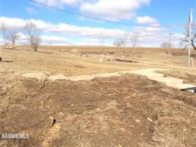
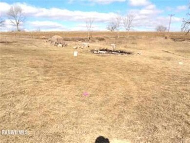
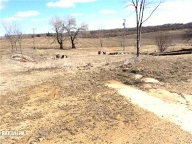
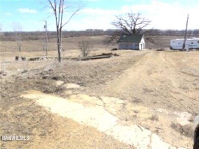
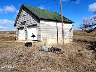
As of April 20132 ACRE BUILDING PLOT. PROPERTY HAS WELL. FREEPORT SCHOOLS. FORMER HOME WAS LOCATED ON PROPERTY, SINCE REMOVED.
Property Details
Property Type
- Land
Est. Annual Taxes
- $790
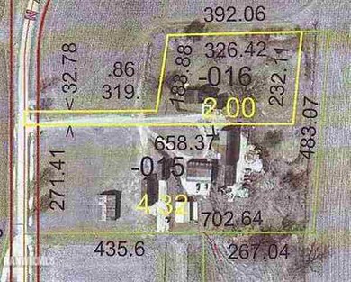
Lot Details
- 2 Acre Lot
Schools
- Freeport 145 Elementary And Middle School
- Freeport 145 High School
Ownership History
Purchase Details
Purchase Details
Home Financials for this Owner
Home Financials are based on the most recent Mortgage that was taken out on this home.Home Values in the Area
Average Home Value in this Area
Purchase History
| Date | Buyer | Sale Price | Title Company |
|---|---|---|---|
| Marcum Mark | $13,000 | -- | |
| -- | $15,000 | -- |
Property History
| Date | Event | Price | List to Sale | Price per Sq Ft |
|---|---|---|---|---|
| 04/10/2013 04/10/13 | Sold | $15,000 | -11.2% | -- |
| 04/04/2013 04/04/13 | Pending | -- | -- | -- |
| 03/30/2013 03/30/13 | For Sale | $16,900 | -- | -- |
Tax History Compared to Growth
Tax History
| Year | Tax Paid | Tax Assessment Tax Assessment Total Assessment is a certain percentage of the fair market value that is determined by local assessors to be the total taxable value of land and additions on the property. | Land | Improvement |
|---|---|---|---|---|
| 2024 | $1,011 | $8,995 | $8,410 | $585 |
| 2023 | $940 | $8,685 | $8,120 | $565 |
| 2022 | $928 | $7,919 | $7,404 | $515 |
| 2021 | $868 | $7,919 | $7,404 | $515 |
| 2020 | $896 | $7,919 | $7,404 | $515 |
| 2019 | $887 | $7,764 | $7,259 | $505 |
| 2018 | $880 | $7,687 | $7,187 | $500 |
| 2017 | $879 | $7,687 | $7,187 | $500 |
| 2016 | $888 | $7,876 | $7,390 | $486 |
| 2015 | $868 | $7,760 | $7,281 | $479 |
| 2013 | $840 | $8,145 | $7,642 | $503 |
Map
Source: NorthWest Illinois Alliance of REALTORS®
MLS Number: 130962
APN: 08-13-05-400-016
Disclaimer: Certain information contained herein is derived from information provided by parties other than Homes.com. All information provided is deemed reliable, but is not guaranteed to be accurate and should be independently verified.
![]() IDX information is provided exclusively for personal, non-commercial use, and may not be used for any purpose other than to identify prospective properties consumers may be interested in purchasing. Information is deemed reliable but not guaranteed.
IDX information is provided exclusively for personal, non-commercial use, and may not be used for any purpose other than to identify prospective properties consumers may be interested in purchasing. Information is deemed reliable but not guaranteed.
- 000 W Beaver Rd
- 3537 Rd
- 3537 3577 N Iris Hill Rd
- 5543 U S 20
- 5543 Us Highway 20 W
- 000 W Us Business 20
- 0000 N Harlem Center Rd
- Parcel 1 TBD N Unity & W Cedarville Rd
- 6844 Us Highway 20 W
- 6844 Us Highway 20 W
- 0000 W Winneshiek Rd
- 2916 Pleasant St
- 5910 N Unity Rd
- Parcel 2 TBD N Unity & W Range Rd
- 2472 W Red Oak Rd
- Parcel 3 TBD N Unity & W Range Rd
- 3723 US Business 20 W
- 000 Fairview Rd
- 7707 US Highway 20 W
- 7707 US Rte 20 W
- 4486 N Ayp Rd
- 4322 N Ayp Rd
- 3977 N Ayp Rd
- 4767 N Ayp Rd
- 5267 W Cedarville Rd
- 3685 N Ayp Rd
- 5311 W Cedarville Rd
- 0 Cedarville Rd Unit 201602562
- 0 Cedarville Rd Unit 20160851
- 0 Cedarville Rd Unit 131993
- 3677 N Ayp Rd
- 5002 W Cedarville Rd
- 3665 N Ayp Rd
- 5747 W Wagner Rd
- 3663 N Ayp Rd
- 4800 W Cedarville Rd
- 5100 Phillips Dr
- 5118 Phillips Dr
- 5128 Phillips Dr
- 5138 Phillips Dr