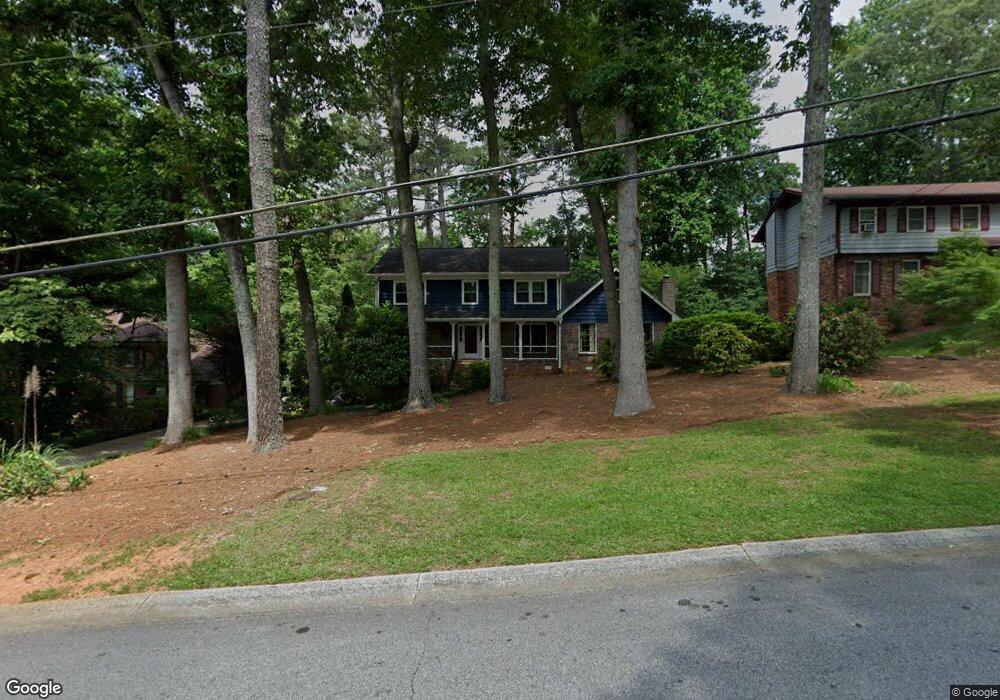
4337 Cedar Wood Dr SW Unit 7 Lilburn, GA 30047
Estimated Value: $471,279 - $516,000
4
Beds
3
Baths
3,104
Sq Ft
$158/Sq Ft
Est. Value
About This Home
This home is located at 4337 Cedar Wood Dr SW Unit 7, Lilburn, GA 30047 and is currently estimated at $491,820, approximately $158 per square foot. 4337 Cedar Wood Dr SW Unit 7 is a home located in Gwinnett County with nearby schools including Camp Creek Elementary School, Trickum Middle School, and Parkview High School.
Ownership History
Date
Name
Owned For
Owner Type
Purchase Details
Closed on
Mar 24, 2015
Sold by
Blanton Ronny
Bought by
Sears Jeffrey P and Carney Sarah
Current Estimated Value
Home Financials for this Owner
Home Financials are based on the most recent Mortgage that was taken out on this home.
Original Mortgage
$174,250
Outstanding Balance
$134,100
Interest Rate
3.89%
Mortgage Type
New Conventional
Estimated Equity
$357,720
Purchase Details
Closed on
Apr 17, 1998
Sold by
Hays Timothy L and Casper Sandra K
Bought by
Blanton Ronny
Home Financials for this Owner
Home Financials are based on the most recent Mortgage that was taken out on this home.
Original Mortgage
$161,500
Interest Rate
7.04%
Mortgage Type
New Conventional
Create a Home Valuation Report for This Property
The Home Valuation Report is an in-depth analysis detailing your home's value as well as a comparison with similar homes in the area
Home Values in the Area
Average Home Value in this Area
Purchase History
| Date | Buyer | Sale Price | Title Company |
|---|---|---|---|
| Sears Jeffrey P | $205,000 | -- | |
| Blanton Ronny | $170,000 | -- |
Source: Public Records
Mortgage History
| Date | Status | Borrower | Loan Amount |
|---|---|---|---|
| Open | Sears Jeffrey P | $174,250 | |
| Previous Owner | Blanton Ronny | $161,500 |
Source: Public Records
Tax History Compared to Growth
Tax History
| Year | Tax Paid | Tax Assessment Tax Assessment Total Assessment is a certain percentage of the fair market value that is determined by local assessors to be the total taxable value of land and additions on the property. | Land | Improvement |
|---|---|---|---|---|
| 2025 | $5,008 | $211,880 | $26,120 | $185,760 |
| 2024 | $5,140 | $178,440 | $26,120 | $152,320 |
| 2023 | $5,140 | $201,760 | $36,560 | $165,200 |
| 2022 | $5,080 | $177,200 | $30,800 | $146,400 |
| 2021 | $4,295 | $135,800 | $26,000 | $109,800 |
| 2020 | $4,155 | $127,840 | $22,000 | $105,840 |
| 2019 | $3,895 | $120,920 | $22,000 | $98,920 |
| 2018 | $3,849 | $118,520 | $16,400 | $102,120 |
| 2016 | $3,047 | $82,000 | $12,000 | $70,000 |
| 2015 | $3,020 | $84,160 | $8,000 | $76,160 |
| 2014 | $3,035 | $84,160 | $8,000 | $76,160 |
Source: Public Records
Map
Nearby Homes
- 4307 Cedar Wood Dr SW
- 4367 Cedar Wood Dr SW
- 676 Killian Hill Rd SW
- 4245 Cedar Creek Trail SW
- 4254 Cedar Creek Trail SW Unit 8
- 871 Cedar Trace SW
- 4406 Hale Dr SW
- 551 Killian Hill Rd SW
- 4271 Weston Dr SW
- 753 Brookwood Terrace SW
- 772 Brookwood Terrace SW
- 4582 Warrior Trail SW
- 4567 Town Crier Rd SW
- 1017 Rolling Forest Ln
- 565 James St SW Unit 10
- 4449 Amberleaf Walk
- 478 Dorsey Cir SW
- 4337 Cedar Wood Dr SW
- 4327 Cedar Wood Dr SW Unit 3
- 4347 Cedar Wood Dr SW
- 769 Shadow Trace Path
- 754 Shadow Trace Path Unit 4
- 754 Shadow Trace Path
- 4317 Cedar Wood Dr SW
- 768 Bradford Ct SW
- 4357 Cedar Wood Dr SW
- 779 Bradford Ct SW Unit 3
- 744 Shadow Trace Path
- 759 Shadow Trace Path
- 4316 Cedar Wood Dr SW
- 778 Bradford Ct SW Unit 3
- 749 Shadow Trace Path
- 4310 Kenion Forest Dr
- 767 Killian Hill Rd SW
- 4356 Cedar Wood Dr SW
- 4300 Kenion Forest Dr
- 789 Bradford Ct SW Unit 1