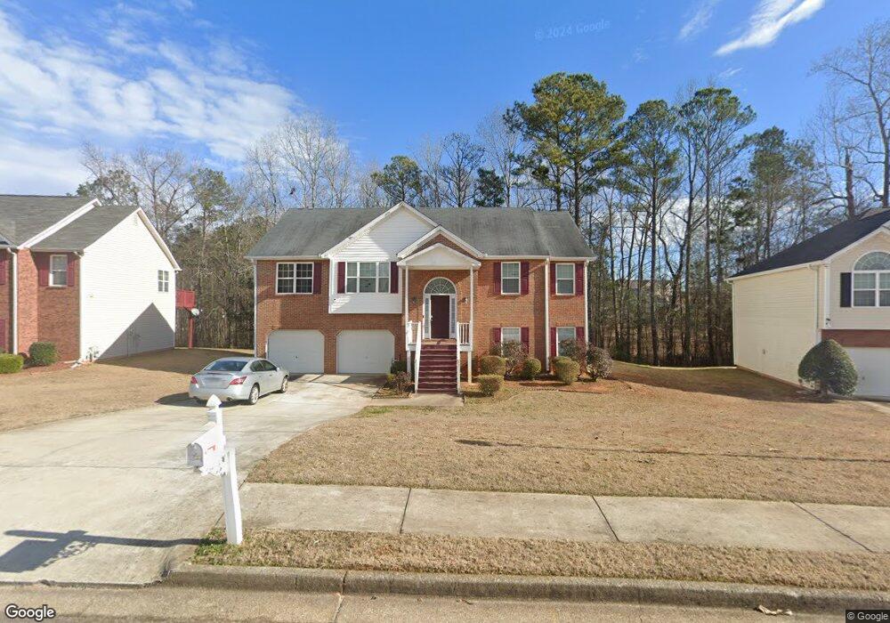
4338 Tillage Path Unit 2 Douglasville, GA 30135
Anneewakee NeighborhoodEstimated Value: $315,000 - $359,000
3
Beds
2
Baths
1,915
Sq Ft
$174/Sq Ft
Est. Value
About This Home
This home is located at 4338 Tillage Path Unit 2, Douglasville, GA 30135 and is currently estimated at $332,410, approximately $173 per square foot. 4338 Tillage Path Unit 2 is a home located in Douglas County with nearby schools including New Manchester Elementary School, Chapel Hill Middle School, and New Manchester High School.
Ownership History
Date
Name
Owned For
Owner Type
Purchase Details
Closed on
Aug 13, 2009
Sold by
Ahiable Emmanuel and Ahiable Matilda S
Bought by
Tanya Gladys
Current Estimated Value
Home Financials for this Owner
Home Financials are based on the most recent Mortgage that was taken out on this home.
Original Mortgage
$112,917
Outstanding Balance
$73,246
Interest Rate
5.11%
Mortgage Type
Stand Alone Second
Estimated Equity
$259,164
Purchase Details
Closed on
Aug 10, 2007
Sold by
Apex Homes Inc
Bought by
Amoako Emmanuel and Ahiable Matilda
Home Financials for this Owner
Home Financials are based on the most recent Mortgage that was taken out on this home.
Original Mortgage
$176,800
Interest Rate
6.65%
Mortgage Type
New Conventional
Create a Home Valuation Report for This Property
The Home Valuation Report is an in-depth analysis detailing your home's value as well as a comparison with similar homes in the area
Home Values in the Area
Average Home Value in this Area
Purchase History
| Date | Buyer | Sale Price | Title Company |
|---|---|---|---|
| Tanya Gladys | $115,000 | -- | |
| Amoako Emmanuel | $176,800 | -- |
Source: Public Records
Mortgage History
| Date | Status | Borrower | Loan Amount |
|---|---|---|---|
| Open | Tanya Gladys | $112,917 | |
| Previous Owner | Amoako Emmanuel | $176,800 |
Source: Public Records
Tax History Compared to Growth
Tax History
| Year | Tax Paid | Tax Assessment Tax Assessment Total Assessment is a certain percentage of the fair market value that is determined by local assessors to be the total taxable value of land and additions on the property. | Land | Improvement |
|---|---|---|---|---|
| 2024 | $4,122 | $128,960 | $25,200 | $103,760 |
| 2023 | $4,122 | $128,960 | $25,200 | $103,760 |
| 2022 | $3,603 | $108,640 | $19,240 | $89,400 |
| 2021 | $2,507 | $74,880 | $16,000 | $58,880 |
| 2020 | $2,539 | $74,880 | $16,000 | $58,880 |
| 2019 | $1,993 | $62,560 | $13,680 | $48,880 |
| 2018 | $1,955 | $61,040 | $13,680 | $47,360 |
| 2017 | $1,614 | $49,120 | $12,240 | $36,880 |
| 2016 | $1,594 | $47,680 | $12,240 | $35,440 |
| 2015 | $1,336 | $46,480 | $12,240 | $34,240 |
| 2014 | $1,336 | $38,080 | $10,800 | $27,280 |
| 2013 | -- | $36,080 | $10,240 | $25,840 |
Source: Public Records
Map
Nearby Homes
- 3863 Grist Mill
- 3771 Tackett Rd Unit 1
- 3939 Craggy Perch
- 3784 Tackett Rd
- 4295 Caroline Ct
- 3675 Buffalo Ct
- 4159 Birch Bark Way
- 4469 White Hill Place
- 4015 Soaring Dr
- 4542 White Rd
- 4112 Twig Ct
- 3448 Craggy Perch Unit 4
- 3203 Lower Creek Dr
- 3269 N Winds Trail
- 3945 Crowned Eagle
- 4066 Wedgefield Ct
- 4050 Harvest Ridge Dr
- 4232 Antler Ct
- 4338 Tillage Path
- 4338 Tillage Path Unit 45
- 0 Tillage Path Unit 8948108
- 0 Tillage Path Unit 8750426
- 0 Tillage Path Unit 3272970
- 0 Tillage Path Unit 7135667
- 0 Tillage Path
- 4328 Tillage Path
- 4358 Tillage Path
- 4318 Tillage Path
- 3843 Grist Mill
- 4339 Tillage Path
- 3833 Grist Mill Unit 2
- 4329 Tillage Path
- 4359 Tillage Path
- 4368 Tillage Path
- 3863 Grist Mill Dr
- 4361 Singletree Dr
- 3823 Grist Mill
- 0 Grist Mill Dr Unit 8447208