Estimated Value: $381,889 - $424,000
4
Beds
3
Baths
1,312
Sq Ft
$303/Sq Ft
Est. Value
About This Home
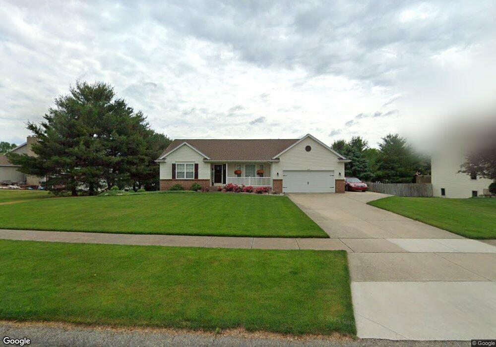
This home is located at 4339 Pheasant Run Dr, Dorr, MI 49323 and is currently estimated at $397,472, approximately $302 per square foot. 4339 Pheasant Run Dr is a home located in Allegan County with nearby schools including Wayland High School, Byron Center Charter School, and St. Stanislaus School.
Ownership History
Date
Name
Owned For
Owner Type
Purchase Details
Closed on
Feb 11, 2022
Sold by
Vankammen Bernard S and Vankammen Karin L
Bought by
Vankammen Bernard S and Vankammen Bernard S
Current Estimated Value
Purchase Details
Closed on
Aug 6, 1999
Bought by
Vankammen Bernard and Karin Lyn
Purchase Details
Closed on
Jul 31, 1998
Sold by
Dykstra Karl W and Dykstra Linda E
Bought by
Pheasant Ridge Llc
Create a Home Valuation Report for This Property
The Home Valuation Report is an in-depth analysis detailing your home's value as well as a comparison with similar homes in the area
Home Values in the Area
Average Home Value in this Area
Purchase History
| Date | Buyer | Sale Price | Title Company |
|---|---|---|---|
| Vankammen Bernard S | -- | David Wierenga & Lauka Pc | |
| Vankammen Bernard | $24,900 | -- | |
| Pheasant Ridge Llc | $215,000 | -- |
Source: Public Records
Tax History
| Year | Tax Paid | Tax Assessment Tax Assessment Total Assessment is a certain percentage of the fair market value that is determined by local assessors to be the total taxable value of land and additions on the property. | Land | Improvement |
|---|---|---|---|---|
| 2025 | $2,910 | $176,900 | $38,700 | $138,200 |
| 2024 | $2,649 | $167,000 | $33,600 | $133,400 |
| 2023 | $2,713 | $145,800 | $30,800 | $115,000 |
| 2022 | $2,649 | $126,200 | $26,300 | $99,900 |
| 2021 | $2,490 | $122,800 | $27,400 | $95,400 |
| 2020 | $2,370 | $120,700 | $25,200 | $95,500 |
| 2019 | $2,370 | $107,700 | $25,200 | $82,500 |
| 2018 | $2,317 | $106,300 | $16,000 | $90,300 |
| 2017 | $0 | $108,100 | $16,000 | $92,100 |
| 2016 | $0 | $86,800 | $16,000 | $70,800 |
| 2015 | -- | $86,800 | $16,000 | $70,800 |
| 2014 | -- | $76,600 | $15,100 | $61,500 |
| 2013 | -- | $69,500 | $15,100 | $54,400 |
Source: Public Records
Map
Nearby Homes
- Lots A&B 142nd Ave
- 1341 142nd Ave
- 4069 21st St
- 4087 Gene Ct
- 4035 Patti Rd
- 10780 Windward Ave SW
- 10785 Windward Ave SW
- 10725 Windward Ave SW
- 10711 Windward Ave SW
- 4185 24th St
- 136 100th St SW
- 737 100th St SW
- 4335 Tavistock Dr
- Lot A 142nd Ave
- Lot B 142nd Ave
- 4230 Fenwick Dr
- 4316 Sussex Place
- 1125 Russell St
- 4273 Highpoint Dr Unit 112
- 4269 Highpoint Dr Unit 114
- 4340 Pheasant Run Dr
- 4344 Pheasant Run Dr
- 1840 Quail Ridge Dr
- 4335 Pheasant Run Dr
- 4336 Pheasant Run Dr
- 4331 Pheasant Run Dr
- 4332 Pheasant Run Dr
- 4336 Quail Run Dr
- 1836 Quail Ridge Dr
- 4348 Pheasant Run Dr
- 4340 Quail Run Dr
- 4332 Quail Run Dr
- 4328 Pheasant Run Dr
- 1839 Quail Ridge Dr
- 1835 Quail Ridge Dr
- 1841 Pheasant Ridge Dr
- 4341 Quail Run Dr
- 4324 Pheasant Run Dr
- 1833 Pheasant Ridge Dr
- 1837 Pheasant Ridge Dr
Your Personal Tour Guide
Ask me questions while you tour the home.