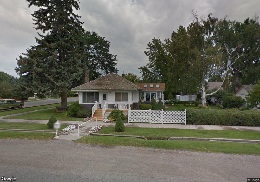
434 4th Ave W Gooding, ID 83330
Estimated Value: $271,000 - $294,000
2
Beds
1
Bath
1,592
Sq Ft
$179/Sq Ft
Est. Value
About This Home
This home is located at 434 4th Ave W, Gooding, ID 83330 and is currently estimated at $284,640, approximately $178 per square foot. 434 4th Ave W is a home with nearby schools including Gooding Elementary School, Gooding Middle School, and Gooding High School.
Ownership History
Date
Name
Owned For
Owner Type
Purchase Details
Closed on
Jul 14, 2009
Sold by
Hughes Tammy and Harding Tammy
Bought by
Harding Courtney
Current Estimated Value
Home Financials for this Owner
Home Financials are based on the most recent Mortgage that was taken out on this home.
Original Mortgage
$38,661
Interest Rate
7%
Create a Home Valuation Report for This Property
The Home Valuation Report is an in-depth analysis detailing your home's value as well as a comparison with similar homes in the area
Home Values in the Area
Average Home Value in this Area
Purchase History
| Date | Buyer | Sale Price | Title Company |
|---|---|---|---|
| Harding Courtney | -- | -- | |
| Harding Courtney | -- | -- |
Source: Public Records
Mortgage History
| Date | Status | Borrower | Loan Amount |
|---|---|---|---|
| Closed | Harding Courtney | $38,661 |
Source: Public Records
Tax History
| Year | Tax Paid | Tax Assessment Tax Assessment Total Assessment is a certain percentage of the fair market value that is determined by local assessors to be the total taxable value of land and additions on the property. | Land | Improvement |
|---|---|---|---|---|
| 2025 | $797 | $292,938 | $61,993 | $230,945 |
| 2024 | $1,692 | $292,938 | $61,993 | $230,945 |
| 2023 | $1,446 | $278,989 | $59,041 | $219,948 |
| 2022 | $1,681 | $257,192 | $59,041 | $198,151 |
| 2021 | $1,693 | $228,473 | $39,758 | $188,715 |
| 2020 | $1,480 | $165,466 | $22,500 | $142,966 |
| 2019 | $1,236 | $134,498 | $22,500 | $111,998 |
| 2018 | $1,236 | $129,165 | $22,500 | $106,665 |
| 2017 | $1,182 | $0 | $0 | $0 |
| 2016 | $1,034 | $0 | $0 | $0 |
| 2015 | $1,050 | $0 | $0 | $0 |
| 2014 | -- | $0 | $0 | $0 |
| 2011 | -- | $0 | $0 | $0 |
Source: Public Records
Map
Nearby Homes
- 409 4th Ave W
- 433 4th Ave W
- 330 Colorado St
- 345 Nevada St
- 337 Nevada St
- 405 Nevada St
- 322 Colorado St
- 341 Colorado St
- 405 Colorado St
- 422 Colorado St
- 329 Nevada St
- 413 Nevada St
- 314 Colorado St
- 413 Colorado St
- 325 Colorado St
- 2230 E 1175 S
- 421 Nevada St
- 430 Colorado St
- 429 3rd Ave W
- 429 3rd Ave W Unit 1
Your Personal Tour Guide
Ask me questions while you tour the home.