Estimated Value: $189,000 - $270,000
--
Bed
--
Bath
2,432
Sq Ft
$94/Sq Ft
Est. Value
About This Home
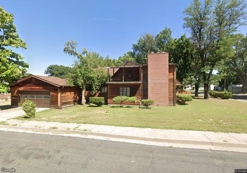
This home is located at 434 Franklin St, Wray, CO 80758 and is currently estimated at $229,067, approximately $94 per square foot. 434 Franklin St is a home located in Yuma County with nearby schools including Wray Elementary School, Buchanan Middle School, and Wray Junior/Senior High School.
Ownership History
Date
Name
Owned For
Owner Type
Purchase Details
Closed on
May 15, 2025
Sold by
Conrad Shaw B
Bought by
Fatboy Ventures Llc
Current Estimated Value
Purchase Details
Closed on
Nov 12, 2024
Sold by
Conrad Joseph and Conrad Joseph Roberts
Bought by
Conrad Shaw B
Purchase Details
Closed on
Mar 11, 2013
Sold by
Conrad Joseph Roberts and Conrad Christopher Q`
Bought by
Conrad Chris Q and Conrad Joseph R
Purchase Details
Closed on
May 18, 2012
Sold by
Conrad Chris Q and Conrad Joseph R
Bought by
Conrad Chris Q and Conrad Joseph R
Create a Home Valuation Report for This Property
The Home Valuation Report is an in-depth analysis detailing your home's value as well as a comparison with similar homes in the area
Home Values in the Area
Average Home Value in this Area
Purchase History
| Date | Buyer | Sale Price | Title Company |
|---|---|---|---|
| Fatboy Ventures Llc | $190,000 | Stewart Title | |
| Conrad Shaw B | -- | None Listed On Document | |
| Conrad Shaw B | -- | None Listed On Document | |
| Conrad Shaw B | -- | None Listed On Document | |
| Conrad Chris Q | -- | None Available | |
| Conrad Chris Q | -- | None Available | |
| Conrad Chris Q | -- | None Available |
Source: Public Records
Tax History Compared to Growth
Tax History
| Year | Tax Paid | Tax Assessment Tax Assessment Total Assessment is a certain percentage of the fair market value that is determined by local assessors to be the total taxable value of land and additions on the property. | Land | Improvement |
|---|---|---|---|---|
| 2024 | $428 | $4,480 | $0 | $0 |
| 2023 | $428 | $9,702 | $973 | $8,729 |
| 2022 | $407 | $7,053 | $973 | $6,080 |
| 2021 | $616 | $7,053 | $973 | $6,080 |
| 2020 | $569 | $6,501 | $973 | $5,528 |
| 2019 | $580 | $6,501 | $973 | $5,528 |
| 2018 | $545 | $5,430 | $0 | $0 |
| 2017 | $484 | $5,430 | $0 | $0 |
| 2016 | $508 | $5,710 | $0 | $0 |
| 2015 | $420 | $5,710 | $0 | $0 |
| 2014 | $420 | $5,280 | $0 | $0 |
| 2013 | $420 | $5,280 | $0 | $0 |
Source: Public Records
Map
Nearby Homes
- 541 W 5th St
- 549 Emerson St
- 526 Emerson St
- 731 W 9th St
- 820 Grant St Unit D
- 820 Grant St Unit E
- 820 Grant St Unit G
- 734 W 8th St
- 410 Clay St Unit 9
- G4 Grant St Unit G4
- 742 W 9th St
- 841 Dexter St
- 440 Blake St
- 924 Grant St
- TBD Dexter St Unit Lot B
- 18124 U S Highway 385
- 1124 W 7th St
- 1021 Grant St
- 1037 Cottonwood Dr
- 30342 Us Highway 34
- 644 W 5th St
- 715 W 5th St
- 418 Franklin St
- 435 Franklin St
- 425 Franklin St
- 505 Franklin St
- 508 Franklin St
- 417 Franklin St
- 506 Franklin St
- 509 Franklin St
- 419 Emerson St
- 720 W 5th St
- 509 Emerson St
- 437 Emerson St
- 503 Emerson St
- 516 Franklin St
- 411 Emerson St
- 517 Franklin St
- 403 Franklin St
- 519 Emerson St