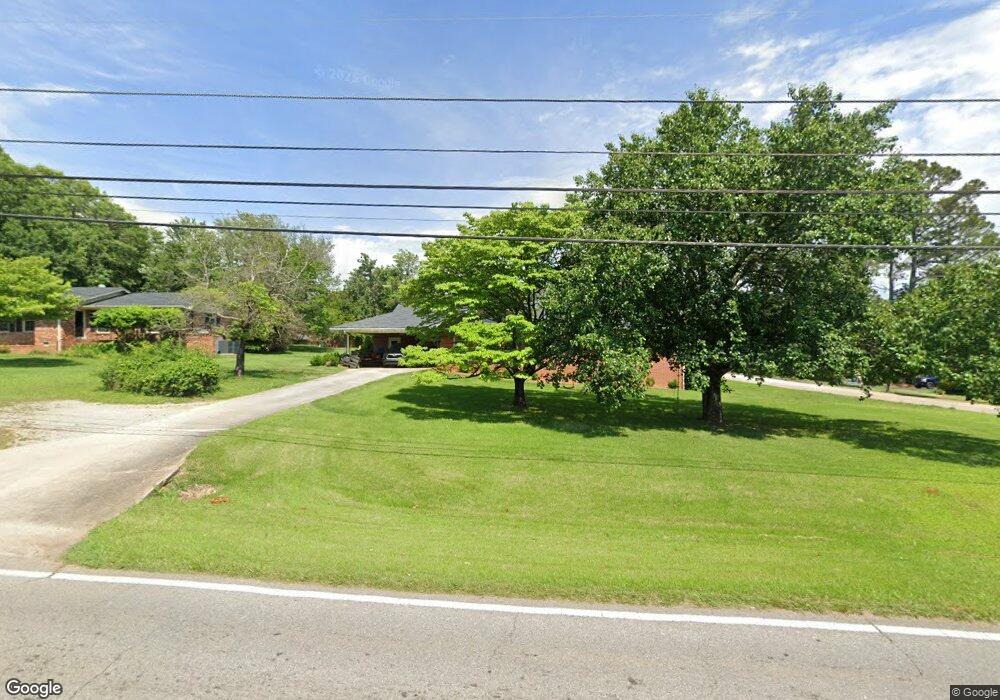
434 Hays Mill Rd Carrollton, GA 30117
Estimated Value: $265,529 - $329,000
3
Beds
2
Baths
1,600
Sq Ft
$187/Sq Ft
Est. Value
About This Home
This home is located at 434 Hays Mill Rd, Carrollton, GA 30117 and is currently estimated at $299,882, approximately $187 per square foot. 434 Hays Mill Rd is a home located in Carroll County with nearby schools including Carrollton Elementary School, Carrollton Upper Elementary School, and Carrollton Middle School.
Ownership History
Date
Name
Owned For
Owner Type
Purchase Details
Closed on
Feb 2, 2024
Sold by
E & S Holdings Llc
Bought by
Daddy Of Aces Llc
Current Estimated Value
Purchase Details
Closed on
Jan 1, 2021
Sold by
Ballard Jeff
Bought by
E & S Holdings Llc
Purchase Details
Closed on
May 16, 2014
Sold by
Johnson Jonathan D
Bought by
Ballard Robert
Purchase Details
Closed on
Oct 17, 2012
Sold by
Tuggle Sherry S
Bought by
Johnson Jonathan D
Home Financials for this Owner
Home Financials are based on the most recent Mortgage that was taken out on this home.
Original Mortgage
$83,460
Interest Rate
3.25%
Mortgage Type
FHA
Purchase Details
Closed on
Feb 14, 1998
Sold by
Scott Brice
Bought by
Scott Brice
Purchase Details
Closed on
Apr 14, 1965
Bought by
Scott Brice
Create a Home Valuation Report for This Property
The Home Valuation Report is an in-depth analysis detailing your home's value as well as a comparison with similar homes in the area
Home Values in the Area
Average Home Value in this Area
Purchase History
| Date | Buyer | Sale Price | Title Company |
|---|---|---|---|
| Daddy Of Aces Llc | $200,000 | -- | |
| E & S Holdings Llc | -- | -- | |
| E & S Holdings Llc | -- | -- | |
| Ballard Robert | $120,000 | -- | |
| Johnson Jonathan D | $85,000 | -- | |
| Scott Brice | -- | -- | |
| Scott Brice | -- | -- |
Source: Public Records
Mortgage History
| Date | Status | Borrower | Loan Amount |
|---|---|---|---|
| Previous Owner | Johnson Jonathan D | $83,460 |
Source: Public Records
Tax History Compared to Growth
Tax History
| Year | Tax Paid | Tax Assessment Tax Assessment Total Assessment is a certain percentage of the fair market value that is determined by local assessors to be the total taxable value of land and additions on the property. | Land | Improvement |
|---|---|---|---|---|
| 2024 | $2,915 | $106,694 | $38,924 | $67,770 |
| 2023 | $2,915 | $47,899 | $19,199 | $28,700 |
| 2022 | $1,398 | $47,899 | $19,199 | $28,700 |
| 2021 | $1,471 | $50,380 | $19,206 | $31,174 |
| 2020 | $1,382 | $47,299 | $19,206 | $28,093 |
| 2019 | $1,352 | $45,851 | $19,206 | $26,645 |
| 2018 | $1,337 | $44,686 | $19,206 | $25,480 |
| 2017 | $1,344 | $44,686 | $19,206 | $25,480 |
| 2016 | $1,149 | $44,686 | $19,206 | $25,480 |
| 2015 | $1,127 | $36,503 | $9,312 | $27,192 |
| 2014 | $1,009 | $36,504 | $9,312 | $27,192 |
Source: Public Records
Map
Nearby Homes
- 308 Hays Mill Rd
- 101 Ferndale Rd
- 104 Ferndale Rd
- 103 Ferndale Rd
- 103 Ferndale Rd
- 103 Ferndale Rd Unit 40
- 276 Hays Mill Rd
- 301 Hays Mill Rd
- 103 S Nixon St
- 0 Ferndale Rd Unit 3290349
- 0 Ferndale Rd Unit 8484353
- 0 Ferndale Rd Unit 8193051
- 0 Ferndale Rd Unit 8365857
- 104 N Nixon St
- N N Nixon St
- 234 Hays Mill Rd
- 202 Ferndale Rd
- 105 S Nixon St
- S S Nixon St
- 102 S Nixon St