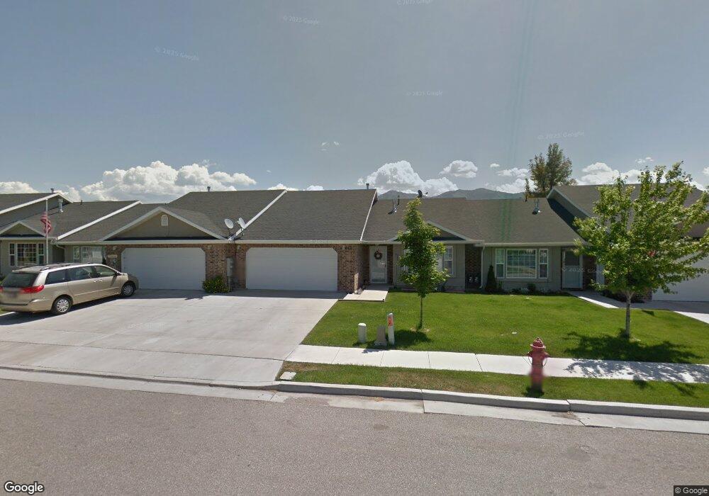
434 S 80 W Smithfield, UT 84335
Estimated Value: $346,000 - $407,000
2
Beds
2
Baths
1,344
Sq Ft
$275/Sq Ft
Est. Value
About This Home
This home is located at 434 S 80 W, Smithfield, UT 84335 and is currently estimated at $370,054, approximately $275 per square foot. 434 S 80 W is a home located in Cache County with nearby schools including Summit School, Cedar Ridge School, and North Cache Middle School.
Ownership History
Date
Name
Owned For
Owner Type
Purchase Details
Closed on
Jul 16, 2018
Sold by
Rawlings Glade and Rawlings Georgia I
Bought by
Rawlings Glade and Rawlings Georgia I
Current Estimated Value
Purchase Details
Closed on
Jun 9, 2017
Sold by
Bennett Lorna K
Bought by
Rawlings Glade and Rawlings Georgia
Home Financials for this Owner
Home Financials are based on the most recent Mortgage that was taken out on this home.
Original Mortgage
$175,000
Outstanding Balance
$145,334
Interest Rate
4.05%
Mortgage Type
Purchase Money Mortgage
Estimated Equity
$224,720
Purchase Details
Closed on
Jun 11, 2007
Sold by
Co Ax Enterprises
Bought by
Bennett Lorna K
Home Financials for this Owner
Home Financials are based on the most recent Mortgage that was taken out on this home.
Original Mortgage
$131,900
Interest Rate
6.14%
Mortgage Type
New Conventional
Create a Home Valuation Report for This Property
The Home Valuation Report is an in-depth analysis detailing your home's value as well as a comparison with similar homes in the area
Home Values in the Area
Average Home Value in this Area
Purchase History
| Date | Buyer | Sale Price | Title Company |
|---|---|---|---|
| Rawlings Glade | -- | None Available | |
| Rawlings Glade | -- | Northern Title Company | |
| Bennett Lorna K | -- | Hickman Land Title Company |
Source: Public Records
Mortgage History
| Date | Status | Borrower | Loan Amount |
|---|---|---|---|
| Open | Rawlings Glade | $175,000 | |
| Previous Owner | Bennett Lorna K | $131,900 |
Source: Public Records
Tax History
| Year | Tax Paid | Tax Assessment Tax Assessment Total Assessment is a certain percentage of the fair market value that is determined by local assessors to be the total taxable value of land and additions on the property. | Land | Improvement |
|---|---|---|---|---|
| 2025 | $1,463 | $195,910 | $0 | $0 |
| 2024 | $1,398 | $175,515 | $0 | $0 |
| 2023 | $1,496 | $177,650 | $0 | $0 |
| 2022 | $1,520 | $177,650 | $0 | $0 |
| 2021 | $1,251 | $223,315 | $55,000 | $168,315 |
| 2020 | $1,245 | $207,306 | $55,000 | $152,306 |
| 2019 | $1,148 | $182,306 | $30,000 | $152,306 |
| 2018 | $1,058 | $162,440 | $30,000 | $132,440 |
| 2017 | $986 | $82,720 | $0 | $0 |
| 2016 | $1,004 | $82,720 | $0 | $0 |
| 2015 | $915 | $75,070 | $0 | $0 |
| 2014 | $897 | $75,070 | $0 | $0 |
| 2013 | -- | $75,070 | $0 | $0 |
Source: Public Records
Map
Nearby Homes
Your Personal Tour Guide
Ask me questions while you tour the home.