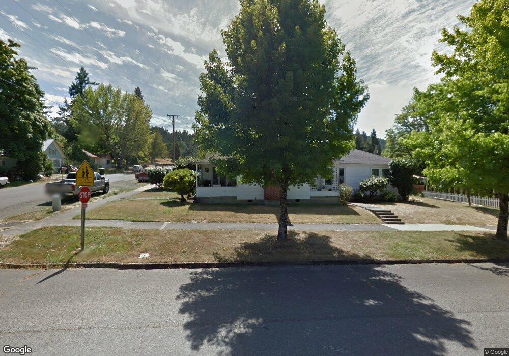
434 SE Locust St Oakland, OR 97462
Estimated Value: $273,000 - $312,000
3
Beds
1
Bath
1,667
Sq Ft
$180/Sq Ft
Est. Value
About This Home
This home is located at 434 SE Locust St, Oakland, OR 97462 and is currently estimated at $300,418, approximately $180 per square foot. 434 SE Locust St is a home with nearby schools including Oakland Elementary School, Lincoln Middle School, and Oakland High School.
Ownership History
Date
Name
Owned For
Owner Type
Purchase Details
Closed on
Jan 30, 2012
Sold by
Stanley Peggy Y
Bought by
Brown Floyd R and Diane Brown B
Current Estimated Value
Home Financials for this Owner
Home Financials are based on the most recent Mortgage that was taken out on this home.
Original Mortgage
$129,000
Interest Rate
3.88%
Mortgage Type
Seller Take Back
Purchase Details
Closed on
Jul 16, 2010
Sold by
Stearns William F and Stanley Peggy Y
Bought by
Stanley Peggy Y
Create a Home Valuation Report for This Property
The Home Valuation Report is an in-depth analysis detailing your home's value as well as a comparison with similar homes in the area
Home Values in the Area
Average Home Value in this Area
Purchase History
| Date | Buyer | Sale Price | Title Company |
|---|---|---|---|
| Brown Floyd R | $140,000 | Western Title & Escrow | |
| Stanley Peggy Y | -- | None Available |
Source: Public Records
Mortgage History
| Date | Status | Borrower | Loan Amount |
|---|---|---|---|
| Closed | Brown Floyd R | $129,000 |
Source: Public Records
Tax History Compared to Growth
Tax History
| Year | Tax Paid | Tax Assessment Tax Assessment Total Assessment is a certain percentage of the fair market value that is determined by local assessors to be the total taxable value of land and additions on the property. | Land | Improvement |
|---|---|---|---|---|
| 2024 | $1,997 | $132,523 | -- | -- |
| 2023 | $1,831 | $128,664 | $0 | $0 |
| 2022 | $1,777 | $124,913 | $0 | $0 |
| 2021 | $1,781 | $121,274 | $0 | $0 |
| 2020 | $1,731 | $117,745 | $0 | $0 |
| 2019 | $1,683 | $114,313 | $0 | $0 |
| 2018 | $1,635 | $110,984 | $0 | $0 |
| 2017 | $1,596 | $107,754 | $0 | $0 |
| 2016 | $1,536 | $104,620 | $0 | $0 |
| 2015 | $1,401 | $100,264 | $0 | $0 |
| 2014 | $1,451 | $102,249 | $0 | $0 |
| 2013 | -- | $96,642 | $0 | $0 |
Source: Public Records
Map
Nearby Homes
- 134 SE 5th St
- 413 SE Pear St
- 0 Locust St
- 312 SE Front St
- 411 NE 1st St
- 1858 Old Town Loop Rd
- 106 Green Valley Rd
- 839 Union Gap Loop Rd
- 276 Union Gap Loop Rd
- 249 Union Gap Loop Rd
- 1980 E Sixth Ave
- 660 Jade St
- 402 Northside Rd
- 1545 E Fourth Ave
- 689 Sherwood Dr
- 1234 E Fourth Ave
- 1762 E Fourth Ave
- 642 Terrace Ln
- 776 E Fourth Ave
- 119 Terrace Ln
- 133 SE 5th St
- 404 SE Locust St
- 510 SE Locust St
- 433 Locust St
- 415 SE Maple St
- 516 Locust St
- 405 NE Locust St
- 507 NE Locust St
- 209 SE 5th St
- 131 NE 5th St
- 420 SE Maple St
- 406 Oak St
- 536 Locust St
- 338 SE Locust St
- 333 NE Locust St
- 210 SE 4th St
- 136 NE 5th St
- 220 SE 5th St
- 525 NE Locust St
- 214 SE 5th St