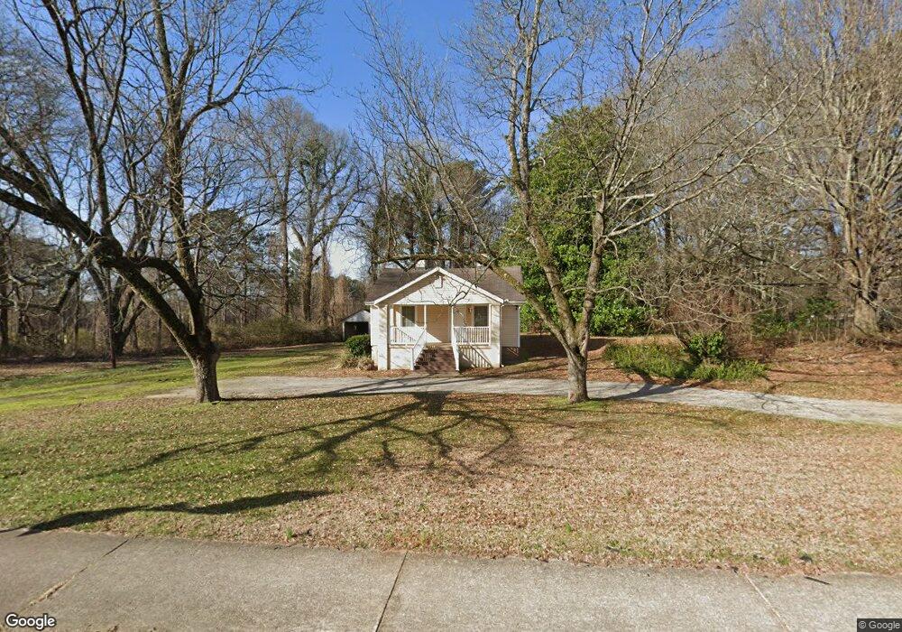
4340 Floyd Rd Austell, GA 30106
Estimated Value: $242,000 - $316,000
2
Beds
1
Bath
2,000
Sq Ft
$136/Sq Ft
Est. Value
About This Home
This home is located at 4340 Floyd Rd, Austell, GA 30106 and is currently estimated at $271,093, approximately $135 per square foot. 4340 Floyd Rd is a home located in Cobb County with nearby schools including Sanders Elementary School, Floyd Middle School, and South Cobb High School.
Ownership History
Date
Name
Owned For
Owner Type
Purchase Details
Closed on
Feb 28, 2003
Sold by
Whitener Shawn E and Whitener Nathalie D
Bought by
Bunch Wendy R
Current Estimated Value
Home Financials for this Owner
Home Financials are based on the most recent Mortgage that was taken out on this home.
Original Mortgage
$135,000
Outstanding Balance
$57,522
Interest Rate
5.88%
Mortgage Type
New Conventional
Estimated Equity
$213,571
Create a Home Valuation Report for This Property
The Home Valuation Report is an in-depth analysis detailing your home's value as well as a comparison with similar homes in the area
Home Values in the Area
Average Home Value in this Area
Purchase History
| Date | Buyer | Sale Price | Title Company |
|---|---|---|---|
| Bunch Wendy R | $150,000 | -- |
Source: Public Records
Mortgage History
| Date | Status | Borrower | Loan Amount |
|---|---|---|---|
| Open | Bunch Wendy R | $135,000 |
Source: Public Records
Tax History
| Year | Tax Paid | Tax Assessment Tax Assessment Total Assessment is a certain percentage of the fair market value that is determined by local assessors to be the total taxable value of land and additions on the property. | Land | Improvement |
|---|---|---|---|---|
| 2025 | $2,748 | $91,216 | $32,832 | $58,384 |
| 2024 | $2,750 | $91,216 | $32,832 | $58,384 |
| 2023 | $2,328 | $77,204 | $36,288 | $40,916 |
Source: Public Records
Map
Nearby Homes
- 1252 Parktown Dr
- 1114 Hibiscus Way SW
- 960 Verlander Trail
- 4505 Brookwood Dr SW
- 1147 Silvergate Ln SW
- 4520 Verlander Ct
- 4581 Moray Dr
- 4201 Regal Ridge Rd
- 4076 Elsdon Dr
- 4846 Floydwood Ln
- 4589 Moray Dr
- 4615 Moray Dr
- 4599 Moray Dr
- 4607 Moray Dr
- 4733 Stridemore Ct
- 4556 Sweetlake Ct
- 4601 Ethel Springs Trail SW
- 4406 Yelverton Place
- 4690 Glore Rd SW
- 8009 Haven Springs Trace
- 4349 Floyd Rd
- 4345 Floyd Rd
- 4339 Floyd Rd
- 4321 Black Blvd
- 1143 Anderson Mill Rd
- 4331 Floyd Rd
- 4329 Black Blvd
- 0 Anderson Mill Rd
- 0 Anderson Mill Rd Unit 7573399
- 1050 Bates Rd
- 4321 Floyd Rd
- 1159 Anderson Mill Rd
- 4330 Black Blvd
- 1130 Parktown Dr Unit 1
- 1130 Parktown Dr
- 4405 Floyd Rd SW
- 1126 Parktown Dr Unit 1
- 1126 Parktown Dr Unit 2
- 1132 Parktown Dr Unit 2
- 1132 Parktown Dr Unit 4
Your Personal Tour Guide
Ask me questions while you tour the home.