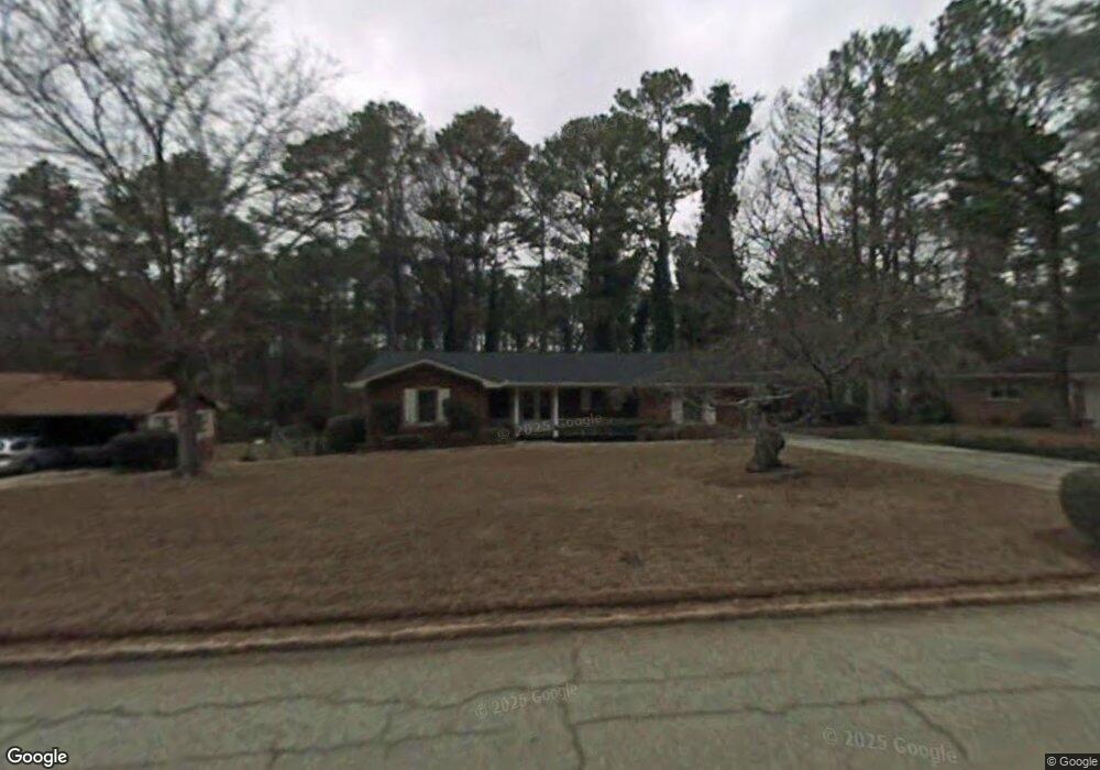
4340 Langdon Dr Unit 1 Decatur, GA 30035
Southwest DeKalb NeighborhoodEstimated Value: $235,286 - $305,000
3
Beds
2
Baths
1,937
Sq Ft
$139/Sq Ft
Est. Value
About This Home
This home is located at 4340 Langdon Dr Unit 1, Decatur, GA 30035 and is currently estimated at $268,572, approximately $138 per square foot. 4340 Langdon Dr Unit 1 is a home located in DeKalb County with nearby schools including Canby Lane Elementary School, Mary McLeod Bethune Middle School, and Towers High School.
Ownership History
Date
Name
Owned For
Owner Type
Purchase Details
Closed on
Apr 24, 2012
Sold by
Cullins Robert H
Bought by
Cullins Robert H and Brown Shari L
Current Estimated Value
Purchase Details
Closed on
Sep 28, 1994
Sold by
White C L Mary S
Bought by
Cullins Robert H
Home Financials for this Owner
Home Financials are based on the most recent Mortgage that was taken out on this home.
Original Mortgage
$80,200
Interest Rate
8.53%
Mortgage Type
VA
Create a Home Valuation Report for This Property
The Home Valuation Report is an in-depth analysis detailing your home's value as well as a comparison with similar homes in the area
Home Values in the Area
Average Home Value in this Area
Purchase History
| Date | Buyer | Sale Price | Title Company |
|---|---|---|---|
| Cullins Robert H | -- | -- | |
| Cullins Robert H | $77,900 | -- |
Source: Public Records
Mortgage History
| Date | Status | Borrower | Loan Amount |
|---|---|---|---|
| Previous Owner | Cullins Robert H | $80,200 |
Source: Public Records
Tax History Compared to Growth
Tax History
| Year | Tax Paid | Tax Assessment Tax Assessment Total Assessment is a certain percentage of the fair market value that is determined by local assessors to be the total taxable value of land and additions on the property. | Land | Improvement |
|---|---|---|---|---|
| 2025 | $661 | $95,240 | $12,000 | $83,240 |
| 2024 | $682 | $93,960 | $6,480 | $87,480 |
| 2023 | $682 | $98,600 | $6,480 | $92,120 |
| 2022 | $583 | $71,360 | $6,480 | $64,880 |
| 2021 | $583 | $40,880 | $6,480 | $34,400 |
| 2020 | $583 | $41,000 | $6,480 | $34,520 |
| 2019 | $508 | $28,160 | $6,480 | $21,680 |
| 2018 | $504 | $33,360 | $6,480 | $26,880 |
| 2017 | $600 | $37,040 | $6,480 | $30,560 |
| 2016 | $542 | $31,000 | $6,480 | $24,520 |
| 2014 | $373 | $16,000 | $6,480 | $9,520 |
Source: Public Records
Map
Nearby Homes
- 4379 Cross Ln
- 4373 Buckingham Cir
- 2468 Leslie Brook Dr
- 4371 Aldergate Dr
- 4214 Canby Ln
- 2419 Leslie Brook Dr
- 2087 John Wesley Ct
- 4202 Wesley Hall Ln
- 4326 Aldergate Dr
- 2356 Wingfoot Place
- 4225 Wesley Hall Ln
- 2146 Wingfoot Place
- 2416 Newgate Dr
- 2393 Winshire Dr
- 2313 Wingfoot Place
- 2303 Wingfoot Place
- 4421 John Wesley Dr
- 4211 Wingfoot Ct
- 2401 Winshire Dr
- 2360 S Hairston Rd
- 4332 Langdon Dr
- 4350 Langdon Dr Unit F
- 2215 April Ln
- 4326 Langdon Dr
- 2209 April Ln
- 4337 Langdon Dr
- 4345 Langdon Dr Unit 1
- 4329 Langdon Dr
- 4353 Langdon Dr
- 4318 Langdon Dr
- 4364 Langdon Dr
- 2201 April Ln
- 4323 Langdon Dr
- 4310 Langdon Dr
- 2214 April Ln
- 4315 Langdon Dr Unit I
- 4365 Langdon Dr
- 2195 April Ln
- 4342 Riverwood Cir
- 2200 Wesley Chapel Rd