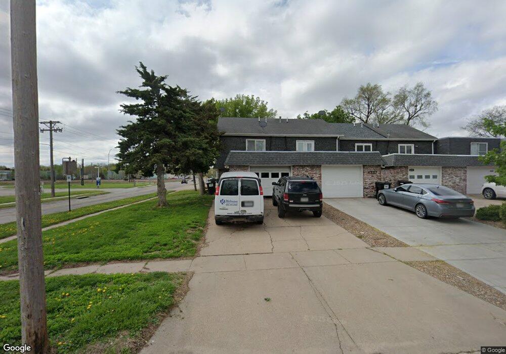
4341 Edison Cir Lincoln, NE 68504
Sunset Acres NeighborhoodEstimated Value: $146,000 - $203,000
3
Beds
2
Baths
1,460
Sq Ft
$121/Sq Ft
Est. Value
About This Home
This home is located at 4341 Edison Cir, Lincoln, NE 68504 and is currently estimated at $176,096, approximately $120 per square foot. 4341 Edison Cir is a home located in Lancaster County with nearby schools including Norwood Park Elementary School, Dawes Middle School, and Lincoln Northeast High School.
Ownership History
Date
Name
Owned For
Owner Type
Purchase Details
Closed on
Nov 12, 2021
Sold by
Stone Codie D
Bought by
Schulz Anthony M
Current Estimated Value
Purchase Details
Closed on
Aug 20, 2021
Sold by
Schulz Rosemary L and Estate Of Rosemary L Schulz
Bought by
Schulz Anthony M and Stone Codie D
Home Financials for this Owner
Home Financials are based on the most recent Mortgage that was taken out on this home.
Original Mortgage
$183,640
Interest Rate
2.9%
Mortgage Type
VA
Purchase Details
Closed on
Nov 12, 2007
Sold by
Hesson Gladys G and Hesson Jack A
Bought by
Schulz Rosemary L
Home Financials for this Owner
Home Financials are based on the most recent Mortgage that was taken out on this home.
Original Mortgage
$67,933
Interest Rate
6.42%
Mortgage Type
Purchase Money Mortgage
Create a Home Valuation Report for This Property
The Home Valuation Report is an in-depth analysis detailing your home's value as well as a comparison with similar homes in the area
Home Values in the Area
Average Home Value in this Area
Purchase History
| Date | Buyer | Sale Price | Title Company |
|---|---|---|---|
| Schulz Anthony M | $44,000 | None Listed On Document | |
| Schulz Anthony M | -- | None Listed On Document | |
| Schulz Rosemary L | $69,000 | Ct |
Source: Public Records
Mortgage History
| Date | Status | Borrower | Loan Amount |
|---|---|---|---|
| Previous Owner | Schulz Anthony M | $183,640 | |
| Previous Owner | Schulz Rosemary L | $67,933 |
Source: Public Records
Tax History Compared to Growth
Tax History
| Year | Tax Paid | Tax Assessment Tax Assessment Total Assessment is a certain percentage of the fair market value that is determined by local assessors to be the total taxable value of land and additions on the property. | Land | Improvement |
|---|---|---|---|---|
| 2025 | $1,828 | $169,700 | $35,000 | $134,700 |
| 2024 | $1,828 | $132,300 | $25,000 | $107,300 |
| 2023 | $2,217 | $132,300 | $20,000 | $112,300 |
| 2022 | $2,067 | $103,700 | $20,000 | $83,700 |
| 2021 | $1,955 | $0 | $0 | $0 |
| 2020 | $1,668 | $87,300 | $20,000 | $67,300 |
| 2019 | $1,668 | $87,300 | $20,000 | $67,300 |
| 2018 | $1,576 | $82,100 | $16,000 | $66,100 |
| 2017 | $1,590 | $82,100 | $16,000 | $66,100 |
| 2016 | $1,260 | $64,700 | $16,000 | $48,700 |
| 2015 | $1,251 | $64,700 | $16,000 | $48,700 |
| 2014 | $1,286 | $66,100 | $16,000 | $50,100 |
| 2013 | -- | $66,100 | $16,000 | $50,100 |
Source: Public Records
Map
Nearby Homes
- 4411 Colfax Cir
- 4521 Turner St
- 4624 Gladstone St
- 4720 Gladstone St
- 4925 Colfax Ave
- 3950 Ballard Ct
- 2944 N 44th St
- 2940 N 41st St
- 5102 Judson St
- 4940 Greenwood St
- 4834 Adams St
- 3400 N 52nd St
- 5341 Benton St
- 5125 Greenwood St
- 5202 Greenwood St
- 5501 Hartley St
- 3501 Pearl Crescent Dr
- 5202 Adams St
- 3909 Madison Ave
- 3556 Pearl Crescent Dr
- 4337 Edison Cir
- 4329 Edison Cir
- 4325 Edison Cir
- 4321 Edison Cir
- 3615 N 44th St
- 3601 N 44th St
- 3720 N 44th St
- 4320 Edison Cir
- 3721 N 44th St
- 3720 N 44th St
- 3731 N 44th St
- 3730 N 44th St
- 4300 Edison Cir
- 4315 Colfax Ave
- 3741 N 44th St
- 4305 Colfax Ave
- 3748 N 44th St
- 4217 Colfax Ave
- 4421 Colfax Cir
- 4300 Cornhusker Hwy