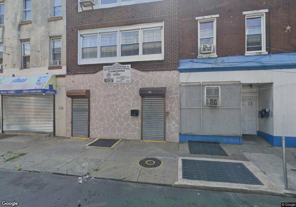
4341 Frankford Ave Philadelphia, PA 19124
Frankford NeighborhoodEstimated Value: $605,000
--
Bed
--
Bath
7,356
Sq Ft
$82/Sq Ft
Est. Value
About This Home
This home is located at 4341 Frankford Ave, Philadelphia, PA 19124 and is currently estimated at $605,000, approximately $82 per square foot. 4341 Frankford Ave is a home with nearby schools including Allen M. Stearne School, Frankford High School, and First Philadelphia Preparatory Charter School.
Ownership History
Date
Name
Owned For
Owner Type
Purchase Details
Closed on
Jul 13, 2005
Sold by
Iglesia De Dios Pentecostal M I Region D
Bought by
Iglesia De Dios Pentecostal M I La Glori
Current Estimated Value
Purchase Details
Closed on
Nov 23, 1999
Sold by
Mayfair Fcu
Bought by
Iglesia De Dios Pentecostal Mi Region De
Purchase Details
Closed on
Oct 2, 1995
Sold by
Pearsall Vernon and Pearsall Vernon
Bought by
Mayfair Fcu
Create a Home Valuation Report for This Property
The Home Valuation Report is an in-depth analysis detailing your home's value as well as a comparison with similar homes in the area
Home Values in the Area
Average Home Value in this Area
Purchase History
| Date | Buyer | Sale Price | Title Company |
|---|---|---|---|
| Iglesia De Dios Pentecostal M I La Glori | -- | -- | |
| Iglesia De Dios Pentecostal Mi Region De | $25,200 | -- | |
| Mayfair Fcu | -- | -- |
Source: Public Records
Tax History Compared to Growth
Tax History
| Year | Tax Paid | Tax Assessment Tax Assessment Total Assessment is a certain percentage of the fair market value that is determined by local assessors to be the total taxable value of land and additions on the property. | Land | Improvement |
|---|---|---|---|---|
| 2026 | -- | $548,000 | $71,240 | $476,760 |
| 2025 | -- | $548,000 | $71,240 | $476,760 |
| 2024 | -- | $548,000 | $71,240 | $476,760 |
| 2023 | -- | $548,000 | $71,240 | $476,760 |
| 2022 | $0 | $548,000 | $0 | $0 |
| 2021 | $1,803 | $548,000 | $71,240 | $476,760 |
| 2020 | $1,803 | $0 | $0 | $0 |
| 2019 | $1,803 | $0 | $0 | $0 |
| 2018 | $1,803 | $0 | $0 | $0 |
| 2017 | -- | $0 | $0 | $0 |
| 2016 | -- | $0 | $0 | $0 |
| 2015 | -- | $0 | $0 | $0 |
| 2014 | -- | $514,100 | $45,000 | $469,100 |
| 2012 | -- | $18,144 | $7,526 | $10,618 |
Source: Public Records
Map
Nearby Homes
- 4742 Frankford Ave
- 4283 Frankford Ave
- 4405 Frankford Ave
- 4347 Paul St
- 4270 Paul St
- 1419 Unity St
- 1417 Unity St
- 4267 Paul St
- 4328 Leiper St
- 4361 Frankford Ave
- 1519 Womrath St
- 1424 Sellers St
- 1501 Womrath St
- 1337 Sellers St
- 4255-57 Orchard St
- 4410 Waln St
- 4412 Waln St
- 4461 Leiper St
- 1319 Church St
- 4229 Griscom St
- 4337 Frankford Ave
- 4337-39 Frankford Ave
- 4337 39 Frankford Ave
- 4353 Frankford Ave
- 4349-51 Frankford Ave
- 4349 Frankford Ave
- 4355 Frankford Ave
- 4325-27 Frankford Ave
- 4325 Frankford Ave
- 4359 Frankford Ave Unit B
- 4359 Frankford Ave Unit A
- 4359 Frankford Ave
- 1610 Unity St Unit 1
- 1610 Unity St
- 1612 Unity St
- 1618 Unity St
- 1614 Unity St
- 1616 Unity St
- 1620 Unity St
- 1622 Unity St