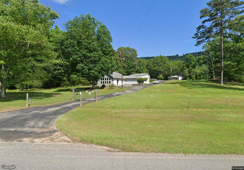
4343 Crawfords Cove Rd Springville, AL 35146
Estimated Value: $423,274 - $477,000
4
Beds
2
Baths
1,016
Sq Ft
$439/Sq Ft
Est. Value
About This Home
This home is located at 4343 Crawfords Cove Rd, Springville, AL 35146 and is currently estimated at $446,319, approximately $439 per square foot. 4343 Crawfords Cove Rd is a home located in St. Clair County with nearby schools including Springville Elementary School, Springville Middle School, and Springville High School.
Ownership History
Date
Name
Owned For
Owner Type
Purchase Details
Closed on
Dec 30, 2004
Sold by
Killough Carl F and Killough Audrey L
Bought by
Morgan Phillip W and Morgan Reba
Current Estimated Value
Home Financials for this Owner
Home Financials are based on the most recent Mortgage that was taken out on this home.
Original Mortgage
$162,000
Outstanding Balance
$81,033
Interest Rate
5.61%
Mortgage Type
New Conventional
Estimated Equity
$365,286
Create a Home Valuation Report for This Property
The Home Valuation Report is an in-depth analysis detailing your home's value as well as a comparison with similar homes in the area
Home Values in the Area
Average Home Value in this Area
Purchase History
| Date | Buyer | Sale Price | Title Company |
|---|---|---|---|
| Morgan Phillip W | -- | None Available |
Source: Public Records
Mortgage History
| Date | Status | Borrower | Loan Amount |
|---|---|---|---|
| Open | Morgan Phillip W | $162,000 |
Source: Public Records
Tax History Compared to Growth
Tax History
| Year | Tax Paid | Tax Assessment Tax Assessment Total Assessment is a certain percentage of the fair market value that is determined by local assessors to be the total taxable value of land and additions on the property. | Land | Improvement |
|---|---|---|---|---|
| 2024 | $1,714 | $71,470 | $13,440 | $58,030 |
| 2023 | $1,714 | $71,470 | $13,440 | $58,030 |
| 2022 | $1,060 | $30,403 | $4,490 | $25,913 |
| 2021 | $853 | $30,403 | $4,490 | $25,913 |
| 2020 | $853 | $24,739 | $4,497 | $20,242 |
| 2019 | $853 | $24,739 | $4,497 | $20,242 |
| 2018 | $752 | $25,820 | $0 | $0 |
| 2017 | $741 | $25,820 | $0 | $0 |
| 2016 | $752 | $25,820 | $0 | $0 |
| 2015 | $741 | $25,760 | $0 | $0 |
| 2014 | $741 | $25,440 | $0 | $0 |
Source: Public Records
Map
Nearby Homes
- 4892 Crawfords Cove Rd
- 2775 Crawford Cove Rd
- 560 Phillips Dr
- 265 Rolling Oaks Dr
- 0 Reneau Rd Unit 21434500
- 15158 US Highway 11
- 631 Burtram Cir
- 0 Sweatt Rd Unit Tract C - 29+/- Acre
- 0 Sweatt Rd Unit 21398227
- 620 Washburn Dr
- 146 McDonald Dr
- 51 Taft Rd
- 000 Shore Dr Unit 420, 421, 422
- 2523 Shore Dr
- 1254 Shore Dr
- 506 Washburn Dr
- 30 Allen Rd
- 1187 Crawfords Cove Rd
- 24 Reneau Rd
- 93 Washington Rd
- 4391 Crawfords Cove Rd
- 4440 Crawfords Cove Rd
- 4314 Crawfords Cove Rd
- 4450 Crawfords Cove Rd
- 4328 Crawfords Cove Rd
- 4455 Crawfords Cove Rd
- 4093 Crawfords Cove Rd
- 3961 Crawfords Cove Rd
- 3992 Crawfords Cove Rd
- 4979 Crawfords Cove Rd
- 7570 Cove Rd
- 8190 County Highway 24
- 7805 County Highway 24
- 165 Blackberry Ln
- 7634 Thornberry Pkwy
- 3651 Crawfords Cove Rd
- 8138 County Highway 24
- 8207 County Highway 24
- 7607 County Highway 24
- 90 Blackberry Ln