Estimated Value: $593,000 - $820,015
--
Bed
1
Bath
3,588
Sq Ft
$197/Sq Ft
Est. Value
About This Home
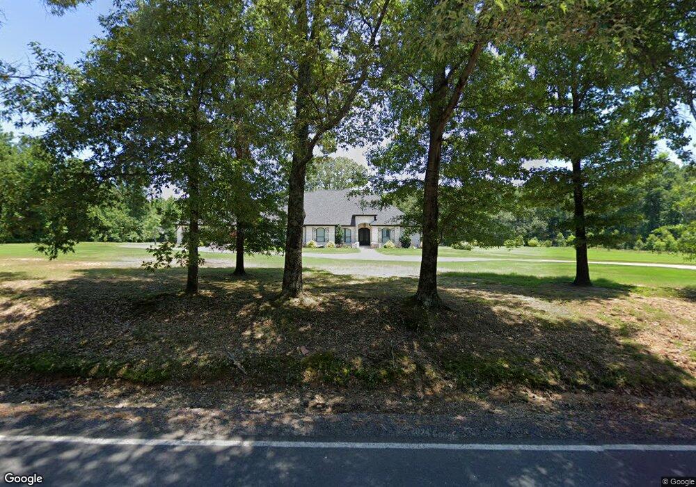
This home is located at 4343 Kerr Station Rd, Cabot, AR 72023 and is currently estimated at $706,508, approximately $196 per square foot. 4343 Kerr Station Rd is a home with nearby schools including Southside Elementary School, Cabot Junior High South, and Cabot Middle School South.
Ownership History
Date
Name
Owned For
Owner Type
Purchase Details
Closed on
Jun 20, 2013
Sold by
Petersen Rosalie L and Petersen Horace R
Bought by
Rose Ronnie A and Rose Krista
Current Estimated Value
Purchase Details
Closed on
Jun 13, 2013
Sold by
Petersen Rosalie L and Petersen Horace R
Bought by
Rose Ronnie A and Rose Krista
Purchase Details
Closed on
Oct 27, 2010
Sold by
Poole Helen and Poole Paul E
Bought by
Petersen Rosalie L
Purchase Details
Closed on
Apr 12, 2006
Bought by
Poole
Purchase Details
Closed on
Mar 24, 2006
Bought by
Poole
Purchase Details
Closed on
Nov 17, 1999
Bought by
Peterson
Create a Home Valuation Report for This Property
The Home Valuation Report is an in-depth analysis detailing your home's value as well as a comparison with similar homes in the area
Home Values in the Area
Average Home Value in this Area
Purchase History
| Date | Buyer | Sale Price | Title Company |
|---|---|---|---|
| Rose Ronnie A | -- | -- | |
| Rose Ronnie A | -- | -- | |
| Petersen Rosalie L | -- | -- | |
| Petersen Rosalie L | -- | -- | |
| Poole | -- | -- | |
| Poole | -- | -- | |
| Peterson | -- | -- |
Source: Public Records
Tax History Compared to Growth
Tax History
| Year | Tax Paid | Tax Assessment Tax Assessment Total Assessment is a certain percentage of the fair market value that is determined by local assessors to be the total taxable value of land and additions on the property. | Land | Improvement |
|---|---|---|---|---|
| 2025 | $4,724 | $113,550 | $2,100 | $111,450 |
| 2024 | $4,724 | $113,550 | $2,100 | $111,450 |
| 2023 | $4,724 | $113,550 | $2,100 | $111,450 |
| 2022 | $4,551 | $113,550 | $2,100 | $111,450 |
| 2021 | $4,329 | $113,550 | $2,100 | $111,450 |
| 2020 | $4,455 | $96,960 | $1,950 | $95,010 |
| 2019 | $26 | $460 | $460 | $0 |
| 2018 | $26 | $460 | $460 | $0 |
| 2017 | $20 | $460 | $460 | $0 |
| 2016 | $26 | $460 | $460 | $0 |
| 2015 | $22 | $530 | $530 | $0 |
| 2014 | $29 | $530 | $530 | $0 |
Source: Public Records
Map
Nearby Homes
- 84 Springwood Ct
- 97 Summerwood Dr
- 1064 Oliver Ln
- 75 Chickadee Cove
- 232 Sunset Cir
- 15 Calvados Ct
- 11 Calvados Ct
- 29 Calvados Ct
- 28 Calvados Ct
- 33 Ravell Rd
- 21 Wolfsbridge Loop
- 19 Wolfsbridge Loop
- 17 Wolfsbridge Loop
- 15 Wolfsbridge Loop
- 30 Ravell
- 11 Brixton
- 4755 Arkansas 89
- 4755 A- Ar Hwy 89 S
- 29 Mcclellan Dr
- 118 N Candlewood
- 4346 Kerr Station Rd
- 350 Elk Ridge Cove
- 410 Elk Ridge Cove
- 320 Elk Ridge Cove
- 270 Elk Ridge Cove
- 315 Elk Ridge Cove
- 375 Elk Ridge Cove
- 200 Elk Ridge Cove
- 345 Elk Ridge Cove
- 415 Elk Ridge Cove
- 275 Elk Ridge Cove
- 320 Oliver Trail
- 235 Elk Ridge Cove
- 4182 Kerr Station Rd
- 37 Sunset Rd
- 0 Elk Ridge Cove Unit 16015522
- 0 Elk Ridge Cove Unit 20033224
- 0 Elk Ridge Cove Unit 20030002
- 0 Elk Ridge Cove Unit 10347679
- 0 Elk Ridge Cove Unit 18004975