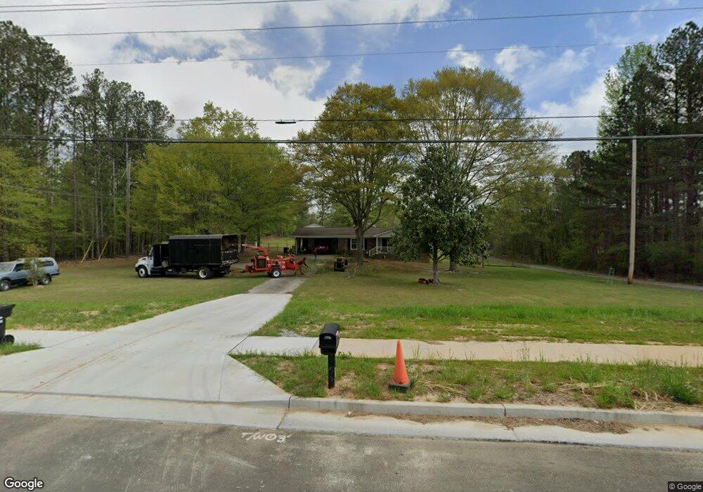
4343 MacLand Rd Hiram, GA 30141
East Paulding County NeighborhoodEstimated Value: $248,000 - $360,000
--
Bed
2
Baths
1,442
Sq Ft
$214/Sq Ft
Est. Value
About This Home
This home is located at 4343 MacLand Rd, Hiram, GA 30141 and is currently estimated at $307,953, approximately $213 per square foot. 4343 MacLand Rd is a home located in Paulding County with nearby schools including Mcgarity Elementary School, P. B. Ritch Middle School, and East Paulding High School.
Ownership History
Date
Name
Owned For
Owner Type
Purchase Details
Closed on
May 11, 2004
Sold by
Dillard Christopher R and Dillard Melanie D
Bought by
Dillard Betty J
Current Estimated Value
Home Financials for this Owner
Home Financials are based on the most recent Mortgage that was taken out on this home.
Original Mortgage
$66,400
Interest Rate
6.3%
Mortgage Type
New Conventional
Purchase Details
Closed on
Apr 30, 1980
Sold by
Carlan Odis E and Carlan
Bought by
Carlan Oscar M
Create a Home Valuation Report for This Property
The Home Valuation Report is an in-depth analysis detailing your home's value as well as a comparison with similar homes in the area
Home Values in the Area
Average Home Value in this Area
Purchase History
| Date | Buyer | Sale Price | Title Company |
|---|---|---|---|
| Dillard Betty J | -- | -- | |
| Carlan Oscar M | -- | -- |
Source: Public Records
Mortgage History
| Date | Status | Borrower | Loan Amount |
|---|---|---|---|
| Closed | Dillard Betty J | $66,400 |
Source: Public Records
Tax History Compared to Growth
Tax History
| Year | Tax Paid | Tax Assessment Tax Assessment Total Assessment is a certain percentage of the fair market value that is determined by local assessors to be the total taxable value of land and additions on the property. | Land | Improvement |
|---|---|---|---|---|
| 2024 | $751 | $112,880 | $15,960 | $96,920 |
| 2023 | $837 | $106,648 | $15,200 | $91,448 |
| 2022 | $718 | $90,320 | $12,720 | $77,600 |
| 2021 | $659 | $67,952 | $10,720 | $57,232 |
| 2020 | $603 | $59,072 | $10,240 | $48,832 |
| 2019 | $964 | $53,176 | $9,200 | $43,976 |
| 2018 | $751 | $43,040 | $10,000 | $33,040 |
| 2017 | $713 | $40,456 | $9,560 | $30,896 |
| 2016 | $580 | $34,604 | $9,560 | $25,044 |
| 2015 | $929 | $32,044 | $9,400 | $22,644 |
| 2014 | $838 | $28,404 | $8,600 | $19,804 |
| 2013 | -- | $25,760 | $9,520 | $16,240 |
Source: Public Records
Map
Nearby Homes
- 119 English Barn Way
- 4622 MacLand Rd
- 4624 MacLand Rd
- 132 English Barn Way
- 142 English Barn Way
- 152 English Barn Way
- 162 English Barn Way
- 20 Weathervane Way
- 225 Harvest Trail
- 34 English Barn Way
- 290 Harvest Trail
- 44 English Barn Way
- 56 English Barn Way
- 66 English Barn Way
- 76 English Barn Way
- 7 Hickory Branch
- The Cedarwood Plan at Echols Farm
- The Brookhaven Plan at Echols Farm
- The Rosewood Plan at Echols Farm
- The Asher Plan at Echols Farm
- 4361 MacLand Rd
- 00 Lake Rd
- 4322 MacLand Rd
- 37 Lake Rd
- 84 Smith Rd
- 4450 MacLand Rd
- 4229 MacLand Rd
- 152 Smith Rd
- 150 Smith Rd
- 105 Smith Rd
- 131 Lake Rd
- 42 Lantern Trace
- 70 Lake Rd
- 34 Lantern Trace
- 22 Lantern Trace
- 10 Lantern Trace
- 5 Homestead Crossing
- 72 Moreland Cir
- 19 Homestead Crossing
- 4488 MacLand Rd