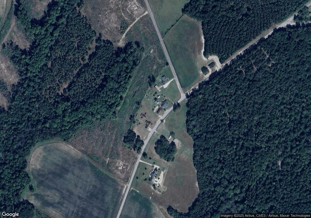
4343 Zoar Rd Cheraw, SC 29520
Estimated Value: $106,562 - $198,000
--
Bed
--
Bath
1,624
Sq Ft
$100/Sq Ft
Est. Value
About This Home
This home is located at 4343 Zoar Rd, Cheraw, SC 29520 and is currently estimated at $162,891, approximately $100 per square foot. 4343 Zoar Rd is a home with nearby schools including Edwards Elementary School, Chesterfield-Ruby Middle School, and Chesterfield High School.
Ownership History
Date
Name
Owned For
Owner Type
Purchase Details
Closed on
Feb 9, 2024
Sold by
Cheves Brock Evelyn
Bought by
Brock Thomas Howard
Current Estimated Value
Purchase Details
Closed on
Mar 10, 2016
Sold by
Brock Evelyn C
Bought by
Brock Thomas H
Purchase Details
Closed on
Feb 9, 2006
Sold by
Streater Jody L
Bought by
Stafford Joni Marie and Streater Joni S
Home Financials for this Owner
Home Financials are based on the most recent Mortgage that was taken out on this home.
Original Mortgage
$29,000
Interest Rate
6.14%
Mortgage Type
Future Advance Clause Open End Mortgage
Create a Home Valuation Report for This Property
The Home Valuation Report is an in-depth analysis detailing your home's value as well as a comparison with similar homes in the area
Home Values in the Area
Average Home Value in this Area
Purchase History
| Date | Buyer | Sale Price | Title Company |
|---|---|---|---|
| Brock Thomas Howard | -- | None Listed On Document | |
| Brock Thomas H | -- | Attorney | |
| Brock Evelyn C | $35,000 | Attorney | |
| Stafford Joni Marie | -- | -- |
Source: Public Records
Mortgage History
| Date | Status | Borrower | Loan Amount |
|---|---|---|---|
| Previous Owner | Stafford Joni Marie | $29,000 |
Source: Public Records
Tax History Compared to Growth
Tax History
| Year | Tax Paid | Tax Assessment Tax Assessment Total Assessment is a certain percentage of the fair market value that is determined by local assessors to be the total taxable value of land and additions on the property. | Land | Improvement |
|---|---|---|---|---|
| 2024 | $417 | $3,210 | $200 | $3,010 |
| 2023 | $400 | $3,210 | $200 | $3,010 |
| 2022 | $379 | $3,210 | $200 | $3,010 |
| 2021 | $378 | $3,210 | $200 | $3,010 |
| 2020 | $419 | $3,210 | $200 | $3,010 |
| 2019 | $1,116 | $3,210 | $200 | $3,010 |
| 2018 | $1,103 | $3,210 | $200 | $3,010 |
| 2015 | $228 | $3,210 | $200 | $3,010 |
| 2014 | $206 | $1,820 | $190 | $1,630 |
| 2010 | -- | $1,440 | $160 | $1,280 |
Source: Public Records
Map
Nearby Homes
- 565 Johnson Melton Rd
- 0 Haven Rd Unit 745154
- 0 Haven Rd Unit CAR4267901
- 0 Haven Rd Unit 1181235
- TBD 3 Sweeney Rd
- TBD Lot 2 Sweeney Rd
- 224 Sweeney Rd
- TBD Sweeney Rd
- 535 Baskins Rd
- 595 Vaughn Ln
- TBD Adams Rd
- TBD Sandy Ridge Church Rd Unit 3
- TBD Sandy Ridge Church Rd Unit 2
- TBD Sandy Ridge Church Rd Unit 1
- 363 Sandy Ridge Church Rd
- TBD Deberry Way
- 521 Short St Unit 8
- 306 S White Oak St
- 155 Ivy Ave
- 504 Mcdougal Cir
- 4357 Zoar Rd
- 43 Westfield Church Rd
- 4222 Zoar Rd
- 4696 Zoar Rd
- 357 Westfield Church Rd
- 423 Westfield Church Rd
- 4787 Zoar Rd
- 3868 Zoar Rd
- 994 Carey Freeman Rd
- 2405 Hinson Hill Rd
- 708 Orchard Rd
- 2354 Hinson Hill Rd
- 2388 Hinson Hill Rd
- 1200 Carey Freeman Rd
- 2318 Hinson Hill Rd
- 843 Carey Freeman Rd
- 3664 Zoar Rd
- 5073 Zoar Rd
- 2201 Hinson Hill Rd
- 103 Philip Watson Ln
