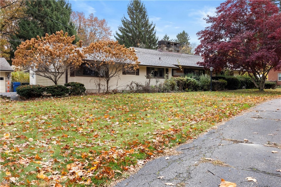
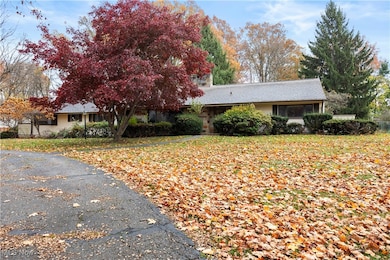

4345 Martin Dr North Olmsted, OH 44070
Estimated payment $2,117/month
Highlights
- 0.72 Acre Lot
- Deck
- No HOA
- North Olmsted Middle School Rated 9+
- 2 Fireplaces
- 4 Car Detached Garage
About This Home
This sprawling ranch offers over 2,300 sq. ft. of living space and sits on a beautiful 3⁄4-acre lot with a large
turnaround driveway and a 4-car detached garage. Featuring 4 bedrooms and 2.5 baths, this home offers both
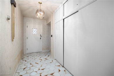
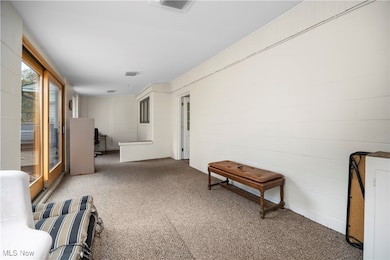
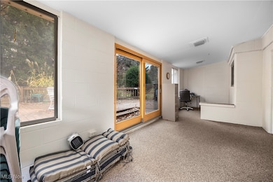
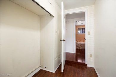
comfort and function with plenty of room to spread out. The home has two convenient entrances, front and back. From the back breezeway, you'll enter near the owners suite, which includes a spacious 14x20 bedroom and a bath with a relaxing soaking tub. Wood floors extend through the owners bath, half bath, and laundry area. The laundry room leads into the kitchen, which
features oak cabinetry, laminate countertops, and all appliances included. The kitchen opens to a generous eating area and flows into the living and dining rooms, complete with a cozy wood-burning fireplace. A family room on the opposite side of the living/dining area adds even more living space and features a gas fireplace for added warmth and charm. The additional three bedrooms and a full bath are located in their own wing of the home, offering great separation and privacy. One bedroom was previously used as a beauty salon, providing extra flexibility for a home office, craft room, or hobby space. Outside, you'll love the large composite 23X28 (Trex) deck overlooking the spacious yard, perfect for entertaining or relaxing. Additional updates include a newer hot water tank and newer Anderson sliding door to the deck. Several Anderson windows throughout the home bring in great natural light. With some updates, this home offers instant equity potential and is priced accordingly. Seller is unable to make any repairs and selling as-is. A fantastic opportunity for those seeking a spacious, well-built ranch with multiple living areas, great storage, and plenty of garage space! Home Warranty included!
Listing Agent
Russell Real Estate Services Brokerage Email: realtorjentaylor@gmail.com, 440-864-9792 License #2013002382 Listed on: 11/12/2025

Home Details
Home Type
- Single Family
Est. Annual Taxes
- $7,167
Year Built
- Built in 1954
Lot Details
- 0.72 Acre Lot
- Property is Fully Fenced
- Chain Link Fence
- Many Trees
Parking
- 4 Car Detached Garage
Home Design
- Slab Foundation
- Fiberglass Roof
- Asphalt Roof
- Vinyl Siding
Interior Spaces
- 2,321 Sq Ft Home
- 1-Story Property
- 2 Fireplaces
- Wood Burning Fireplace
- Fireplace With Glass Doors
- Gas Log Fireplace
- Double Pane Windows
- Entrance Foyer
- Fire and Smoke Detector
- Laundry Room
Kitchen
- Eat-In Kitchen
- Range
- Microwave
- Dishwasher
Bedrooms and Bathrooms
- 4 Main Level Bedrooms
- 2.5 Bathrooms
- Soaking Tub
Outdoor Features
- Deck
Utilities
- Forced Air Heating and Cooling System
- Heating System Uses Gas
Listing and Financial Details
- Home warranty included in the sale of the property
- Assessor Parcel Number 232-03-017
Community Details
Overview
- No Home Owners Association
- Porter Road Acre Subdivision
Amenities
- Shops
Recreation
- Park
Map
Home Values in the Area
Average Home Value in this Area
Tax History
| Year | Tax Paid | Tax Assessment Tax Assessment Total Assessment is a certain percentage of the fair market value that is determined by local assessors to be the total taxable value of land and additions on the property. | Land | Improvement |
|---|---|---|---|---|
| 2024 | $7,167 | $114,380 | $26,530 | $87,850 |
| 2023 | $5,766 | $79,770 | $24,680 | $55,090 |
| 2022 | $5,770 | $79,770 | $24,680 | $55,090 |
| 2021 | $5,222 | $79,770 | $24,680 | $55,090 |
| 2020 | $4,658 | $64,860 | $20,060 | $44,800 |
| 2019 | $4,532 | $185,300 | $57,300 | $128,000 |
| 2018 | $4,597 | $64,860 | $20,060 | $44,800 |
| 2017 | $4,236 | $56,350 | $16,940 | $39,410 |
| 2016 | $4,199 | $56,350 | $16,940 | $39,410 |
| 2015 | $4,032 | $56,350 | $16,940 | $39,410 |
| 2014 | $4,032 | $54,190 | $16,280 | $37,910 |
Property History
| Date | Event | Price | List to Sale | Price per Sq Ft |
|---|---|---|---|---|
| 11/12/2025 11/12/25 | For Sale | $289,900 | -- | $125 / Sq Ft |
Purchase History
| Date | Type | Sale Price | Title Company |
|---|---|---|---|
| Fiduciary Deed | -- | None Listed On Document | |
| Quit Claim Deed | -- | Roth Lisa J | |
| Interfamily Deed Transfer | -- | Title Access Llc | |
| Quit Claim Deed | -- | Rockwell Title | |
| Deed | -- | -- | |
| Deed | -- | -- |
Mortgage History
| Date | Status | Loan Amount | Loan Type |
|---|---|---|---|
| Previous Owner | $99,000 | No Value Available |
Source: MLS Now
MLS Number: 5171827
APN: 232-03-017
Disclaimer: Certain information contained herein is derived from information provided by parties other than Homes.com. All information provided is deemed reliable, but is not guaranteed to be accurate and should be independently verified.
![]() IDX information is provided exclusively for personal, non-commercial use, and may not be used for any purpose other than to identify prospective properties consumers may be interested in purchasing. Information is deemed reliable but not guaranteed.
IDX information is provided exclusively for personal, non-commercial use, and may not be used for any purpose other than to identify prospective properties consumers may be interested in purchasing. Information is deemed reliable but not guaranteed.
- #3 Fifth Ave
- #4 Fifth Ave
- #5 Fifth Ave
- #2 Fifth Ave
- 4553 Porter Rd
- 27609 Laurell Ln
- 27504 Cottonwood Trail
- 29003 Brockway Dr
- 29053 W Brockway Dr
- LUCAS TH Plan at Brentwood - Brentwood Townhomes
- LIBBY TH Plan at Brentwood - Brentwood Townhomes
- ABBY TH Plan at Brentwood - Brentwood Townhomes
- 4324 Palomar Ln
- 29852 Lenox Dr
- 4958 Hampton Dr
- 5032 Devon Dr
- 29459 Hummingbird Cir Unit 51
- 30105 Center Ridge Rd Unit A
- 5248 W Park Dr
- 30233 Center Ridge Rd Unit 5
- 4351 Dover Center Rd Unit North
- 27279 Dunford Rd
- 28331 Center Ridge Rd
- 27243 Westown Blvd
- 2850 Northglen Dr
- 5264 Victoria Ln
- 5938 Porter Rd
- 26101 Country Club Blvd
- 25735 Lorain Rd Unit 219
- 25735 Lorain Rd Unit 18
- 25801 Country Club Blvd
- 25157 Carlton Park
- 4122 Columbia Square
- 25151 Brookpark Rd
- 5800 Great Northern Blvd
- 24851 Country Club Blvd
- 177 Market St
- 2730 Columbia Rd
- 5250 Columbia Rd
- 4809 Columbia Rd