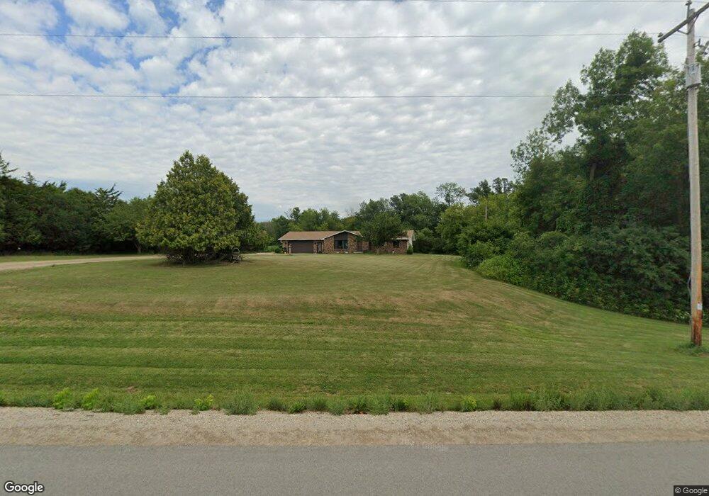
4345 Rosin Rd de Pere, WI 54115
Estimated Value: $319,000 - $487,000
Studio
--
Bath
--
Sq Ft
1.63
Acres
About This Home
This home is located at 4345 Rosin Rd, de Pere, WI 54115 and is currently estimated at $398,614. 4345 Rosin Rd is a home located in Brown County with nearby schools including Wrightstown Elementary School, Wrightstown Middle School, and Wrightstown High School.
Ownership History
Date
Name
Owned For
Owner Type
Purchase Details
Closed on
Sep 23, 2024
Sold by
Rosin Carrie J and Rosin Y
Bought by
Rosin Carrie J and Parrish Joseph
Current Estimated Value
Home Financials for this Owner
Home Financials are based on the most recent Mortgage that was taken out on this home.
Original Mortgage
$213,750
Outstanding Balance
$211,343
Interest Rate
6.46%
Estimated Equity
$187,271
Purchase Details
Closed on
Jun 29, 2022
Sold by
Rosin Kurt R
Bought by
Rosin Carrie J
Home Financials for this Owner
Home Financials are based on the most recent Mortgage that was taken out on this home.
Original Mortgage
$125,200
Interest Rate
5.1%
Purchase Details
Closed on
Dec 21, 2021
Sold by
Rosin Clyde and Rosin Y
Bought by
Rosin Kurt and Rosin Y
Purchase Details
Closed on
Aug 4, 2021
Sold by
Rosin Clyde
Bought by
Town Of Wrightstown
Create a Home Valuation Report for This Property
The Home Valuation Report is an in-depth analysis detailing your home's value as well as a comparison with similar homes in the area
Home Values in the Area
Average Home Value in this Area
Purchase History
| Date | Buyer | Sale Price | Title Company |
|---|---|---|---|
| Rosin Carrie J | -- | Title 365 | |
| Rosin Carrie J | $270,000 | -- | |
| Rosin Kurt | -- | -- | |
| Town Of Wrightstown | $1,640 | None Available |
Source: Public Records
Mortgage History
| Date | Status | Borrower | Loan Amount |
|---|---|---|---|
| Open | Rosin Carrie J | $213,750 | |
| Previous Owner | Rosin Carrie J | $125,200 |
Source: Public Records
Tax History
| Year | Tax Paid | Tax Assessment Tax Assessment Total Assessment is a certain percentage of the fair market value that is determined by local assessors to be the total taxable value of land and additions on the property. | Land | Improvement |
|---|---|---|---|---|
| 2024 | $2,937 | $250,800 | $34,500 | $216,300 |
| 2023 | $3,078 | $250,800 | $34,500 | $216,300 |
| 2022 | $3,340 | $250,800 | $34,500 | $216,300 |
| 2021 | $2,727 | $149,400 | $26,300 | $123,100 |
| 2020 | $2,642 | $149,400 | $26,300 | $123,100 |
| 2019 | $2,517 | $149,400 | $26,300 | $123,100 |
| 2018 | $2,524 | $149,400 | $26,300 | $123,100 |
| 2017 | $2,428 | $149,400 | $26,300 | $123,100 |
| 2016 | $2,568 | $149,400 | $26,300 | $123,100 |
| 2015 | $2,714 | $149,400 | $26,300 | $123,100 |
| 2014 | $2,872 | $149,400 | $26,300 | $123,100 |
| 2013 | $2,872 | $149,400 | $26,300 | $123,100 |
Source: Public Records
Map
Nearby Homes
- 4207 Lost Dauphin Rd
- 4079 Lost Dauphin Rd
- 421 Fawnwood Ct
- 3979 Lost Dauphin Rd
- 217 Patricia Ln
- 3829 Lost Dauphin Rd
- 109 Nicole Ln
- 544 Nicole Ln
- 230 Kerrigan Dr
- 113 Beckerae Ct
- 128 Beckerae Ct
- 110 Beckerae Ct
- 278 Kerrigan Dr
- 287 Kerrigan Dr
- 269 Kerrigan Dr
- 308 Kerrigan Dr
- 5305 Goldust Ct
- 302 Kerrigan Dr
- 263 Kerrigan Dr
- 254 Peterlynn Dr
- 4392 Rosin Rd
- 4314 Rosin Rd
- 4240 Rosin Rd
- 4237 Rosin Rd
- 2437 Amos Mary Ct
- 2462 Amos Mary Ct
- 2456 Amos Mary Ct
- 2432 Amos Mary Ct
- 4306 Lost Dauphin Rd
- 4108 Old Car Ct
- 4134 Lost Dauphin Rd
- 171 Fox Shores Dr
- 4094 Old Car Ct
- 166 Fox Shores Dr
- 167 167 Fox Shores
- 4111 Old Car Ct
- 4536 Rosin Rd
- 154 Fox Shores Dr
- 4072 Old Car Ct
- 142 Fox Shores Dr