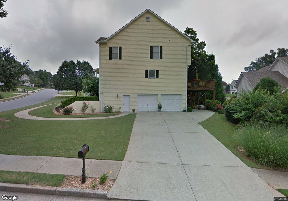
4348 Clairesbrook Ln Acworth, GA 30101
Estimated Value: $395,000 - $434,000
4
Beds
3
Baths
2,364
Sq Ft
$174/Sq Ft
Est. Value
About This Home
This home is located at 4348 Clairesbrook Ln, Acworth, GA 30101 and is currently estimated at $410,289, approximately $173 per square foot. 4348 Clairesbrook Ln is a home located in Cobb County with nearby schools including Baker Elementary School, Barber Middle School, and North Cobb High School.
Ownership History
Date
Name
Owned For
Owner Type
Purchase Details
Closed on
Aug 20, 2020
Sold by
Aronhalt Robert L and Aronhalt Patricia A
Bought by
Beach Richard Keith and Beach Janny
Current Estimated Value
Home Financials for this Owner
Home Financials are based on the most recent Mortgage that was taken out on this home.
Original Mortgage
$279,720
Outstanding Balance
$247,572
Interest Rate
3%
Mortgage Type
VA
Estimated Equity
$162,717
Purchase Details
Closed on
Oct 8, 1999
Sold by
Brownstone Assoc Inc
Bought by
Aronhalt Robert L and Aronhalt Patricia A
Home Financials for this Owner
Home Financials are based on the most recent Mortgage that was taken out on this home.
Original Mortgage
$146,320
Interest Rate
7.91%
Mortgage Type
New Conventional
Create a Home Valuation Report for This Property
The Home Valuation Report is an in-depth analysis detailing your home's value as well as a comparison with similar homes in the area
Home Values in the Area
Average Home Value in this Area
Purchase History
| Date | Buyer | Sale Price | Title Company |
|---|---|---|---|
| Beach Richard Keith | $270,000 | None Available | |
| Aronhalt Robert L | $182,900 | -- |
Source: Public Records
Mortgage History
| Date | Status | Borrower | Loan Amount |
|---|---|---|---|
| Open | Beach Richard Keith | $279,720 | |
| Previous Owner | Aronhalt Robert L | $146,320 |
Source: Public Records
Tax History Compared to Growth
Tax History
| Year | Tax Paid | Tax Assessment Tax Assessment Total Assessment is a certain percentage of the fair market value that is determined by local assessors to be the total taxable value of land and additions on the property. | Land | Improvement |
|---|---|---|---|---|
| 2025 | $1,238 | $146,356 | $32,000 | $114,356 |
| 2024 | $1,262 | $153,344 | $22,000 | $131,344 |
| 2023 | $1,056 | $153,344 | $22,000 | $131,344 |
| 2022 | $1,201 | $133,044 | $22,000 | $111,044 |
| 2021 | $1,126 | $108,000 | $21,160 | $86,840 |
| 2020 | $860 | $106,356 | $26,000 | $80,356 |
| 2019 | $828 | $95,608 | $26,000 | $69,608 |
| 2018 | $828 | $95,608 | $26,000 | $69,608 |
| 2017 | $693 | $84,128 | $19,200 | $64,928 |
| 2016 | $695 | $84,128 | $19,200 | $64,928 |
| 2015 | $587 | $62,628 | $19,200 | $43,428 |
| 2014 | $598 | $62,628 | $0 | $0 |
Source: Public Records
Map
Nearby Homes
- 4321 Clairesbrook Ln
- 4344 Thorngate Ln
- 4336 Thorngate Ln
- 4210 Steeplehill Dr NW
- 4198 Gramercy Main NW
- 4476 High Gate Ct NW
- 2698 Claredon Trace NW
- 2773 Northgate Way NW Unit 1
- 2540 Willow Grove Rd NW Unit 15
- 4317 Chesapeake Trace NW
- 2264 Serenity Dr NW
- 2482 Insdale Trace NW
- 4591 Grenadine Cir
- 4662 Webster Way NW
- 2521 Eden Ridge Ln Unit 7
- 2170 Sugar Maple Cove NW
- 2430 Brookgreen Commons NW
- 4346 Clairesbrook Ln
- 4346 Clairesbrook Ln Unit 11
- 2613 Jacobean Rd
- 2613 Jacobean Rd
- 2613 Jacobean Rd Unit 2
- 0 Jacobean Rd
- 4349 Clairesbrook Ln
- 4344 Clairesbrook Ln
- 4352 Clairesbrook Ln
- 2614 Jacobean Rd
- 4347 Clairesbrook Ln
- 4351 Clairesbrook Ln
- 0 Morlowe Ct Unit 7067620
- 0 Morlowe Ct Unit 8185984
- 4415 Morlowe Ct
- 4353 Clairesbrook Ln
- 4345 Clairesbrook Ln
- 4342 Clairesbrook Ln
- 2612 Jacobean Rd
- 2612 Jacobean Rd Unit ONE