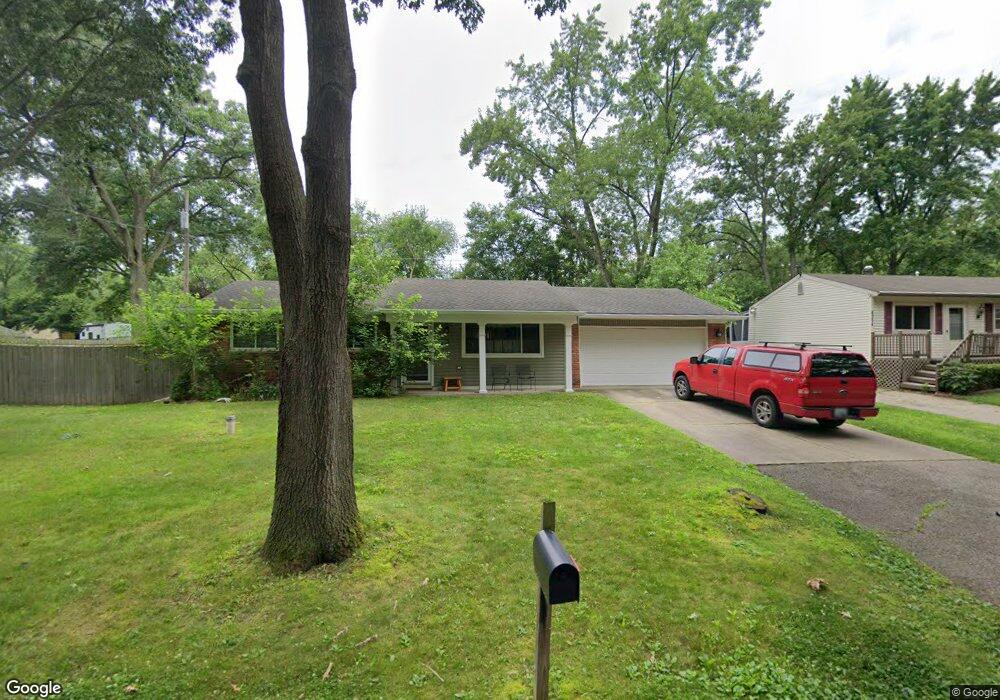
4348 Middledale Ave West Bloomfield, MI 48323
Estimated Value: $265,536 - $301,000
3
Beds
1
Bath
984
Sq Ft
$287/Sq Ft
Est. Value
About This Home
This home is located at 4348 Middledale Ave, West Bloomfield, MI 48323 and is currently estimated at $282,884, approximately $287 per square foot. 4348 Middledale Ave is a home located in Oakland County with nearby schools including Walled Lake Central High School, Our Lady Of Refuge School, and Frankel Jewish Academy Of Metro Detroit.
Ownership History
Date
Name
Owned For
Owner Type
Purchase Details
Closed on
Nov 15, 2010
Sold by
Smart Jason C and Stocker Smart Bree A
Bought by
Robbins Christine
Current Estimated Value
Purchase Details
Closed on
Apr 4, 2003
Sold by
Turner Michael E and Ferris Lynn M
Bought by
Smart Jason C
Home Financials for this Owner
Home Financials are based on the most recent Mortgage that was taken out on this home.
Original Mortgage
$141,600
Interest Rate
5.74%
Mortgage Type
Purchase Money Mortgage
Purchase Details
Closed on
Jul 15, 2002
Sold by
Ahola Duane J
Bought by
New Vista
Create a Home Valuation Report for This Property
The Home Valuation Report is an in-depth analysis detailing your home's value as well as a comparison with similar homes in the area
Home Values in the Area
Average Home Value in this Area
Purchase History
| Date | Buyer | Sale Price | Title Company |
|---|---|---|---|
| Robbins Christine | $135,000 | Partners Title Agency Llc | |
| Smart Jason C | $172,000 | Title Direct | |
| New Vista | -- | -- |
Source: Public Records
Mortgage History
| Date | Status | Borrower | Loan Amount |
|---|---|---|---|
| Previous Owner | Smart Jason C | $141,600 |
Source: Public Records
Tax History Compared to Growth
Tax History
| Year | Tax Paid | Tax Assessment Tax Assessment Total Assessment is a certain percentage of the fair market value that is determined by local assessors to be the total taxable value of land and additions on the property. | Land | Improvement |
|---|---|---|---|---|
| 2024 | $1,387 | $108,810 | $0 | $0 |
| 2022 | $1,214 | $88,750 | $27,050 | $61,700 |
| 2021 | $1,996 | $85,790 | $0 | $0 |
| 2020 | $1,199 | $84,330 | $27,050 | $57,280 |
| 2018 | $1,943 | $72,670 | $22,550 | $50,120 |
| 2015 | -- | $59,170 | $0 | $0 |
| 2014 | -- | $54,400 | $0 | $0 |
| 2011 | -- | $47,440 | $0 | $0 |
Source: Public Records
Map
Nearby Homes
- 4335 Crestdale Ave
- 4245 Bunker Ave
- 4212 Greendale Ave
- 7337 Richardson Rd
- 6978 Colony Dr
- 7381 Crestmore St
- 4442 Borland St
- 6980 Hambro St
- 4066 Green Lake Rd
- 3991 Fieldview Ave
- 7359 Woodlore Dr
- 6903 Dandison Blvd
- 0000 Langtoft
- 3965 Carrick Ave
- 6675 Langtoft St
- 4540 Rolling Pine Ct
- 3950 Bradmore Ave
- 6768 Buckland Ave
- 3632 Fieldview Ave
- 7369 Sweetbriar
- 4334 Middledale Ave
- 4345 Crestdale Ave
- 7112 Manderson Terrace
- 4323 Crestdale Ave
- 4316 Middledale Ave
- 4315 Crestdale Ave
- 000 Manderson Terrace
- 4303 Crestdale Ave
- 4315 Middledale Ave
- 4306 Middledale Ave
- 4291 Crestdale Ave
- 7111 Manderson Terrace
- Lot 12 Cedar Ave
- 4340 Crestdale Ave
- 4324 Crestdale Ave
- Lot 11 Cedar Ave
- Lots 11 & 12 Cedar Ave
- 4350 Crestdale Ave
- 7125 Manderson Trc
- 4291 Middledale Ave