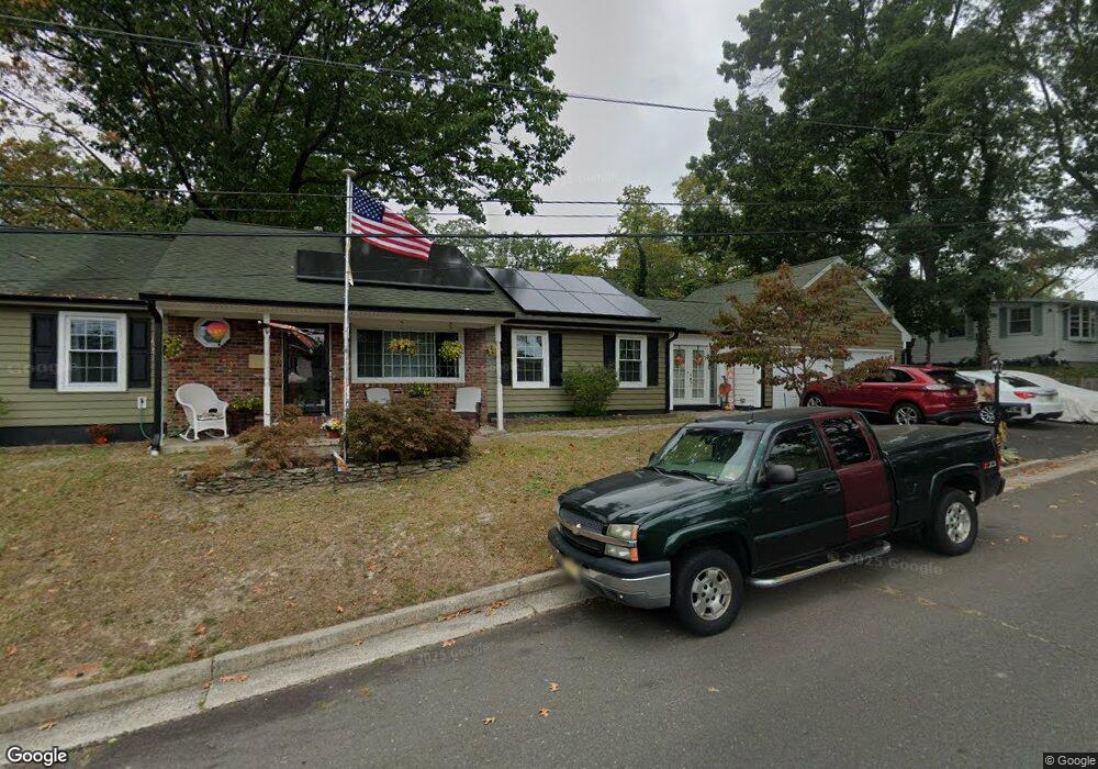
435 Cedar Ave Leonardo, NJ 07737
Estimated Value: $573,000 - $649,000
3
Beds
2
Baths
1,632
Sq Ft
$368/Sq Ft
Est. Value
About This Home
This home is located at 435 Cedar Ave, Leonardo, NJ 07737 and is currently estimated at $600,041, approximately $367 per square foot. 435 Cedar Ave is a home located in Monmouth County with nearby schools including Leonardo Elementary School, Bayshore Middle School, and Middletown - South High School.
Ownership History
Date
Name
Owned For
Owner Type
Purchase Details
Closed on
Jun 30, 1994
Sold by
Zullo Patrick
Bought by
Piatti Michael and Piatti Audrey
Current Estimated Value
Home Financials for this Owner
Home Financials are based on the most recent Mortgage that was taken out on this home.
Original Mortgage
$142,000
Interest Rate
8.55%
Mortgage Type
VA
Create a Home Valuation Report for This Property
The Home Valuation Report is an in-depth analysis detailing your home's value as well as a comparison with similar homes in the area
Home Values in the Area
Average Home Value in this Area
Purchase History
| Date | Buyer | Sale Price | Title Company |
|---|---|---|---|
| Piatti Michael | $139,000 | -- |
Source: Public Records
Mortgage History
| Date | Status | Borrower | Loan Amount |
|---|---|---|---|
| Closed | Piatti Michael | $142,000 |
Source: Public Records
Tax History
| Year | Tax Paid | Tax Assessment Tax Assessment Total Assessment is a certain percentage of the fair market value that is determined by local assessors to be the total taxable value of land and additions on the property. | Land | Improvement |
|---|---|---|---|---|
| 2025 | $7,120 | $524,600 | $329,100 | $195,500 |
| 2024 | $7,192 | $432,800 | $238,100 | $194,700 |
| 2023 | $7,192 | $413,800 | $223,600 | $190,200 |
| 2022 | $6,978 | $370,100 | $183,300 | $186,800 |
| 2021 | $6,978 | $335,500 | $169,400 | $166,100 |
| 2020 | $6,587 | $308,100 | $143,500 | $164,600 |
| 2019 | $6,461 | $305,900 | $142,200 | $163,700 |
| 2018 | $6,016 | $277,600 | $119,500 | $158,100 |
| 2017 | $5,972 | $272,800 | $119,500 | $153,300 |
| 2016 | $5,679 | $266,500 | $119,500 | $147,000 |
| 2015 | $5,842 | $264,700 | $119,500 | $145,200 |
| 2014 | $5,707 | $252,200 | $119,500 | $132,700 |
Source: Public Records
Map
Nearby Homes
- 28 Florence Ave
- 86 Washington Ave
- 45 Viola Ave
- 218 Beach Ave
- 12 Thompson Ave
- 21 7th St
- 477 N Fox Ave
- 190 8th St
- 201 Summit Ave
- 1209 Wedgewood Cir
- 308 Wedgewood Cir Unit 324
- 610 Center Ave
- 46 Hosford Ave
- 135 Railroad Ave
- 287 Linda St
- 350 East Rd
- 325 Hollie Dr E
- 571 Hopping Rd
- 574 Hopping Rd
- 13 Brant Dr Unit Lot 5.09
- 463 Monmouth Ave
- 465 Monmouth Ave
- 447 Monmouth Ave
- 433 Cedar Ave
- 467 Monmouth Ave
- 432 Cedar Ave
- 445 Monmouth Ave
- 437 Cedar Ave
- 136 Burlington Ave
- 431 Cedar Ave
- 452 Monmouth Ave
- 443 Monmouth Ave
- 466 Monmouth Ave
- 450 Monmouth Ave
- 132 Burlington Ave
- 448 Monmouth Ave
- 439 Cedar Ave
- 446 Monmouth Ave
- 439 Monmouth Ave
- 128 Burlington Ave
Your Personal Tour Guide
Ask me questions while you tour the home.