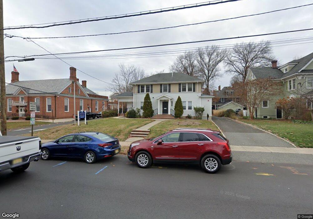
435 E Broad St Unit 1 Westfield, NJ 07090
Estimated Value: $2,196,300
Studio
--
Bath
3,688
Sq Ft
$596/Sq Ft
Est. Value
About This Home
This home is located at 435 E Broad St Unit 1, Westfield, NJ 07090 and is currently estimated at $2,196,300, approximately $595 per square foot. 435 E Broad St Unit 1 is a home located in Union County with nearby schools including Wilson Elementary School, Roosevelt Intermediate School, and Westfield Senior High School.
Ownership History
Date
Name
Owned For
Owner Type
Purchase Details
Closed on
Oct 5, 2018
Sold by
Pp & L Westfield Property Llc
Bought by
Broad Realty Llc
Current Estimated Value
Home Financials for this Owner
Home Financials are based on the most recent Mortgage that was taken out on this home.
Original Mortgage
$1,060,000
Interest Rate
4.5%
Mortgage Type
Commercial
Purchase Details
Closed on
Jul 29, 2004
Sold by
435 E Broad Street Llc
Bought by
Pp&L Westfield Property Llc
Purchase Details
Closed on
May 17, 2002
Sold by
Heimlich James C and Heimlich Patricia L
Bought by
435 East Broad Street Llc
Home Financials for this Owner
Home Financials are based on the most recent Mortgage that was taken out on this home.
Original Mortgage
$513,750
Interest Rate
6.9%
Mortgage Type
Commercial
Create a Home Valuation Report for This Property
The Home Valuation Report is an in-depth analysis detailing your home's value as well as a comparison with similar homes in the area
Home Values in the Area
Average Home Value in this Area
Purchase History
| Date | Buyer | Sale Price | Title Company |
|---|---|---|---|
| Broad Realty Llc | $1,325,000 | None Available | |
| Pp&L Westfield Property Llc | $900,000 | -- | |
| 435 East Broad Street Llc | $685,000 | -- |
Source: Public Records
Mortgage History
| Date | Status | Borrower | Loan Amount |
|---|---|---|---|
| Previous Owner | Broad Realty Llc | $1,060,000 | |
| Previous Owner | 435 East Broad Street Llc | $513,750 |
Source: Public Records
Tax History
| Year | Tax Paid | Tax Assessment Tax Assessment Total Assessment is a certain percentage of the fair market value that is determined by local assessors to be the total taxable value of land and additions on the property. | Land | Improvement |
|---|---|---|---|---|
| 2025 | $30,679 | $1,362,300 | $598,400 | $763,900 |
| 2024 | $30,052 | $1,362,300 | $598,400 | $763,900 |
| 2023 | $30,052 | $1,362,300 | $598,400 | $763,900 |
| 2022 | $29,426 | $1,362,300 | $598,400 | $763,900 |
| 2021 | $29,467 | $1,362,300 | $598,400 | $763,900 |
| 2020 | $28,460 | $1,318,800 | $598,400 | $720,400 |
| 2019 | $28,354 | $1,318,800 | $598,400 | $720,400 |
| 2018 | $25,046 | $269,400 | $166,000 | $103,400 |
| 2017 | $24,909 | $269,400 | $166,000 | $103,400 |
| 2016 | $24,324 | $269,400 | $166,000 | $103,400 |
| 2015 | $23,839 | $269,400 | $166,000 | $103,400 |
| 2014 | $23,053 | $269,400 | $166,000 | $103,400 |
Source: Public Records
Map
Nearby Homes
- 318 S Euclid Ave
- 203 Ross Place
- 215 Ross Place Unit J
- 208 Jefferson Ave
- 756 Kimball Ave
- 553 Parkview Ave
- 765 Marcellus Dr
- 771 Oak Ave
- 515 Trinity Place Unit 3AN
- 529 Benson Place
- 820 E Broad St
- 122 Livingston St
- 615 Maple Ct Unit 615
- 710 Girard Ave
- 23 Stoneleigh Park
- 825 Grant Ave
- 722 Boulevard
- 514 Downer St
- 143 Stanmore Place
- 733 Summit Ave
- 435 E Broad St
- 445 E Broad St
- 117 N Euclid Ave
- 121 N Euclid Ave
- 127 N Euclid Ave
- 114 N Euclid Ave
- 118 N Euclid Ave
- 131 N Euclid Ave
- 114 S Euclid Ave Unit 114
- 114 S Euclid Ave Unit 1-2
- 114 S Euclid Ave
- 114 S Euclid Ave Unit 1
- 509 E Broad St Unit 13
- 502 E Broad St
- 126 N Euclid Ave
- 135 N Euclid Ave
- 115 Harrison Ave
- 116 S Euclid Ave Unit 3
- 116 S Euclid Ave
- 132 N Euclid Ave
Your Personal Tour Guide
Ask me questions while you tour the home.