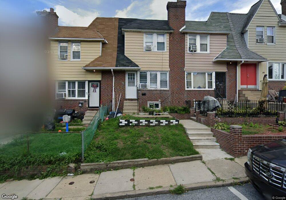
435 Hampden Rd Upper Darby, PA 19082
Estimated Value: $118,000 - $174,000
3
Beds
1
Bath
1,216
Sq Ft
$122/Sq Ft
Est. Value
About This Home
This home is located at 435 Hampden Rd, Upper Darby, PA 19082 and is currently estimated at $147,921, approximately $121 per square foot. 435 Hampden Rd is a home located in Delaware County with nearby schools including Upper Darby Kdg Center, Upper Darby High School, and Philadelphia Christian Academy.
Ownership History
Date
Name
Owned For
Owner Type
Purchase Details
Closed on
Jan 13, 2020
Sold by
Jsp Real Estate Llc
Bought by
Waheduzzaman Momtaz
Current Estimated Value
Purchase Details
Closed on
Aug 29, 2019
Sold by
Kline David B and Kline Beth R
Bought by
Jsp Real Estate Llc
Purchase Details
Closed on
Apr 5, 2006
Sold by
Selby Elizabeth
Bought by
Kline David B and Kline Beth R
Home Financials for this Owner
Home Financials are based on the most recent Mortgage that was taken out on this home.
Original Mortgage
$51,600
Interest Rate
6.37%
Mortgage Type
Purchase Money Mortgage
Purchase Details
Closed on
May 29, 1998
Sold by
Hornig Joseph F and Hornig Ellen
Bought by
Selby Elizabeth
Home Financials for this Owner
Home Financials are based on the most recent Mortgage that was taken out on this home.
Original Mortgage
$42,650
Interest Rate
7.05%
Create a Home Valuation Report for This Property
The Home Valuation Report is an in-depth analysis detailing your home's value as well as a comparison with similar homes in the area
Home Values in the Area
Average Home Value in this Area
Purchase History
| Date | Buyer | Sale Price | Title Company |
|---|---|---|---|
| Waheduzzaman Momtaz | -- | None Available | |
| Jsp Real Estate Llc | $46,500 | Terra Abstract Inc | |
| Kline David B | $64,500 | None Available | |
| Selby Elizabeth | $44,000 | -- |
Source: Public Records
Mortgage History
| Date | Status | Borrower | Loan Amount |
|---|---|---|---|
| Previous Owner | Kline David B | $51,600 | |
| Previous Owner | Selby Elizabeth | $42,650 |
Source: Public Records
Tax History Compared to Growth
Tax History
| Year | Tax Paid | Tax Assessment Tax Assessment Total Assessment is a certain percentage of the fair market value that is determined by local assessors to be the total taxable value of land and additions on the property. | Land | Improvement |
|---|---|---|---|---|
| 2025 | $3,265 | $77,200 | $13,490 | $63,710 |
| 2024 | $3,265 | $77,200 | $13,490 | $63,710 |
| 2023 | $3,234 | $77,200 | $13,490 | $63,710 |
| 2022 | $3,147 | $77,200 | $13,490 | $63,710 |
| 2021 | $4,244 | $77,200 | $13,490 | $63,710 |
| 2020 | $2,912 | $45,010 | $12,260 | $32,750 |
| 2019 | $2,860 | $45,010 | $12,260 | $32,750 |
| 2018 | $2,827 | $45,010 | $0 | $0 |
| 2017 | $2,754 | $45,010 | $0 | $0 |
| 2016 | $247 | $45,010 | $0 | $0 |
| 2015 | $247 | $45,010 | $0 | $0 |
| 2014 | $247 | $45,010 | $0 | $0 |
Source: Public Records
Map
Nearby Homes
- 426 Hampden Rd
- 418 Hampden Rd
- 433 Copley Rd
- 432 Grace Rd
- 346 Long Ln
- 424 Woodcliffe Rd
- 337 Copley Rd
- 504 Woodcliffe Rd
- 7114 Locust St
- 513 Woodcliffe Rd
- 7139 Guilford Rd
- 271 Wembly Rd
- 404 Croyden Rd
- 268 Hampden Rd
- 607 Littlecroft Rd
- 419 Gilpin Rd
- 214 Kingston Rd
- 6858 Marshall Rd
- 577 Snowden Rd
- 7252 Brent Rd
- 413 Hampden Rd
- 439 Hampden Rd
- 441 Hampden Rd
- 445 Hampden Rd
- 419 Hampden Rd
- 433 Hampden Rd
- 431 Hampden Rd
- 427 Hampden Rd
- 425 Hampden Rd
- 417 Hampden Rd
- 415 Hampden Rd
- 411 Hampden Rd
- 409 Hampden Rd
- 421 Hampden Rd
- 416 Littlecroft Rd
- 436 Littlecroft Rd
- 438 Littlecroft Rd
- 440 Littlecroft Rd
- 423 Hampden Rd
- 442 Littlecroft Rd