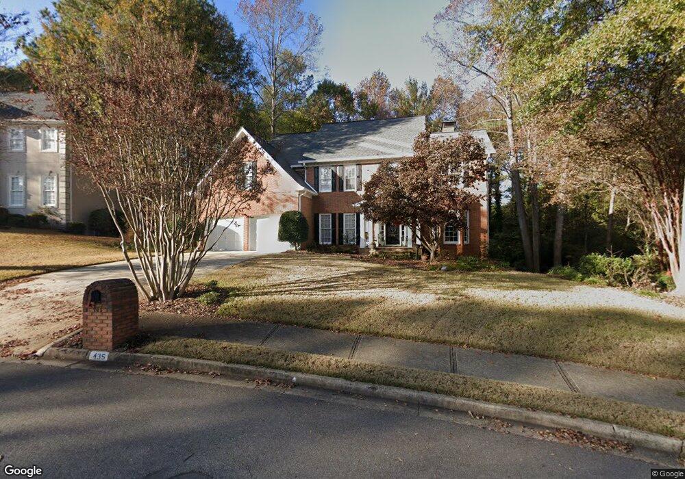
435 Kirkstall Trail Alpharetta, GA 30022
Estimated Value: $782,000 - $899,000
4
Beds
4
Baths
3,420
Sq Ft
$250/Sq Ft
Est. Value
About This Home
This home is located at 435 Kirkstall Trail, Alpharetta, GA 30022 and is currently estimated at $855,763, approximately $250 per square foot. 435 Kirkstall Trail is a home located in Fulton County with nearby schools including Ocee Elementary School, Taylor Road Middle School, and Chattahoochee High School.
Ownership History
Date
Name
Owned For
Owner Type
Purchase Details
Closed on
Jun 29, 2001
Sold by
Lindberg Kari K
Bought by
Lindberg Kari K and Lindberg Jaana L
Current Estimated Value
Home Financials for this Owner
Home Financials are based on the most recent Mortgage that was taken out on this home.
Original Mortgage
$271,900
Interest Rate
7.17%
Mortgage Type
New Conventional
Create a Home Valuation Report for This Property
The Home Valuation Report is an in-depth analysis detailing your home's value as well as a comparison with similar homes in the area
Home Values in the Area
Average Home Value in this Area
Purchase History
| Date | Buyer | Sale Price | Title Company |
|---|---|---|---|
| Lindberg Kari K | -- | -- | |
| Lindberg Kari K | $339,900 | -- |
Source: Public Records
Mortgage History
| Date | Status | Borrower | Loan Amount |
|---|---|---|---|
| Open | Lindberg Kari | $225,000 | |
| Closed | Lindberg Jaana L | $245,000 | |
| Closed | Lindberg Kari K | $268,000 | |
| Closed | Lindberg Kari K | $271,900 | |
| Previous Owner | Lampe Robert F | $195,000 | |
| Previous Owner | Lampe Robert F | $60,000 |
Source: Public Records
Tax History Compared to Growth
Tax History
| Year | Tax Paid | Tax Assessment Tax Assessment Total Assessment is a certain percentage of the fair market value that is determined by local assessors to be the total taxable value of land and additions on the property. | Land | Improvement |
|---|---|---|---|---|
| 2025 | $953 | $356,480 | $85,280 | $271,200 |
| 2023 | $9,110 | $322,760 | $62,240 | $260,520 |
| 2022 | $4,424 | $245,000 | $42,280 | $202,720 |
| 2021 | $5,206 | $213,680 | $41,080 | $172,600 |
| 2020 | $5,240 | $211,160 | $40,600 | $170,560 |
| 2019 | $805 | $214,800 | $37,960 | $176,840 |
| 2018 | $5,183 | $209,720 | $37,040 | $172,680 |
| 2017 | $4,882 | $185,800 | $22,720 | $163,080 |
| 2016 | $4,284 | $158,800 | $25,320 | $133,480 |
| 2015 | $5,014 | $158,800 | $25,320 | $133,480 |
| 2014 | $3,747 | $158,800 | $25,320 | $133,480 |
Source: Public Records
Map
Nearby Homes
- 10880 Windham Way
- 125 Sandridge Ct
- 345 Kincardine Way Unit IIIA
- 10610 Kingsmark Trail
- 10530 Tuxford Dr
- 10880 S Kimball Bridge Crossing Unit CRS
- 10875 S Kimball Bridge Crossing Unit CRS
- 825 Highland Bend Cove
- 3775 Banyon Ln
- 710 Country Manor Way
- 10650 Colony Glen Dr
- 4465 Hawthorn Cir
- 3785 Hebden Bridge Ln
- 4462 Hawthorn Cir
- 4475 Hawthorn Cir
- 10650 Centennial Dr
- 3582 Cape York Trace
- 12080 Castleton Ct
- Portis Plan at Hawthorn
- Rhinewood Plan at Hawthorn
- 425 Kirkstall Trail
- 445 Kirkstall Trail
- 420 Kirkstall Trail
- 415 Kirkstall Trail
- 430 Kirkstall Trail Unit IV
- 455 Kirkstall Trail
- 410 Kirkstall Trail
- 405 Kirkstall Trail
- 440 Kirkstall Trail
- 510 Bisland Ct
- 10820 Windham Way Unit IV
- 775 Mallory Manor Ct
- 0 Kirkstall Trail Unit 7130869
- 0 Kirkstall Trail Unit 8888360
- 0 Kirkstall Trail Unit 7634839
- 0 Kirkstall Trail
- 465 Kirkstall Trail
- 465 Kirkstall Trail Unit IV
- 10850 Windham Way
- 320 Hayward Ln Unit 1