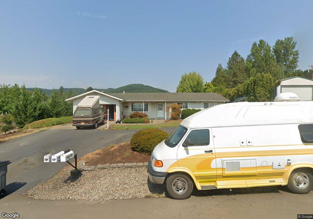
435 NW Gutbrod St Sheridan, OR 97378
Estimated Value: $353,000 - $383,000
3
Beds
2
Baths
1,412
Sq Ft
$262/Sq Ft
Est. Value
About This Home
This home is located at 435 NW Gutbrod St, Sheridan, OR 97378 and is currently estimated at $369,806, approximately $261 per square foot. 435 NW Gutbrod St is a home located in Yamhill County with nearby schools including Faulconer-Chapman School, Sheridan High School, and Sheridan Allprep Academy.
Ownership History
Date
Name
Owned For
Owner Type
Purchase Details
Closed on
Dec 14, 2011
Sold by
Latham Douglas C
Bought by
Coyle Cecil C and Coyle Emily R
Current Estimated Value
Home Financials for this Owner
Home Financials are based on the most recent Mortgage that was taken out on this home.
Original Mortgage
$138,924
Outstanding Balance
$94,017
Interest Rate
3.94%
Mortgage Type
VA
Estimated Equity
$275,789
Create a Home Valuation Report for This Property
The Home Valuation Report is an in-depth analysis detailing your home's value as well as a comparison with similar homes in the area
Home Values in the Area
Average Home Value in this Area
Purchase History
| Date | Buyer | Sale Price | Title Company |
|---|---|---|---|
| Coyle Cecil C | $136,000 | First American |
Source: Public Records
Mortgage History
| Date | Status | Borrower | Loan Amount |
|---|---|---|---|
| Open | Coyle Cecil C | $138,924 |
Source: Public Records
Tax History Compared to Growth
Tax History
| Year | Tax Paid | Tax Assessment Tax Assessment Total Assessment is a certain percentage of the fair market value that is determined by local assessors to be the total taxable value of land and additions on the property. | Land | Improvement |
|---|---|---|---|---|
| 2025 | $2,644 | $195,072 | -- | -- |
| 2024 | $2,428 | $189,390 | -- | -- |
| 2023 | $2,358 | $183,874 | $0 | $0 |
| 2022 | $2,293 | $178,518 | $0 | $0 |
| 2021 | $2,595 | $173,318 | $0 | $0 |
| 2020 | $2,507 | $168,270 | $0 | $0 |
| 2019 | $2,463 | $163,369 | $0 | $0 |
| 2018 | $2,394 | $158,611 | $0 | $0 |
| 2017 | $2,349 | $153,991 | $0 | $0 |
| 2016 | $2,281 | $149,506 | $0 | $0 |
| 2015 | $2,190 | $145,153 | $0 | $0 |
| 2014 | $2,112 | $140,927 | $0 | $0 |
Source: Public Records
Map
Nearby Homes
- 18940 SW Canyon Rd
- 21000 SW Canyon Rd
- 240 NW Sagan Loop
- 1200 NE Center St Unit Par 1
- 1200 NE Center St Unit Parce2
- 1200 NE Center St Unit Par3
- 0 NE Center St Unit 1 491349230
- 0 NE Center St Unit 2 430429617
- 0 NE Center St Unit 3 552444847
- 0 NE Center St Unit 4 271594201
- 1200 Blk NE Center St Unit Parcel 4
- 119 NW Sherman St
- 328 NW Sherman St
- 0 NW Viola St
- 370 NW Yamhill St
- 1429 NE Center St
- 510 NE Hill St
- 0 SW Rock Creek Rd Unit 216113550
- 0 SW Rock Creek Rd Unit 827138
- 617 SW Monroe St
- 423 NW Gutbrod St
- 438 NW Gutbrod St
- 445 NW Gutbrod St
- 840 NW Evans St
- 0 NW Gutbrod St
- 920 NW Evans St
- 446 NW Gutbrod St
- 915 NW Evans St
- 838 NW Evans St
- 851 NW Evans St
- 832 NW Evans St
- 836 NW Evans St
- 835 NW Evans St
- 824 NW Evans St
- 828 NW Evans St
- 825 NW Evans St
- 805 NW Evans St
- 822 NW Evans St
- 820 NW Evans St
- 863 NW Evans St