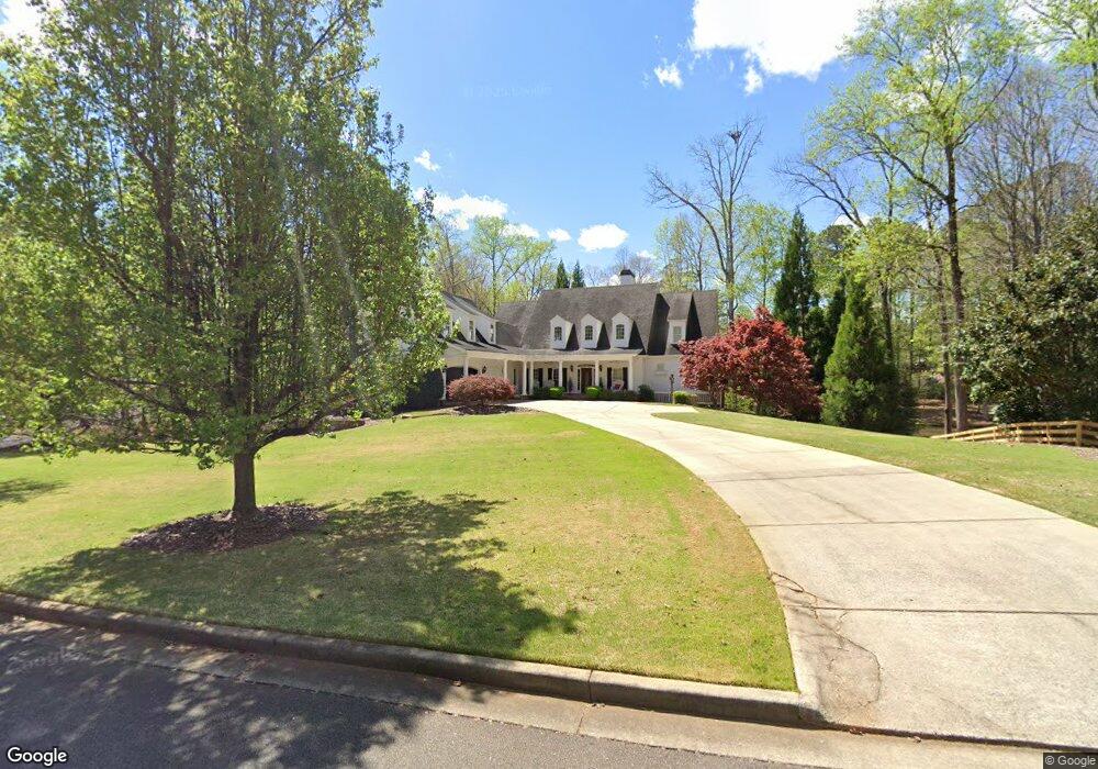
435 S Burgess Trail Unit II Alpharetta, GA 30004
Estimated Value: $1,191,843 - $1,453,000
4
Beds
4
Baths
4,938
Sq Ft
$269/Sq Ft
Est. Value
About This Home
This home is located at 435 S Burgess Trail Unit II, Alpharetta, GA 30004 and is currently estimated at $1,330,711, approximately $269 per square foot. 435 S Burgess Trail Unit II is a home located in Fulton County with nearby schools including Summit Hill Elementary School, Northwestern Middle School, and Cambridge High School.
Ownership History
Date
Name
Owned For
Owner Type
Purchase Details
Closed on
Jul 27, 2001
Sold by
Amico Gregory L
Bought by
Callahan Daniel F and Callahan Cheryl H
Current Estimated Value
Home Financials for this Owner
Home Financials are based on the most recent Mortgage that was taken out on this home.
Original Mortgage
$506,000
Outstanding Balance
$193,527
Interest Rate
6.88%
Mortgage Type
New Conventional
Estimated Equity
$1,137,184
Create a Home Valuation Report for This Property
The Home Valuation Report is an in-depth analysis detailing your home's value as well as a comparison with similar homes in the area
Home Values in the Area
Average Home Value in this Area
Purchase History
| Date | Buyer | Sale Price | Title Company |
|---|---|---|---|
| Callahan Daniel F | $632,500 | -- |
Source: Public Records
Mortgage History
| Date | Status | Borrower | Loan Amount |
|---|---|---|---|
| Open | Callahan Daniel F | $506,000 |
Source: Public Records
Tax History Compared to Growth
Tax History
| Year | Tax Paid | Tax Assessment Tax Assessment Total Assessment is a certain percentage of the fair market value that is determined by local assessors to be the total taxable value of land and additions on the property. | Land | Improvement |
|---|---|---|---|---|
| 2025 | $1,409 | $311,400 | $56,120 | $255,280 |
| 2023 | $8,774 | $310,840 | $56,120 | $254,720 |
| 2022 | $7,280 | $310,840 | $56,120 | $254,720 |
| 2021 | $7,266 | $301,800 | $54,480 | $247,320 |
| 2020 | $7,335 | $298,240 | $53,840 | $244,400 |
| 2019 | $1,456 | $292,960 | $52,880 | $240,080 |
| 2018 | $7,227 | $286,080 | $51,640 | $234,440 |
| 2017 | $7,220 | $274,800 | $49,600 | $225,200 |
| 2016 | $7,186 | $274,800 | $49,600 | $225,200 |
| 2015 | $8,442 | $274,800 | $49,600 | $225,200 |
| 2014 | $5,527 | $193,040 | $39,800 | $153,240 |
Source: Public Records
Map
Nearby Homes
- 515 N Burgess Trail
- 0 Providence Way Rear
- 14040 Providence Rd
- 14300 Providence Rd
- 335 Creek Point
- 380 Creek Point
- 13440 Hipworth Rd
- 13980 Haystack Ln
- 13890 Cowart Rd
- Lot 2 Cowart Rd
- LOT 2 13920 Cowart Rd
- 910 Pleasant Hollow Trail
- 13630 Birmingham Hwy
- 900 Crabapple Hill
- 13825 Cowart Rd
- 139200 Cowart Rd
- 14050 Providence Rd
- 14250 Freemanville Rd
- 815 Brickwood Ln
- 14260 Phillips Cir
- 600 Oak Farm Ln Unit 10
- 600 Oak Farm Ln Unit 2
- 445 S Burgess Trail
- 220 Holcombe Hill Ln
- 2555 S Burgess Trail
- 2555 S Burgess Trail
- S S Burgess Trail Unit 1
- S S Burgess Trail
- 440 S Burgess Trail
- 210 Holcombe Hill Ln Unit 2
- 450 S Burgess Trail
- 430 S Burgess Trail
- 455 S Burgess Trail
- 200 Holcombe Hill Ln Unit 2
- 420 S Burgess Trail
- 230 Holcombe Hill Ln Unit 2
- 0 Holcombe Hill Ct Unit 7077880
- 0 Oak Farm Ln Unit 8998882
- 0 Oak Farm Ln Unit 3119103
- 0 Oak Farm Ln Unit 3176387