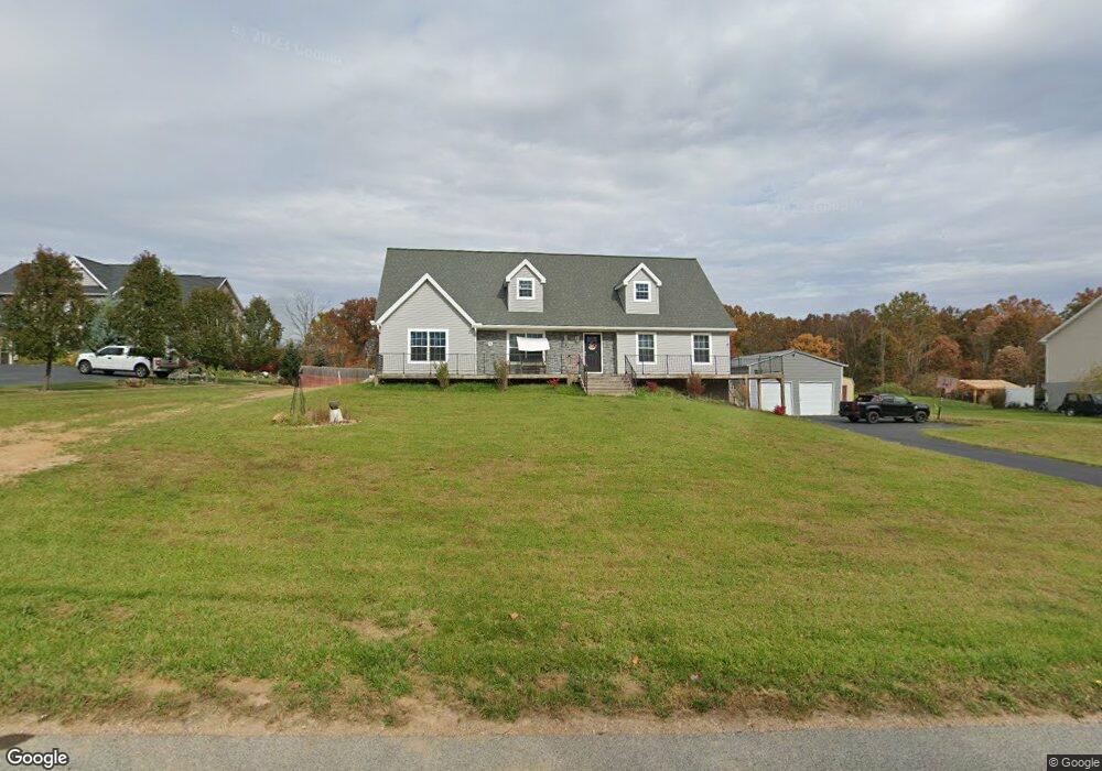
435 Thundergust Mill Rd Wellsville, PA 17365
Warrington Township NeighborhoodEstimated Value: $493,066 - $499,000
3
Beds
3
Baths
2,706
Sq Ft
$183/Sq Ft
Est. Value
About This Home
This home is located at 435 Thundergust Mill Rd, Wellsville, PA 17365 and is currently estimated at $495,517, approximately $183 per square foot. 435 Thundergust Mill Rd is a home with nearby schools including Northern Middle School and Northern High School.
Ownership History
Date
Name
Owned For
Owner Type
Purchase Details
Closed on
Oct 17, 2019
Sold by
Fox Harry H
Bought by
Shaffer Amber H and Shaffer Carrie A
Current Estimated Value
Home Financials for this Owner
Home Financials are based on the most recent Mortgage that was taken out on this home.
Original Mortgage
$240,000
Interest Rate
3.6%
Mortgage Type
Construction
Purchase Details
Closed on
Jul 15, 2015
Sold by
Fox Harry H and Fox Ann G
Bought by
Fox Harry H
Create a Home Valuation Report for This Property
The Home Valuation Report is an in-depth analysis detailing your home's value as well as a comparison with similar homes in the area
Home Values in the Area
Average Home Value in this Area
Purchase History
| Date | Buyer | Sale Price | Title Company |
|---|---|---|---|
| Shaffer Amber H | $59,900 | None Available | |
| Fox Harry H | -- | None Available |
Source: Public Records
Mortgage History
| Date | Status | Borrower | Loan Amount |
|---|---|---|---|
| Closed | Shaffer Amber H | $240,000 |
Source: Public Records
Tax History Compared to Growth
Tax History
| Year | Tax Paid | Tax Assessment Tax Assessment Total Assessment is a certain percentage of the fair market value that is determined by local assessors to be the total taxable value of land and additions on the property. | Land | Improvement |
|---|---|---|---|---|
| 2025 | $6,584 | $241,670 | $55,100 | $186,570 |
| 2024 | $6,512 | $241,670 | $55,100 | $186,570 |
| 2023 | $6,382 | $241,670 | $55,100 | $186,570 |
| 2022 | $6,145 | $237,760 | $55,100 | $182,660 |
| 2021 | $5,744 | $237,760 | $55,100 | $182,660 |
| 2020 | $1,005 | $42,600 | $42,600 | $0 |
| 2019 | $979 | $42,600 | $42,600 | $0 |
| 2018 | $958 | $42,600 | $42,600 | $0 |
| 2017 | $958 | $42,600 | $42,600 | $0 |
| 2016 | $0 | $42,600 | $42,600 | $0 |
| 2015 | -- | $42,600 | $42,600 | $0 |
| 2014 | -- | $42,600 | $42,600 | $0 |
Source: Public Records
Map
Nearby Homes
- 480 Mount Airy Rd Unit 13
- 1967 Pinetown Rd
- 329 Mount Airy Rd
- 450 Stone Jug Rd
- 0 W Camping Area Rd
- Tract #1 Carlisle Rd
- 375 Mount Zion Rd
- 859 Pinetown Rd
- 6520 Old Carlisle Rd
- 6 Glencarron Ct
- 5 Glencarron Ct
- 200 Mountain Rd
- 814 Moores Mountain Rd
- 708 Bencru Ave
- 270 S Winding Rd
- 910 Emanuel Rd
- 6200 Old Carlisle Rd
- 833 Stonybrook Ln
- 6031 Mountain Rd
- 5840 Old Carlisle Rd
- 445 Thundergust Mill Rd
- 425 Thunder Gust Mill Rd
- 425 Thundergust Mill Rd
- 480 Thundergust Mill Rd
- 455 Thundergust Mill Rd
- 460 Thunder Gust Mill Rd
- 405 Thundergust Mill Rd
- 108 Colonial Ct
- 600 Lisburn Rd
- 395 Thunder Gust Mill Rd
- 109 Colonial Ct
- 420 Thundergust Mill Rd
- 106 Colonial Ct
- 620 Lisburn Rd
- 104 Colonial Ct
- 325 Thundergust Mill Rd
- 275 Thundergust Mill Rd
- 635 Lisburn Rd
- 315 Thundergust Mill Rd
- 565 Lisburn Rd