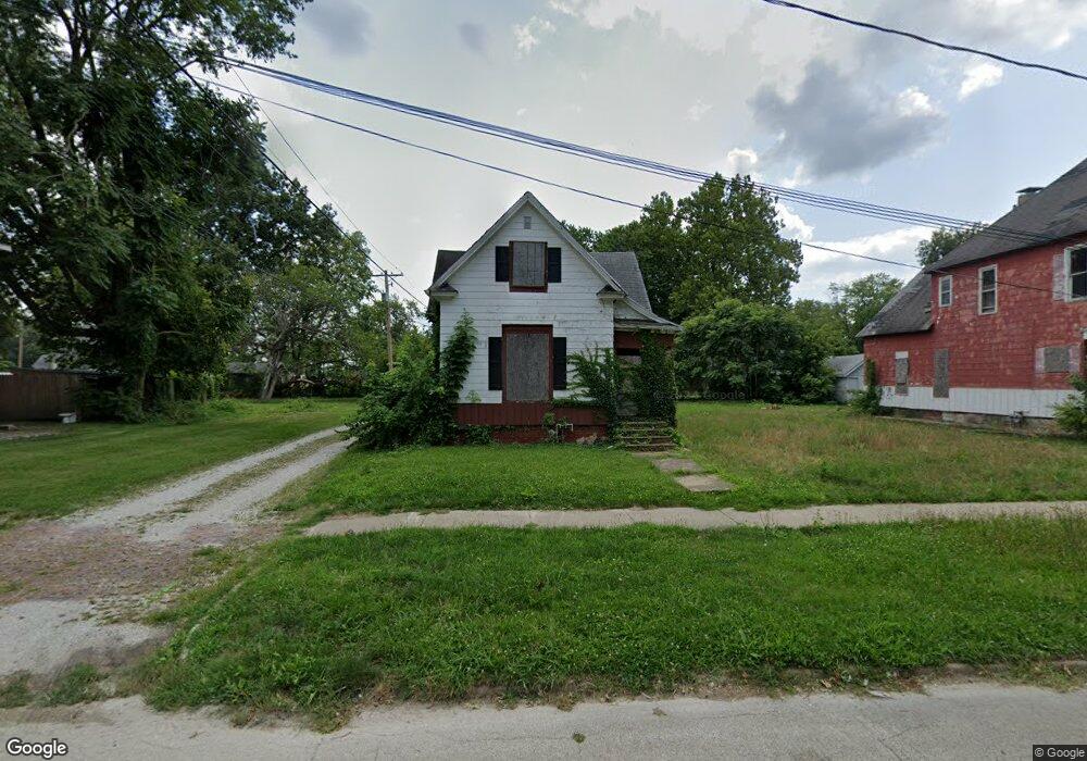
435 W King St Decatur, IL 62522
Estimated Value: $30,000 - $108,000
--
Bed
--
Bath
944
Sq Ft
$60/Sq Ft
Est. Value
About This Home
This home is located at 435 W King St, Decatur, IL 62522 and is currently estimated at $56,803, approximately $60 per square foot. 435 W King St is a home located in Macon County with nearby schools including Hope Academy, St. Patrick School, and Teen Challenge-Home For Girls.
Ownership History
Date
Name
Owned For
Owner Type
Purchase Details
Closed on
Jan 1, 1985
Current Estimated Value
Create a Home Valuation Report for This Property
The Home Valuation Report is an in-depth analysis detailing your home's value as well as a comparison with similar homes in the area
Home Values in the Area
Average Home Value in this Area
Purchase History
| Date | Buyer | Sale Price | Title Company |
|---|---|---|---|
| -- | $3,000 | -- |
Source: Public Records
Tax History Compared to Growth
Tax History
| Year | Tax Paid | Tax Assessment Tax Assessment Total Assessment is a certain percentage of the fair market value that is determined by local assessors to be the total taxable value of land and additions on the property. | Land | Improvement |
|---|---|---|---|---|
| 2024 | $234 | $2,416 | $437 | $1,979 |
| 2023 | $232 | $2,331 | $422 | $1,909 |
| 2022 | $224 | $2,192 | $390 | $1,802 |
| 2021 | $211 | $2,048 | $365 | $1,683 |
| 2020 | $208 | $1,954 | $349 | $1,605 |
| 2019 | $208 | $1,954 | $349 | $1,605 |
| 2018 | $213 | $2,028 | $134 | $1,894 |
| 2017 | $218 | $2,083 | $138 | $1,945 |
| 2016 | $222 | $2,104 | $139 | $1,965 |
| 2015 | $211 | $2,067 | $137 | $1,930 |
| 2014 | $177 | $1,831 | $185 | $1,646 |
| 2013 | $181 | $1,900 | $192 | $1,708 |
Source: Public Records
Map
Nearby Homes
- 844 N Edward St
- 415 W Green St
- 875 N Monroe St
- 1245 N Union St
- 141 E Packard St
- 422 W William St
- 330 W William St
- 837 W Grand Ave
- 609 W William St
- 233 N Edward St
- 452 W Prairie Ave
- 442 W Prairie Ave
- 366 W Prairie Ave
- 254 N Pine St
- 1458 N Union St
- 281 W Prairie Ave
- 1504 N Monroe St
- 1545 N Monroe St
- 320 W Main St
- 717 W Prairie Ave Unit 2
- 445 W King St
- 455 W King St
- 423 W King St
- 465 W King St
- 855 N Edward St
- 867 N Edward St
- 475 W King St
- 851 N Edward St
- 442 W King St
- 430 W King St
- 420 W King St
- 843 N Edward St
- 836 N College St
- 842 N College St
- 835 N Edward St
- 904 N College St
- 905 N Edward St
- 916 N College St
- 826 N College St
- 915 N Edward St