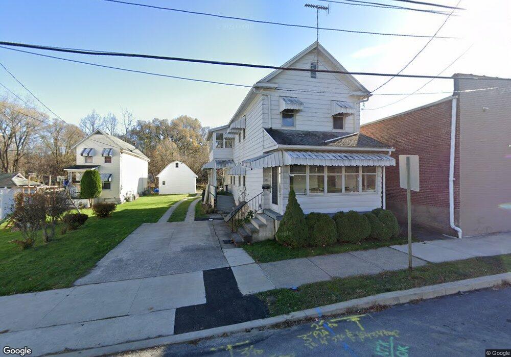
435 W Union St Nanticoke, PA 18634
Estimated Value: $137,155 - $177,000
--
Bed
--
Bath
1,728
Sq Ft
$94/Sq Ft
Est. Value
About This Home
This home is located at 435 W Union St, Nanticoke, PA 18634 and is currently estimated at $163,039, approximately $94 per square foot. 435 W Union St is a home located in Luzerne County with nearby schools including Kennedy Early Childhood Center, Nanticoke Area Elementary Center Center, and Greater Nanticoke Area Senior High School.
Ownership History
Date
Name
Owned For
Owner Type
Purchase Details
Closed on
Sep 23, 2021
Sold by
Malavenda David
Bought by
Malavenda David
Current Estimated Value
Purchase Details
Closed on
Dec 13, 2016
Sold by
Toigo Karen M
Bought by
Malavenda David
Purchase Details
Closed on
Oct 13, 2016
Sold by
Toigo Karen M and Studle Elizabeth Maciejczyk
Bought by
Toigo Karen M
Purchase Details
Closed on
May 9, 2000
Bought by
Maciejczyk Frances
Create a Home Valuation Report for This Property
The Home Valuation Report is an in-depth analysis detailing your home's value as well as a comparison with similar homes in the area
Home Values in the Area
Average Home Value in this Area
Purchase History
| Date | Buyer | Sale Price | Title Company |
|---|---|---|---|
| Malavenda David | $13,000 | None Listed On Document | |
| Malavenda David | $42,000 | None Available | |
| Toigo Karen M | $42,000 | None Available | |
| Maciejczyk Frances | -- | -- |
Source: Public Records
Tax History Compared to Growth
Tax History
| Year | Tax Paid | Tax Assessment Tax Assessment Total Assessment is a certain percentage of the fair market value that is determined by local assessors to be the total taxable value of land and additions on the property. | Land | Improvement |
|---|---|---|---|---|
| 2025 | $1,800 | $69,000 | $16,200 | $52,800 |
| 2024 | $1,800 | $69,000 | $16,200 | $52,800 |
| 2023 | $1,775 | $69,000 | $16,200 | $52,800 |
| 2022 | $1,693 | $69,000 | $16,200 | $52,800 |
| 2021 | $1,656 | $69,000 | $16,200 | $52,800 |
| 2020 | $1,656 | $69,000 | $16,200 | $52,800 |
| 2019 | $1,643 | $69,000 | $16,200 | $52,800 |
| 2018 | $1,615 | $69,000 | $16,200 | $52,800 |
| 2017 | $1,585 | $69,000 | $16,200 | $52,800 |
| 2016 | $604 | $69,000 | $16,200 | $52,800 |
| 2015 | $849 | $69,000 | $16,200 | $52,800 |
| 2014 | $849 | $69,000 | $16,200 | $52,800 |
Source: Public Records
Map
Nearby Homes
- 200 W Union St
- 131 W Union St
- 314 W Main St
- 162 W Green St
- 0 Enterprise St
- 65 W South St
- 20 Locust St
- 257 E Ridge St
- 246 E Washington St
- 22 S Walnut St
- 317 E Green St
- 46 W Kirmar Ave
- Lot 55 Vista Dr
- Lot 45 Vista Dr
- Lot 47 Vista Dr
- Lot 50 Vista Dr
- Lot 53 Vista Dr
- 333 State St
- 339 E Broad St
- 9 Garfield St