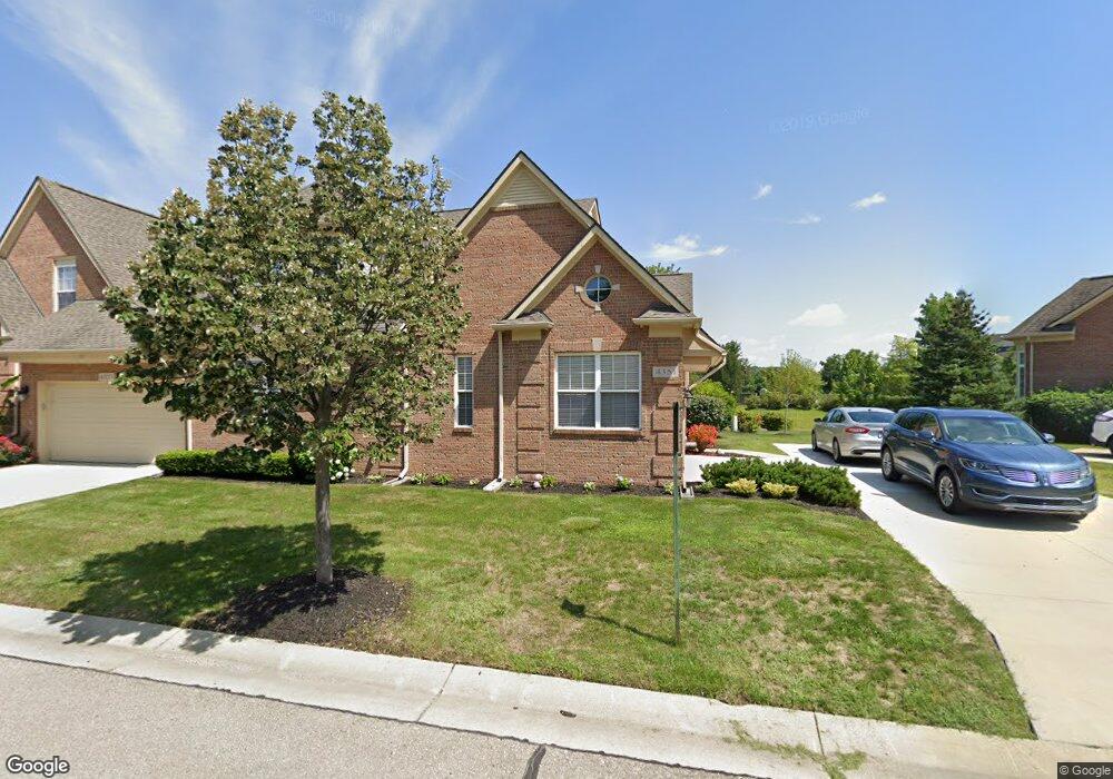
4351 Forest Bridge Dr Unit 48 Canton, MI 48188
Estimated Value: $389,586 - $436,000
Studio
3
Baths
1,837
Sq Ft
$227/Sq Ft
Est. Value
About This Home
This home is located at 4351 Forest Bridge Dr Unit 48, Canton, MI 48188 and is currently estimated at $416,147, approximately $226 per square foot. 4351 Forest Bridge Dr Unit 48 is a home located in Wayne County with nearby schools including Heber Hunt Elementary School, Horace Mann Elementary School, and Rawsonville Elementary School.
Ownership History
Date
Name
Owned For
Owner Type
Purchase Details
Closed on
Sep 27, 2023
Sold by
Lago Kenneth H
Bought by
Lago Kenneth H
Current Estimated Value
Purchase Details
Closed on
Jan 7, 2010
Sold by
Geric Group Llc
Bought by
Lago Kenneth H
Create a Home Valuation Report for This Property
The Home Valuation Report is an in-depth analysis detailing your home's value as well as a comparison with similar homes in the area
Home Values in the Area
Average Home Value in this Area
Purchase History
| Date | Buyer | Sale Price | Title Company |
|---|---|---|---|
| Lago Kenneth H | -- | None Listed On Document | |
| Lago Kenneth H | $216,100 | Visionary Title Agency Llc |
Source: Public Records
Tax History Compared to Growth
Tax History
| Year | Tax Paid | Tax Assessment Tax Assessment Total Assessment is a certain percentage of the fair market value that is determined by local assessors to be the total taxable value of land and additions on the property. | Land | Improvement |
|---|---|---|---|---|
| 2025 | $2,026 | $198,500 | $0 | $0 |
| 2024 | $1,969 | $178,900 | $0 | $0 |
| 2023 | $1,878 | $174,700 | $0 | $0 |
| 2022 | $4,546 | $149,400 | $0 | $0 |
| 2021 | $4,414 | $147,400 | $0 | $0 |
| 2020 | $4,357 | $144,600 | $0 | $0 |
| 2019 | $4,282 | $136,930 | $0 | $0 |
| 2018 | $1,514 | $122,310 | $0 | $0 |
| 2017 | $4,956 | $120,800 | $0 | $0 |
| 2016 | $3,933 | $121,900 | $0 | $0 |
| 2015 | $9,598 | $118,740 | $0 | $0 |
| 2013 | $9,298 | $106,200 | $0 | $0 |
| 2010 | -- | $64,240 | $16,500 | $47,740 |
Source: Public Records
Map
Nearby Homes
- 48551 Oak Bridge Dr Unit 61
- 4411 Southbridge Dr Unit 226
- 4428 Bridgeview Ln
- 4016 Cornerstone Dr Unit 131
- 48516 Bridge Way Unit 564
- 48510 Bridge Way Unit 563
- 48504 Bridge Way Unit 562
- 48492 Bridge Way Unit 559
- 48486 Bridge Way Unit 560
- 48480 Bridge Way Unit 570
- 48474 Bridge Way Unit 569
- 3956 Cornerstone Dr Unit 568
- 3928 Cornerstone Dr Unit 566
- 4186 Coronet Ave
- 4160 Wrenwood Ln Unit 29
- 4098 Elizabeth Ave
- 3963 Bruton Ave
- 49035 Geddes Rd
- 3571 Brooklyn Dr
- 4041 Radcliff Dr
- 4207 Forest Bridge Dr Unit 56
- 4243 Forest Bridge Dr Unit 54
- 4243 Forest Bridge Dr Unit 14
- 4333 Forest Bridge Dr Unit 49
- 4279 Forest Bridge Dr Unit 52
- 4063 Forest Bridge Dr Unit 82
- 4117 Forest Bridge Dr Unit 79
- 4172 Bridgeview Ln Unit 73
- 4118 Bridgeview Ln Unit 18 70
- 4297 Forest Bridge Dr Unit 51
- 4387 Forest Bridge Dr Unit 46
- 4315 Forest Bridge Dr Unit 50
- 4171 Forest Bridge Dr Unit 58
- 48579 Oak Bridge Dr Unit 60
- 4135 Forest Bridge Dr Unit 78
- 4082 Bridgeview Ln Unit 68
- 4118 Bridgeview Ln Unit 70
- 4100 Bridgeview Ln
- 4153 Forest Bridge Dr Unit 77
- 4154 Bridgeview Ln Unit 72